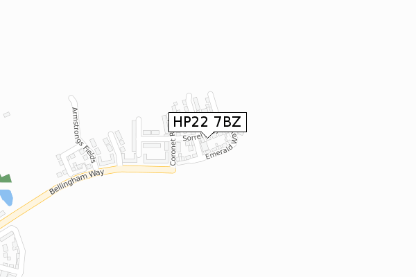
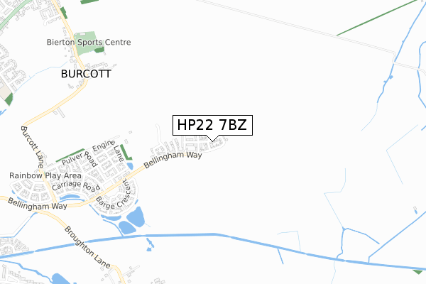
HP22 7BZ is located in the Aston Clinton and Bierton electoral ward, within the unitary authority of Buckinghamshire and the English Parliamentary constituency of Buckingham. The Sub Integrated Care Board (ICB) Location is NHS Buckinghamshire, Oxfordshire and Berkshire West ICB - 14Y and the police force is Thames Valley. This postcode has been in use since November 2019.


GetTheData
Source: OS Open Zoomstack (Ordnance Survey)
Licence: Open Government Licence (requires attribution)
Attribution: Contains OS data © Crown copyright and database right 2024
Source: Open Postcode Geo
Licence: Open Government Licence (requires attribution)
Attribution: Contains OS data © Crown copyright and database right 2024; Contains Royal Mail data © Royal Mail copyright and database right 2024; Source: Office for National Statistics licensed under the Open Government Licence v.3.0
| Easting | 485071 |
| Northing | 214921 |
| Latitude | 51.826449 |
| Longitude | -0.766974 |
GetTheData
Source: Open Postcode Geo
Licence: Open Government Licence
| Country | England |
| Postcode District | HP22 |
| ➜ HP22 open data dashboard ➜ See where HP22 is on a map ➜ Where is Broughton? | |
GetTheData
Source: Land Registry Price Paid Data
Licence: Open Government Licence
| Ward | Aston Clinton And Bierton |
| Constituency | Buckingham |
GetTheData
Source: ONS Postcode Database
Licence: Open Government Licence
39, SORREL WAY, BROUGHTON, AYLESBURY, HP22 7BZ 2022 16 DEC £642,995 |
64, SORREL WAY, BROUGHTON, AYLESBURY, HP22 7BZ 2022 25 NOV £497,995 |
62, SORREL WAY, BROUGHTON, AYLESBURY, HP22 7BZ 2022 30 SEP £494,995 |
25, SORREL WAY, BROUGHTON, AYLESBURY, HP22 7BZ 2022 29 JUN £448,800 |
5, SORREL WAY, BROUGHTON, AYLESBURY, HP22 7BZ 2022 9 MAY £507,995 |
7, SORREL WAY, BROUGHTON, AYLESBURY, HP22 7BZ 2022 1 APR £430,000 |
20, SORREL WAY, BROUGHTON, AYLESBURY, HP22 7BZ 2020 3 MAR £370,000 |
6, SORREL WAY, BROUGHTON, AYLESBURY, HP22 7BZ 2019 20 DEC £449,950 |
3, SORREL WAY, BROUGHTON, AYLESBURY, HP22 7BZ 2019 20 DEC £485,000 |
4, SORREL WAY, BROUGHTON, AYLESBURY, HP22 7BZ 2019 13 DEC £539,950 |
GetTheData
Source: HM Land Registry Price Paid Data
Licence: Contains HM Land Registry data © Crown copyright and database right 2024. This data is licensed under the Open Government Licence v3.0.
| Burcott Lane | Bierton | 1,016m |
| Broughton Crossing (Broughton Lane) | Broughton Village | 1,098m |
| Hulcott Lane (Aylesbury Road) | Bierton | 1,132m |
| Hulcott Lane (Aylesbury Road) | Bierton | 1,141m |
| The Bell Ph (Aylesbury Road) | Bierton | 1,172m |
| Aylesbury Station | 3.6km |
| Stoke Mandeville Station | 4.5km |
GetTheData
Source: NaPTAN
Licence: Open Government Licence
GetTheData
Source: ONS Postcode Database
Licence: Open Government Licence


➜ Get more ratings from the Food Standards Agency
GetTheData
Source: Food Standards Agency
Licence: FSA terms & conditions
| Last Collection | |||
|---|---|---|---|
| Location | Mon-Fri | Sat | Distance |
| Broughton Lane | 17:15 | 07:00 | 1,110m |
| Hulcott Turn | 17:00 | 09:45 | 1,123m |
| Bierton | 17:00 | 09:00 | 1,312m |
GetTheData
Source: Dracos
Licence: Creative Commons Attribution-ShareAlike
| Facility | Distance |
|---|---|
| Kingsbrook View Primary Academy Kingsbrook Basin, Broughton, Aylesbury Grass Pitches | 530m |
| The Kingsbrook School Armstrongs Fields, Broughton, Aylesbury Grass Pitches, Sports Hall | 596m |
| Burcott Lane Recreation Ground Burcott Lane, Bierton, Aylesbury Grass Pitches, Outdoor Tennis Courts | 972m |
GetTheData
Source: Active Places
Licence: Open Government Licence
| School | Phase of Education | Distance |
|---|---|---|
| Kingsbrook View Primary Academy Kingsbrook Basin, Broughton, HP22 7EE | Primary | 530m |
| The Kingsbrook School Armstrongs Fields, Broughton, Aylesbury, HP22 7BR | Secondary | 596m |
| Bierton Church of England Combined School Parsons Lane, Bierton, Aylesbury, HP22 5DF | Primary | 1.3km |
GetTheData
Source: Edubase
Licence: Open Government Licence
The below table lists the International Territorial Level (ITL) codes (formerly Nomenclature of Territorial Units for Statistics (NUTS) codes) and Local Administrative Units (LAU) codes for HP22 7BZ:
| ITL 1 Code | Name |
|---|---|
| TLJ | South East (England) |
| ITL 2 Code | Name |
| TLJ1 | Berkshire, Buckinghamshire and Oxfordshire |
| ITL 3 Code | Name |
| TLJ13 | Buckinghamshire |
| LAU 1 Code | Name |
| E06000060 | Buckinghamshire |
GetTheData
Source: ONS Postcode Directory
Licence: Open Government Licence
The below table lists the Census Output Area (OA), Lower Layer Super Output Area (LSOA), and Middle Layer Super Output Area (MSOA) for HP22 7BZ:
| Code | Name | |
|---|---|---|
| OA | E00089046 | |
| LSOA | E01017641 | Aylesbury Vale 007A |
| MSOA | E02003658 | Aylesbury Vale 007 |
GetTheData
Source: ONS Postcode Directory
Licence: Open Government Licence
| HP22 5AT | Marshalls Lea | 822m |
| HP22 5AS | Burcott Lane | 929m |
| HP22 5DY | Gib Lane | 997m |
| HP22 5AP | Ivy Lane | 1043m |
| HP22 5AR | Broughton Crossing | 1070m |
| HP22 5DS | Aylesbury Road | 1125m |
| HP22 5AW | 1191m | |
| HP22 5AZ | William Hill Drive | 1206m |
| HP22 5BP | Read Drive | 1208m |
| HP22 5AU | Burcott Lane | 1209m |
GetTheData
Source: Open Postcode Geo; Land Registry Price Paid Data
Licence: Open Government Licence