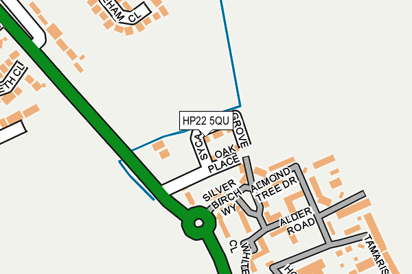
HP22 5QU is located in the Aston Clinton and Bierton electoral ward, within the unitary authority of Buckinghamshire and the English Parliamentary constituency of Aylesbury. The Sub Integrated Care Board (ICB) Location is NHS Buckinghamshire, Oxfordshire and Berkshire West ICB - 14Y and the police force is Thames Valley. This postcode has been in use since July 2017.


GetTheData
Source: OS OpenMap – Local (Ordnance Survey)
Source: OS VectorMap District (Ordnance Survey)
Licence: Open Government Licence (requires attribution)
| Easting | 483966 |
| Northing | 211695 |
| Latitude | 51.797617 |
| Longitude | -0.783784 |
GetTheData
Source: Open Postcode Geo
Licence: Open Government Licence
| Country | England |
| Postcode District | HP22 |
| ➜ HP22 open data dashboard ➜ See where HP22 is on a map ➜ Where is Stoke Mandeville? | |
GetTheData
Source: Land Registry Price Paid Data
Licence: Open Government Licence
| Ward | Aston Clinton And Bierton |
| Constituency | Aylesbury |
GetTheData
Source: ONS Postcode Database
Licence: Open Government Licence
| June 2022 | Anti-social behaviour | On or near Hornbeam Way | 166m |
| May 2022 | Anti-social behaviour | On or near Hornbeam Way | 166m |
| May 2022 | Criminal damage and arson | On or near Alder Road | 170m |
| ➜ Get more crime data in our Crime section | |||
GetTheData
Source: data.police.uk
Licence: Open Government Licence
| Silver Birch Way (Wendover Road) | Stoke Mandeville | 119m |
| Hampden Hall (Wendover Road) | Stoke Mandeville | 265m |
| Hampden Hall (Wendover Road) | Stoke Mandeville | 373m |
| Eascote Road | Aylesbury | 416m |
| Eascote Road | Aylesbury | 431m |
| Stoke Mandeville Station | 1.1km |
| Aylesbury Station | 2.8km |
| Wendover Station | 4.7km |
GetTheData
Source: NaPTAN
Licence: Open Government Licence
➜ Broadband speed and availability dashboard for HP22 5QU
| Percentage of properties with Next Generation Access | 100.0% |
| Percentage of properties with Superfast Broadband | 100.0% |
| Percentage of properties with Ultrafast Broadband | 0.0% |
| Percentage of properties with Full Fibre Broadband | 0.0% |
Superfast Broadband is between 30Mbps and 300Mbps
Ultrafast Broadband is > 300Mbps
| Median download speed | 30.0Mbps |
| Average download speed | 34.5Mbps |
| Maximum download speed | 70.69Mbps |
| Median upload speed | 9.5Mbps |
| Average upload speed | 7.9Mbps |
| Maximum upload speed | 19.53Mbps |
| Percentage of properties unable to receive 2Mbps | 0.0% |
| Percentage of properties unable to receive 5Mbps | 0.0% |
| Percentage of properties unable to receive 10Mbps | 0.0% |
| Percentage of properties unable to receive 30Mbps | 0.0% |
➜ Broadband speed and availability dashboard for HP22 5QU
GetTheData
Source: Ofcom
Licence: Ofcom Terms of Use (requires attribution)
GetTheData
Source: ONS Postcode Database
Licence: Open Government Licence


➜ Get more ratings from the Food Standards Agency
GetTheData
Source: Food Standards Agency
Licence: FSA terms & conditions
| Last Collection | |||
|---|---|---|---|
| Location | Mon-Fri | Sat | Distance |
| Corfe Close | 17:15 | 12:00 | 409m |
| The Grange | 17:00 | 09:30 | 511m |
| Ambleside | 17:15 | 12:00 | 532m |
GetTheData
Source: Dracos
Licence: Creative Commons Attribution-ShareAlike
| Facility | Distance |
|---|---|
| Bedgrove Park Ambleside, Aylesbury Grass Pitches, Outdoor Tennis Courts | 560m |
| William Harding School Hazlehurst Drive, Aylesbury Grass Pitches | 1.1km |
| Stoke Mandeville Playing Fields Eskdale Road, Stoke Mandeville, Aylesbury Grass Pitches, Outdoor Tennis Courts | 1.1km |
GetTheData
Source: Active Places
Licence: Open Government Licence
| School | Phase of Education | Distance |
|---|---|---|
| Bedgrove Infant School Ingram Avenue, Aylesbury, HP21 9DJ | Primary | 813m |
| Bedgrove Junior School Ingram Avenue, Aylesbury, HP21 9DN | Primary | 972m |
| William Harding School Hazlehurst Drive, Aylesbury, HP21 9TJ | Primary | 1.1km |
GetTheData
Source: Edubase
Licence: Open Government Licence
The below table lists the International Territorial Level (ITL) codes (formerly Nomenclature of Territorial Units for Statistics (NUTS) codes) and Local Administrative Units (LAU) codes for HP22 5QU:
| ITL 1 Code | Name |
|---|---|
| TLJ | South East (England) |
| ITL 2 Code | Name |
| TLJ1 | Berkshire, Buckinghamshire and Oxfordshire |
| ITL 3 Code | Name |
| TLJ13 | Buckinghamshire |
| LAU 1 Code | Name |
| E06000060 | Buckinghamshire |
GetTheData
Source: ONS Postcode Directory
Licence: Open Government Licence
The below table lists the Census Output Area (OA), Lower Layer Super Output Area (LSOA), and Middle Layer Super Output Area (MSOA) for HP22 5QU:
| Code | Name | |
|---|---|---|
| OA | E00089272 | |
| LSOA | E01017691 | Aylesbury Vale 019E |
| MSOA | E02003670 | Aylesbury Vale 019 |
GetTheData
Source: ONS Postcode Directory
Licence: Open Government Licence
| HP22 5SZ | Wendover Road | 73m |
| HP22 5WT | Maple End | 83m |
| HP22 5WQ | Silver Birch Way | 87m |
| HP22 5WU | Almond Tree Drive | 130m |
| HP22 5WW | Juniper Drive | 146m |
| HP22 5WX | Hornbeam Way | 161m |
| HP22 5ZE | Alder Road | 176m |
| HP22 5YE | Whitebeam Close | 207m |
| HP22 5WY | Hemlock Close | 214m |
| HP21 9XA | Tyneham Close | 226m |
GetTheData
Source: Open Postcode Geo; Land Registry Price Paid Data
Licence: Open Government Licence