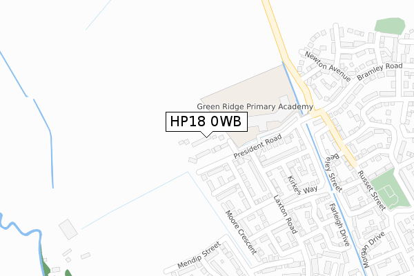
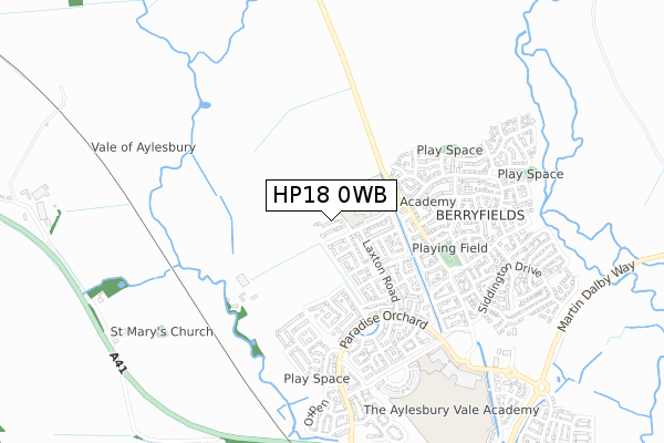
HP18 0WB is located in the Stone and Waddesdon electoral ward, within the unitary authority of Buckinghamshire and the English Parliamentary constituency of Aylesbury. The Sub Integrated Care Board (ICB) Location is NHS Buckinghamshire, Oxfordshire and Berkshire West ICB - 14Y and the police force is Thames Valley. This postcode has been in use since February 2020.


GetTheData
Source: OS Open Zoomstack (Ordnance Survey)
Licence: Open Government Licence (requires attribution)
Attribution: Contains OS data © Crown copyright and database right 2024
Source: Open Postcode Geo
Licence: Open Government Licence (requires attribution)
Attribution: Contains OS data © Crown copyright and database right 2024; Contains Royal Mail data © Royal Mail copyright and database right 2024; Source: Office for National Statistics licensed under the Open Government Licence v.3.0
| Easting | 478600 |
| Northing | 216374 |
| Latitude | 51.840456 |
| Longitude | -0.860521 |
GetTheData
Source: Open Postcode Geo
Licence: Open Government Licence
| Country | England |
| Postcode District | HP18 |
| ➜ HP18 open data dashboard ➜ See where HP18 is on a map ➜ Where is Aylesbury? | |
GetTheData
Source: Land Registry Price Paid Data
Licence: Open Government Licence
| Ward | Stone And Waddesdon |
| Constituency | Aylesbury |
GetTheData
Source: ONS Postcode Database
Licence: Open Government Licence
2022 22 JUL £423,000 |
23, GLENTON GREEN, AYLESBURY, HP18 0WB 2020 14 OCT £375,000 |
25, GLENTON GREEN, AYLESBURY, HP18 0WB 2020 21 AUG £393,950 |
2020 27 MAR £339,950 |
1, GLENTON GREEN, AYLESBURY, HP18 0WB 2020 27 FEB £367,500 |
GetTheData
Source: HM Land Registry Price Paid Data
Licence: Contains HM Land Registry data © Crown copyright and database right 2024. This data is licensed under the Open Government Licence v3.0.
| Worcester Street | Berryfields | 332m |
| Noble Crescent (Paradise Orchard) | Berryfields | 406m |
| Russet Street | Berryfields | 440m |
| Bramley Road | Berryfields | 542m |
| Collington Road | Berryfields | 572m |
| Aylesbury Vale Parkway Station | 1km |
| Aylesbury Station | 4.3km |
GetTheData
Source: NaPTAN
Licence: Open Government Licence
GetTheData
Source: ONS Postcode Database
Licence: Open Government Licence


➜ Get more ratings from the Food Standards Agency
GetTheData
Source: Food Standards Agency
Licence: FSA terms & conditions
| Last Collection | |||
|---|---|---|---|
| Location | Mon-Fri | Sat | Distance |
| Woodford Close | 17:30 | 12:00 | 787m |
| Jackson Road | 17:15 | 12:00 | 1,817m |
| Picasso Place | 17:15 | 12:00 | 1,846m |
GetTheData
Source: Dracos
Licence: Creative Commons Attribution-ShareAlike
| Facility | Distance |
|---|---|
| Aylesbury Vale Academy Paradise Orchard, Aylesbury Sports Hall, Studio, Artificial Grass Pitch, Grass Pitches | 775m |
| Aylesbury Vale Dynamos Haywood Way, Aylesbury Grass Pitches | 1.6km |
| Thomas Hickman School Belgrave Road, Aylesbury Grass Pitches | 2.1km |
GetTheData
Source: Active Places
Licence: Open Government Licence
| School | Phase of Education | Distance |
|---|---|---|
| Green Ridge Primary Academy President Road, Berryfields, Aylesbury, HP18 0YA | Primary | 212m |
| The Aylesbury Vale Academy Paradise Orchard, Aylesbury, HP18 0WS | All-through | 806m |
| Thomas Hickman School Belgrave Road, Aylesbury, HP19 9HP | Primary | 2.1km |
GetTheData
Source: Edubase
Licence: Open Government Licence
The below table lists the International Territorial Level (ITL) codes (formerly Nomenclature of Territorial Units for Statistics (NUTS) codes) and Local Administrative Units (LAU) codes for HP18 0WB:
| ITL 1 Code | Name |
|---|---|
| TLJ | South East (England) |
| ITL 2 Code | Name |
| TLJ1 | Berkshire, Buckinghamshire and Oxfordshire |
| ITL 3 Code | Name |
| TLJ13 | Buckinghamshire |
| LAU 1 Code | Name |
| E06000060 | Buckinghamshire |
GetTheData
Source: ONS Postcode Directory
Licence: Open Government Licence
The below table lists the Census Output Area (OA), Lower Layer Super Output Area (LSOA), and Middle Layer Super Output Area (MSOA) for HP18 0WB:
| Code | Name | |
|---|---|---|
| OA | E00089351 | |
| LSOA | E01017705 | Aylesbury Vale 012A |
| MSOA | E02003663 | Aylesbury Vale 012 |
GetTheData
Source: ONS Postcode Directory
Licence: Open Government Licence
| HP18 0ZH | Redcurrant Avenue | 284m |
| HP18 0HW | Crispin Street | 305m |
| HP18 0GY | Northcliffe Way | 308m |
| HP18 0DQ | Grieve Road | 317m |
| HP18 0GP | Worcester Street | 326m |
| HP18 0ZL | Mendip Street | 330m |
| HP18 0GZ | Beeley Street | 338m |
| HP18 0ZN | Merton Close | 365m |
| HP18 0BN | Newton Avenue | 392m |
| HP18 0HN | Ashmead Street | 400m |
GetTheData
Source: Open Postcode Geo; Land Registry Price Paid Data
Licence: Open Government Licence