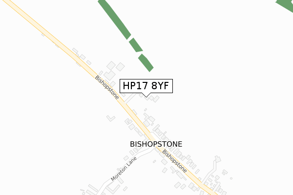
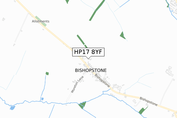
HP17 8YF is located in the Stone and Waddesdon electoral ward, within the unitary authority of Buckinghamshire and the English Parliamentary constituency of Buckingham. The Sub Integrated Care Board (ICB) Location is NHS Buckinghamshire, Oxfordshire and Berkshire West ICB - 14Y and the police force is Thames Valley. This postcode has been in use since February 2020.


GetTheData
Source: OS Open Zoomstack (Ordnance Survey)
Licence: Open Government Licence (requires attribution)
Attribution: Contains OS data © Crown copyright and database right 2024
Source: Open Postcode Geo
Licence: Open Government Licence (requires attribution)
Attribution: Contains OS data © Crown copyright and database right 2024; Contains Royal Mail data © Royal Mail copyright and database right 2024; Source: Office for National Statistics licensed under the Open Government Licence v.3.0
| Easting | 480307 |
| Northing | 210613 |
| Latitude | 51.788426 |
| Longitude | -0.837083 |
GetTheData
Source: Open Postcode Geo
Licence: Open Government Licence
| Country | England |
| Postcode District | HP17 |
| ➜ HP17 open data dashboard ➜ See where HP17 is on a map | |
GetTheData
Source: Land Registry Price Paid Data
Licence: Open Government Licence
| Ward | Stone And Waddesdon |
| Constituency | Buckingham |
GetTheData
Source: ONS Postcode Database
Licence: Open Government Licence
| June 2022 | Public order | On or near Furlong Crescent | 189m |
| November 2021 | Violence and sexual offences | On or near Furlong Crescent | 189m |
| November 2021 | Violence and sexual offences | On or near Moreton Lane | 448m |
| ➜ Get more crime data in our Crime section | |||
GetTheData
Source: data.police.uk
Licence: Open Government Licence
| The Harrow Ph (Bishopstone Road) | Bishopstone | 158m |
| The Harrow Ph (Bishopstone Road) | Bishopstone | 241m |
| Harbourne Close (Anton Way) | Aylesbury | 1,448m |
| Harbourne Close (Anton Way) | Aylesbury | 1,458m |
| Isis Close (Anton Way) | Aylesbury | 1,476m |
| Aylesbury Station | 3.2km |
| Stoke Mandeville Station | 3.7km |
| Little Kimble Station | 4.5km |
GetTheData
Source: NaPTAN
Licence: Open Government Licence
GetTheData
Source: ONS Postcode Database
Licence: Open Government Licence


➜ Get more ratings from the Food Standards Agency
GetTheData
Source: Food Standards Agency
Licence: FSA terms & conditions
| Last Collection | |||
|---|---|---|---|
| Location | Mon-Fri | Sat | Distance |
| Ellen Road | 17:15 | 12:00 | 1,645m |
| Richards Close | 17:00 | 12:00 | 1,689m |
| Hannon Road P.o. | 17:00 | 12:00 | 1,831m |
GetTheData
Source: Dracos
Licence: Creative Commons Attribution-ShareAlike
| Facility | Distance |
|---|---|
| Ashmead Combined School Cole Road, Aylesbury Artificial Grass Pitch, Grass Pitches | 1.9km |
| Walton Court Hannon Road, Aylesbury Grass Pitches | 1.9km |
| Hartwell House Hotel Restaurant And Spa Lower Hartwell, Aylesbury Health and Fitness Gym, Swimming Pool, Outdoor Tennis Courts | 2km |
GetTheData
Source: Active Places
Licence: Open Government Licence
| School | Phase of Education | Distance |
|---|---|---|
| Ashmead Combined School Cole Road, Aylesbury, HP21 8SU | Primary | 1.9km |
| The Mandeville School Ellen Road, Aylesbury, HP21 8ES | Secondary | 2km |
| Booker Park Community School Stoke Leys Close, Aylesbury, HP21 9ET | Not applicable | 2.1km |
GetTheData
Source: Edubase
Licence: Open Government Licence
The below table lists the International Territorial Level (ITL) codes (formerly Nomenclature of Territorial Units for Statistics (NUTS) codes) and Local Administrative Units (LAU) codes for HP17 8YF:
| ITL 1 Code | Name |
|---|---|
| TLJ | South East (England) |
| ITL 2 Code | Name |
| TLJ1 | Berkshire, Buckinghamshire and Oxfordshire |
| ITL 3 Code | Name |
| TLJ13 | Buckinghamshire |
| LAU 1 Code | Name |
| E06000060 | Buckinghamshire |
GetTheData
Source: ONS Postcode Directory
Licence: Open Government Licence
The below table lists the Census Output Area (OA), Lower Layer Super Output Area (LSOA), and Middle Layer Super Output Area (MSOA) for HP17 8YF:
| Code | Name | |
|---|---|---|
| OA | E00089234 | |
| LSOA | E01017678 | Aylesbury Vale 022D |
| MSOA | E02003673 | Aylesbury Vale 022 |
GetTheData
Source: ONS Postcode Directory
Licence: Open Government Licence
| HP17 8SG | Furlong Crescent | 180m |
| HP17 8SF | 287m | |
| HP17 8SQ | Moreton Lane | 368m |
| HP17 8SH | 388m | |
| HP17 8SE | 876m | |
| HP17 8QN | Sedrup | 1026m |
| HP17 8SL | Bishopstone | 1080m |
| HP21 9LN | Oat Close | 1328m |
| HP21 9TF | Deverill Road | 1402m |
| HP21 9LU | Harbourne Close | 1406m |
GetTheData
Source: Open Postcode Geo; Land Registry Price Paid Data
Licence: Open Government Licence