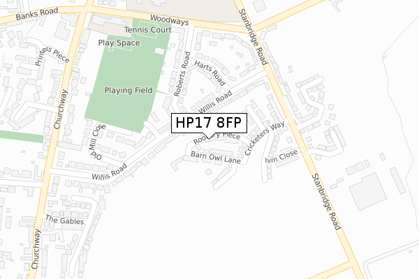
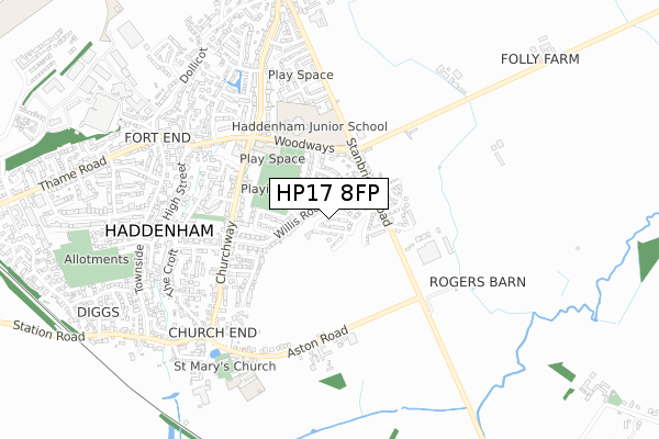
HP17 8FP is located in the Bernwood electoral ward, within the unitary authority of Buckinghamshire and the English Parliamentary constituency of Buckingham. The Sub Integrated Care Board (ICB) Location is NHS Buckinghamshire, Oxfordshire and Berkshire West ICB - 14Y and the police force is Thames Valley. This postcode has been in use since August 2019.


GetTheData
Source: OS Open Zoomstack (Ordnance Survey)
Licence: Open Government Licence (requires attribution)
Attribution: Contains OS data © Crown copyright and database right 2024
Source: Open Postcode Geo
Licence: Open Government Licence (requires attribution)
Attribution: Contains OS data © Crown copyright and database right 2024; Contains Royal Mail data © Royal Mail copyright and database right 2024; Source: Office for National Statistics licensed under the Open Government Licence v.3.0
| Easting | 474596 |
| Northing | 208543 |
| Latitude | 51.770607 |
| Longitude | -0.920309 |
GetTheData
Source: Open Postcode Geo
Licence: Open Government Licence
| Country | England |
| Postcode District | HP17 |
| ➜ HP17 open data dashboard ➜ See where HP17 is on a map ➜ Where is Haddenham? | |
GetTheData
Source: Land Registry Price Paid Data
Licence: Open Government Licence
| Ward | Bernwood |
| Constituency | Buckingham |
GetTheData
Source: ONS Postcode Database
Licence: Open Government Licence
8, ROOKERY PIECE, HADDENHAM, AYLESBURY, HP17 8FP 2020 16 DEC £490,000 |
2, ROOKERY PIECE, HADDENHAM, AYLESBURY, HP17 8FP 2020 9 OCT £399,950 |
1, ROOKERY PIECE, HADDENHAM, AYLESBURY, HP17 8FP 2020 6 OCT £475,000 |
GetTheData
Source: HM Land Registry Price Paid Data
Licence: Contains HM Land Registry data © Crown copyright and database right 2024. This data is licensed under the Open Government Licence v3.0.
| June 2022 | Violence and sexual offences | On or near Willis Road | 136m |
| June 2022 | Violence and sexual offences | On or near Stanbridge Road | 175m |
| May 2022 | Anti-social behaviour | On or near Willis Road | 136m |
| ➜ Get more crime data in our Crime section | |||
GetTheData
Source: data.police.uk
Licence: Open Government Licence
| Medical Centre (Stanbridge Road) | Haddenham | 308m |
| Woodways | Haddenham | 319m |
| Medical Centre (Stanbridge Road) | Haddenham | 321m |
| Woodways | Haddenham | 331m |
| Willis Road (Churchway) | Haddenham | 407m |
| Haddenham & Thame Parkway Station | 1.5km |
GetTheData
Source: NaPTAN
Licence: Open Government Licence
| Percentage of properties with Next Generation Access | 100.0% |
| Percentage of properties with Superfast Broadband | 100.0% |
| Percentage of properties with Ultrafast Broadband | 100.0% |
| Percentage of properties with Full Fibre Broadband | 100.0% |
Superfast Broadband is between 30Mbps and 300Mbps
Ultrafast Broadband is > 300Mbps
| Percentage of properties unable to receive 2Mbps | 0.0% |
| Percentage of properties unable to receive 5Mbps | 0.0% |
| Percentage of properties unable to receive 10Mbps | 0.0% |
| Percentage of properties unable to receive 30Mbps | 0.0% |
GetTheData
Source: Ofcom
Licence: Ofcom Terms of Use (requires attribution)
GetTheData
Source: ONS Postcode Database
Licence: Open Government Licence


➜ Get more ratings from the Food Standards Agency
GetTheData
Source: Food Standards Agency
Licence: FSA terms & conditions
| Last Collection | |||
|---|---|---|---|
| Location | Mon-Fri | Sat | Distance |
| Roberts Road | 15:45 | 08:30 | 270m |
| Churchway | 15:45 | 09:00 | 468m |
| Townside | 16:00 | 09:00 | 733m |
GetTheData
Source: Dracos
Licence: Creative Commons Attribution-ShareAlike
| Facility | Distance |
|---|---|
| Woodways Playing Fields Woodways, Haddenham Grass Pitches, Outdoor Tennis Courts | 302m |
| Haddenham Community Junior School Woodways, Haddenham, Aylesbury Grass Pitches, Artificial Grass Pitch, Sports Hall | 370m |
| New Horizons (Closed) Banks Road, Haddenham, Aylesbury Health and Fitness Gym, Studio | 505m |
GetTheData
Source: Active Places
Licence: Open Government Licence
| School | Phase of Education | Distance |
|---|---|---|
| Haddenham Community Junior School Woodways, Haddenham, Aylesbury, HP17 8DS | Primary | 371m |
| Haddenham Community Infant School Woodways, Haddenham, Aylesbury, HP17 8DS | Primary | 371m |
| Haddenham St Mary's Church of England School Aston Road, Haddenham, Aylesbury, HP17 8AF | Primary | 557m |
GetTheData
Source: Edubase
Licence: Open Government Licence
The below table lists the International Territorial Level (ITL) codes (formerly Nomenclature of Territorial Units for Statistics (NUTS) codes) and Local Administrative Units (LAU) codes for HP17 8FP:
| ITL 1 Code | Name |
|---|---|
| TLJ | South East (England) |
| ITL 2 Code | Name |
| TLJ1 | Berkshire, Buckinghamshire and Oxfordshire |
| ITL 3 Code | Name |
| TLJ13 | Buckinghamshire |
| LAU 1 Code | Name |
| E06000060 | Buckinghamshire |
GetTheData
Source: ONS Postcode Directory
Licence: Open Government Licence
The below table lists the Census Output Area (OA), Lower Layer Super Output Area (LSOA), and Middle Layer Super Output Area (MSOA) for HP17 8FP:
| Code | Name | |
|---|---|---|
| OA | E00089215 | |
| LSOA | E01017677 | Aylesbury Vale 022C |
| MSOA | E02003673 | Aylesbury Vale 022 |
GetTheData
Source: ONS Postcode Directory
Licence: Open Government Licence
| HP17 8HL | Willis Road | 77m |
| HP17 8HJ | Harts Road | 154m |
| HP17 8HH | Roberts Road | 187m |
| HP17 8HN | Stanbridge Road | 195m |
| HP17 8HG | Willis Road | 241m |
| HP17 8HW | Woodways | 244m |
| HP17 8HF | Willis Road | 277m |
| HP17 8HQ | Old Mill Close | 292m |
| HP17 8HA | Churchway | 369m |
| HP17 8DS | Woodways | 383m |
GetTheData
Source: Open Postcode Geo; Land Registry Price Paid Data
Licence: Open Government Licence