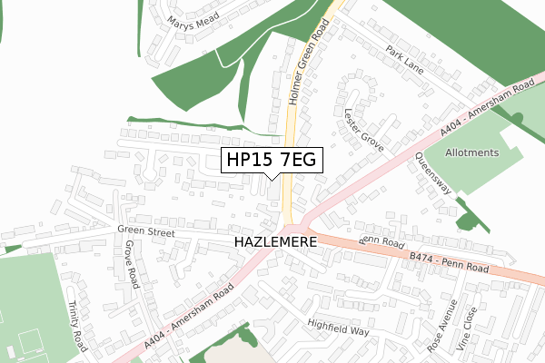
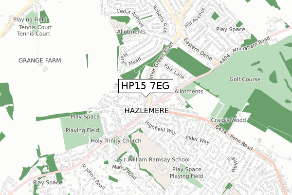
HP15 7EG is located in the Hazlemere electoral ward, within the unitary authority of Buckinghamshire and the English Parliamentary constituency of Wycombe. The Sub Integrated Care Board (ICB) Location is NHS Buckinghamshire, Oxfordshire and Berkshire West ICB - 14Y and the police force is Thames Valley. This postcode has been in use since August 2018.


GetTheData
Source: OS Open Zoomstack (Ordnance Survey)
Licence: Open Government Licence (requires attribution)
Attribution: Contains OS data © Crown copyright and database right 2024
Source: Open Postcode Geo
Licence: Open Government Licence (requires attribution)
Attribution: Contains OS data © Crown copyright and database right 2024; Contains Royal Mail data © Royal Mail copyright and database right 2024; Source: Office for National Statistics licensed under the Open Government Licence v.3.0
| Easting | 489121 |
| Northing | 195629 |
| Latitude | 51.652402 |
| Longitude | -0.713161 |
GetTheData
Source: Open Postcode Geo
Licence: Open Government Licence
| Country | England |
| Postcode District | HP15 |
| ➜ HP15 open data dashboard ➜ See where HP15 is on a map ➜ Where is Hazlemere? | |
GetTheData
Source: Land Registry Price Paid Data
Licence: Open Government Licence
| Ward | Hazlemere |
| Constituency | Wycombe |
GetTheData
Source: ONS Postcode Database
Licence: Open Government Licence
| January 2024 | Anti-social behaviour | On or near Parking Area | 76m |
| July 2023 | Vehicle crime | On or near Parking Area | 76m |
| July 2023 | Anti-social behaviour | On or near Parking Area | 76m |
| ➜ Get more crime data in our Crime section | |||
GetTheData
Source: data.police.uk
Licence: Open Government Licence
| Holmer Green Road | Hazlemere | 26m |
| Crossroads (Amersham Road) | Hazlemere | 135m |
| Crossroads (Penn Road) | Hazlemere | 137m |
| Crossroads (Amersham Road) | Hazlemere | 189m |
| Park Lane (Holmer Green Road) | Hazlemere | 277m |
| High Wycombe Station | 3.4km |
| Beaconsfield Station | 6.6km |
GetTheData
Source: NaPTAN
Licence: Open Government Licence
| Percentage of properties with Next Generation Access | 100.0% |
| Percentage of properties with Superfast Broadband | 100.0% |
| Percentage of properties with Ultrafast Broadband | 100.0% |
| Percentage of properties with Full Fibre Broadband | 100.0% |
Superfast Broadband is between 30Mbps and 300Mbps
Ultrafast Broadband is > 300Mbps
| Percentage of properties unable to receive 2Mbps | 0.0% |
| Percentage of properties unable to receive 5Mbps | 0.0% |
| Percentage of properties unable to receive 10Mbps | 0.0% |
| Percentage of properties unable to receive 30Mbps | 0.0% |
GetTheData
Source: Ofcom
Licence: Ofcom Terms of Use (requires attribution)
GetTheData
Source: ONS Postcode Database
Licence: Open Government Licence


➜ Get more ratings from the Food Standards Agency
GetTheData
Source: Food Standards Agency
Licence: FSA terms & conditions
| Last Collection | |||
|---|---|---|---|
| Location | Mon-Fri | Sat | Distance |
| Hazlemere P.o. | 17:00 | 12:00 | 80m |
| Penn Road | 15:45 | 12:00 | 492m |
| Jackson Court | 16:30 | 12:00 | 508m |
GetTheData
Source: Dracos
Licence: Creative Commons Attribution-ShareAlike
| Facility | Distance |
|---|---|
| Hazlemere Community Centre Rose Avenue, Hazlemere, High Wycombe Sports Hall | 553m |
| Sir William Ramsay School Rose Avenue, Hazlemere, High Wycombe Sports Hall, Grass Pitches, Studio, Health and Fitness Gym | 607m |
| Hazlemere Golf Club Penn Road, Hazlemere, High Wycombe Golf | 643m |
GetTheData
Source: Active Places
Licence: Open Government Licence
| School | Phase of Education | Distance |
|---|---|---|
| Hazlemere Church of England Combined School Amersham Road, Hazlemere, High Wycombe, HP15 7PZ | Primary | 407m |
| Sir William Ramsay School Rose Avenue, Hazlemere, High Wycombe, HP15 7UB | Secondary | 596m |
| Cedar Park School & Nursery Cedar Avenue, Hazlemere, High Wycombe, HP15 7EF | Primary | 659m |
GetTheData
Source: Edubase
Licence: Open Government Licence
The below table lists the International Territorial Level (ITL) codes (formerly Nomenclature of Territorial Units for Statistics (NUTS) codes) and Local Administrative Units (LAU) codes for HP15 7EG:
| ITL 1 Code | Name |
|---|---|
| TLJ | South East (England) |
| ITL 2 Code | Name |
| TLJ1 | Berkshire, Buckinghamshire and Oxfordshire |
| ITL 3 Code | Name |
| TLJ13 | Buckinghamshire |
| LAU 1 Code | Name |
| E06000060 | Buckinghamshire |
GetTheData
Source: ONS Postcode Directory
Licence: Open Government Licence
The below table lists the Census Output Area (OA), Lower Layer Super Output Area (LSOA), and Middle Layer Super Output Area (MSOA) for HP15 7EG:
| Code | Name | |
|---|---|---|
| OA | E00090203 | |
| LSOA | E01017881 | Wycombe 024B |
| MSOA | E02006824 | Wycombe 024 |
GetTheData
Source: ONS Postcode Directory
Licence: Open Government Licence
| HP15 7BB | Holmer Green Road | 47m |
| HP15 7LQ | Market Parade | 99m |
| HP15 7HU | Amersham Road | 100m |
| HP15 7LN | Penn Road | 143m |
| HP15 7HL | Amersham Road | 145m |
| HP15 7PU | Amersham Road | 149m |
| HP15 7BE | Beaumont Way | 158m |
| HP15 7LH | Oakengrove Road | 161m |
| HP15 7BL | Holmer Green Road | 161m |
| HP15 7RB | Green Street | 172m |
GetTheData
Source: Open Postcode Geo; Land Registry Price Paid Data
Licence: Open Government Licence