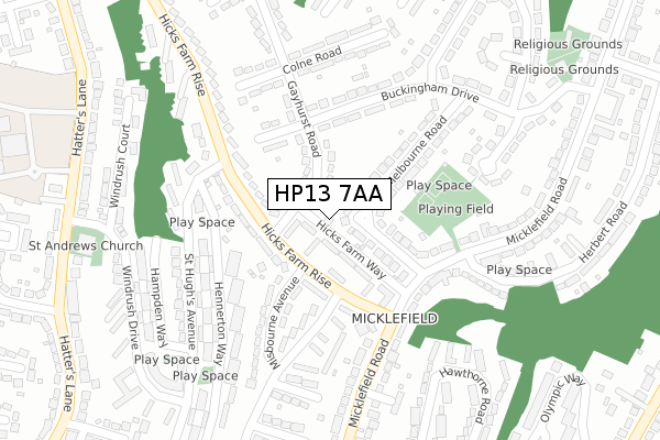
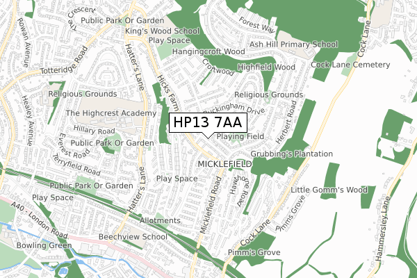
HP13 7AA is located in the Ryemead and Micklefield electoral ward, within the unitary authority of Buckinghamshire and the English Parliamentary constituency of Wycombe. The Sub Integrated Care Board (ICB) Location is NHS Buckinghamshire, Oxfordshire and Berkshire West ICB - 14Y and the police force is Thames Valley. This postcode has been in use since July 2018.


GetTheData
Source: OS Open Zoomstack (Ordnance Survey)
Licence: Open Government Licence (requires attribution)
Attribution: Contains OS data © Crown copyright and database right 2024
Source: Open Postcode Geo
Licence: Open Government Licence (requires attribution)
Attribution: Contains OS data © Crown copyright and database right 2024; Contains Royal Mail data © Royal Mail copyright and database right 2024; Source: Office for National Statistics licensed under the Open Government Licence v.3.0
| Easting | 488887 |
| Northing | 192926 |
| Latitude | 51.628141 |
| Longitude | -0.717228 |
GetTheData
Source: Open Postcode Geo
Licence: Open Government Licence
| Country | England |
| Postcode District | HP13 |
| ➜ HP13 open data dashboard ➜ See where HP13 is on a map ➜ Where is High Wycombe? | |
GetTheData
Source: Land Registry Price Paid Data
Licence: Open Government Licence
| Ward | Ryemead And Micklefield |
| Constituency | Wycombe |
GetTheData
Source: ONS Postcode Database
Licence: Open Government Licence
| January 2024 | Criminal damage and arson | On or near Petrol Station | 175m |
| January 2024 | Criminal damage and arson | On or near Petrol Station | 175m |
| January 2024 | Shoplifting | On or near Petrol Station | 175m |
| ➜ Get more crime data in our Crime section | |||
GetTheData
Source: data.police.uk
Licence: Open Government Licence
| Misbourne Avenue (Hicks Farm Rise) | High Wycombe | 75m |
| Misbourne Avenue (Hicks Farm Rise) | High Wycombe | 95m |
| Roebuck Avenue | High Wycombe | 131m |
| Petrol Station (Hicks Farm Rise) | Micklefield Estate | 153m |
| Hennerton Way North (St Hugh's Avenue) | High Wycombe | 195m |
| High Wycombe Station | 2km |
GetTheData
Source: NaPTAN
Licence: Open Government Licence
| Percentage of properties with Next Generation Access | 100.0% |
| Percentage of properties with Superfast Broadband | 100.0% |
| Percentage of properties with Ultrafast Broadband | 100.0% |
| Percentage of properties with Full Fibre Broadband | 0.0% |
Superfast Broadband is between 30Mbps and 300Mbps
Ultrafast Broadband is > 300Mbps
| Percentage of properties unable to receive 2Mbps | 0.0% |
| Percentage of properties unable to receive 5Mbps | 0.0% |
| Percentage of properties unable to receive 10Mbps | 0.0% |
| Percentage of properties unable to receive 30Mbps | 0.0% |
GetTheData
Source: Ofcom
Licence: Ofcom Terms of Use (requires attribution)
GetTheData
Source: ONS Postcode Database
Licence: Open Government Licence


➜ Get more ratings from the Food Standards Agency
GetTheData
Source: Food Standards Agency
Licence: FSA terms & conditions
| Last Collection | |||
|---|---|---|---|
| Location | Mon-Fri | Sat | Distance |
| Hicks Farm Rise | 16:30 | 12:00 | 78m |
| Micklefield P.o. | 16:30 | 12:00 | 267m |
| Gayhurst Road | 16:30 | 12:00 | 410m |
GetTheData
Source: Dracos
Licence: Creative Commons Attribution-ShareAlike
| Facility | Distance |
|---|---|
| St Andrews Church Hatters Lane, High Wycombe Sports Hall | 376m |
| Highcrest Academy Hatters Lane, High Wycombe Grass Pitches, Sports Hall, Studio, Health and Fitness Gym | 599m |
| Beechview School Guinions Road, High Wycombe Grass Pitches | 732m |
GetTheData
Source: Active Places
Licence: Open Government Licence
| School | Phase of Education | Distance |
|---|---|---|
| The Highcrest Academy Hatters Lane, High Wycombe, HP13 7NQ | Secondary | 598m |
| Kings Wood School and Nursery Hollis Road, High Wycombe, HP13 7UN | Primary | 729m |
| Beechview Academy Guinions Road, High Wycombe, HP13 7NT | Primary | 732m |
GetTheData
Source: Edubase
Licence: Open Government Licence
The below table lists the International Territorial Level (ITL) codes (formerly Nomenclature of Territorial Units for Statistics (NUTS) codes) and Local Administrative Units (LAU) codes for HP13 7AA:
| ITL 1 Code | Name |
|---|---|
| TLJ | South East (England) |
| ITL 2 Code | Name |
| TLJ1 | Berkshire, Buckinghamshire and Oxfordshire |
| ITL 3 Code | Name |
| TLJ13 | Buckinghamshire |
| LAU 1 Code | Name |
| E06000060 | Buckinghamshire |
GetTheData
Source: ONS Postcode Directory
Licence: Open Government Licence
The below table lists the Census Output Area (OA), Lower Layer Super Output Area (LSOA), and Middle Layer Super Output Area (MSOA) for HP13 7AA:
| Code | Name | |
|---|---|---|
| OA | E00090305 | |
| LSOA | E01017899 | Wycombe 014A |
| MSOA | E02003709 | Wycombe 014 |
GetTheData
Source: ONS Postcode Directory
Licence: Open Government Licence
| HP13 7XR | Gayhurst Road | 84m |
| HP13 7HE | Melbourne Road | 109m |
| HP13 7HD | Melbourne Road | 136m |
| HP13 7XP | Buckingham Drive | 140m |
| HP13 7SX | Hicks Farm Rise | 142m |
| HP13 7EZ | Micklefield Road | 182m |
| HP13 7XW | Gayhurst Road | 189m |
| HP13 7TZ | St Hughs Avenue | 195m |
| HP13 7TA | Misbourne Avenue | 197m |
| HP13 7XS | Buckingham Drive | 198m |
GetTheData
Source: Open Postcode Geo; Land Registry Price Paid Data
Licence: Open Government Licence