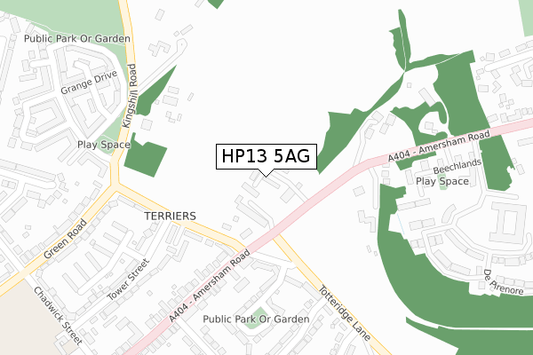
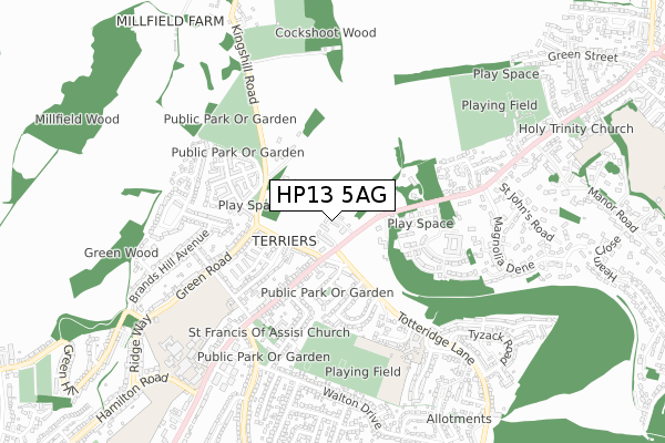
HP13 5AG is located in the Terriers and Amersham Hill electoral ward, within the unitary authority of Buckinghamshire and the English Parliamentary constituency of Wycombe. The Sub Integrated Care Board (ICB) Location is NHS Buckinghamshire, Oxfordshire and Berkshire West ICB - 14Y and the police force is Thames Valley. This postcode has been in use since May 2018.


GetTheData
Source: OS Open Zoomstack (Ordnance Survey)
Licence: Open Government Licence (requires attribution)
Attribution: Contains OS data © Crown copyright and database right 2024
Source: Open Postcode Geo
Licence: Open Government Licence (requires attribution)
Attribution: Contains OS data © Crown copyright and database right 2024; Contains Royal Mail data © Royal Mail copyright and database right 2024; Source: Office for National Statistics licensed under the Open Government Licence v.3.0
| Easting | 487947 |
| Northing | 194910 |
| Latitude | 51.646123 |
| Longitude | -0.730307 |
GetTheData
Source: Open Postcode Geo
Licence: Open Government Licence
| Country | England |
| Postcode District | HP13 |
| ➜ HP13 open data dashboard ➜ See where HP13 is on a map ➜ Where is High Wycombe? | |
GetTheData
Source: Land Registry Price Paid Data
Licence: Open Government Licence
| Ward | Terriers And Amersham Hill |
| Constituency | Wycombe |
GetTheData
Source: ONS Postcode Database
Licence: Open Government Licence
16, DE HAVILLAND COURT, HIGH WYCOMBE, HP13 5AG 2021 5 MAR £620,000 |
6, DE HAVILLAND COURT, HIGH WYCOMBE, HP13 5AG 2020 2 JUN £650,000 |
11, DE HAVILLAND COURT, HIGH WYCOMBE, HP13 5AG 2019 29 NOV £599,000 |
GetTheData
Source: HM Land Registry Price Paid Data
Licence: Contains HM Land Registry data © Crown copyright and database right 2024. This data is licensed under the Open Government Licence v3.0.
| June 2022 | Other theft | On or near Petrol Station | 204m |
| June 2022 | Other theft | On or near Petrol Station | 204m |
| June 2022 | Other theft | On or near Petrol Station | 204m |
| ➜ Get more crime data in our Crime section | |||
GetTheData
Source: data.police.uk
Licence: Open Government Licence
| Kingshill Road | Terriers | 180m |
| Kingshill Road | Terriers | 223m |
| Crossroads (Amersham Road) | Terriers | 242m |
| Crossroads (Amersham Road) | Terriers | 258m |
| Terriers Farm (Kingshill Road) | High Wycombe | 288m |
| High Wycombe Station | 2.1km |
GetTheData
Source: NaPTAN
Licence: Open Government Licence
| Percentage of properties with Next Generation Access | 100.0% |
| Percentage of properties with Superfast Broadband | 100.0% |
| Percentage of properties with Ultrafast Broadband | 0.0% |
| Percentage of properties with Full Fibre Broadband | 0.0% |
Superfast Broadband is between 30Mbps and 300Mbps
Ultrafast Broadband is > 300Mbps
| Percentage of properties unable to receive 2Mbps | 0.0% |
| Percentage of properties unable to receive 5Mbps | 0.0% |
| Percentage of properties unable to receive 10Mbps | 0.0% |
| Percentage of properties unable to receive 30Mbps | 0.0% |
GetTheData
Source: Ofcom
Licence: Ofcom Terms of Use (requires attribution)
GetTheData
Source: ONS Postcode Database
Licence: Open Government Licence


➜ Get more ratings from the Food Standards Agency
GetTheData
Source: Food Standards Agency
Licence: FSA terms & conditions
| Last Collection | |||
|---|---|---|---|
| Location | Mon-Fri | Sat | Distance |
| Terriers P.o. | 16:45 | 12:00 | 179m |
| Brands Hill Avenue | 17:00 | 12:00 | 527m |
| Kingston Road | 16:45 | 12:00 | 758m |
GetTheData
Source: Dracos
Licence: Creative Commons Attribution-ShareAlike
| Facility | Distance |
|---|---|
| Buckinghamshire New University (Wellesbourne Campus) (Closed) Kingshill Road, High Wycombe Sports Hall, Health and Fitness Gym | 374m |
| Hazlemere Recreation Ground Amersham Road, Hazlemere, High Wycombe Grass Pitches | 419m |
| Totteridge Recreation Ground Walton Drive, High Wycombe Grass Pitches | 493m |
GetTheData
Source: Active Places
Licence: Open Government Licence
| School | Phase of Education | Distance |
|---|---|---|
| Highworth Combined School and Nursery Highworth Close, High Wycombe, HP13 7PH | Primary | 539m |
| The Royal Grammar School, High Wycombe Amersham Road, High Wycombe, HP13 6QT | Secondary | 808m |
| Hazlemere Church of England Combined School Amersham Road, Hazlemere, High Wycombe, HP15 7PZ | Primary | 1.1km |
GetTheData
Source: Edubase
Licence: Open Government Licence
The below table lists the International Territorial Level (ITL) codes (formerly Nomenclature of Territorial Units for Statistics (NUTS) codes) and Local Administrative Units (LAU) codes for HP13 5AG:
| ITL 1 Code | Name |
|---|---|
| TLJ | South East (England) |
| ITL 2 Code | Name |
| TLJ1 | Berkshire, Buckinghamshire and Oxfordshire |
| ITL 3 Code | Name |
| TLJ13 | Buckinghamshire |
| LAU 1 Code | Name |
| E06000060 | Buckinghamshire |
GetTheData
Source: ONS Postcode Directory
Licence: Open Government Licence
The below table lists the Census Output Area (OA), Lower Layer Super Output Area (LSOA), and Middle Layer Super Output Area (MSOA) for HP13 5AG:
| Code | Name | |
|---|---|---|
| OA | E00090418 | |
| LSOA | E01017920 | Wycombe 008A |
| MSOA | E02003703 | Wycombe 008 |
GetTheData
Source: ONS Postcode Directory
Licence: Open Government Licence
| HP13 5BT | Terriers Drive | 74m |
| HP13 5AW | Kingshill Road | 121m |
| HP13 7DB | Terriers End | 168m |
| HP13 5AJ | Amersham Road | 175m |
| HP13 5AE | Amersham Road | 216m |
| HP13 5BB | Kingshill Road | 221m |
| HP13 5AF | Amersham Road | 243m |
| HP13 7PG | Totteridge Lane | 245m |
| HP13 7DN | Milton Place | 246m |
| HP13 5AU | Kingshill Road | 257m |
GetTheData
Source: Open Postcode Geo; Land Registry Price Paid Data
Licence: Open Government Licence