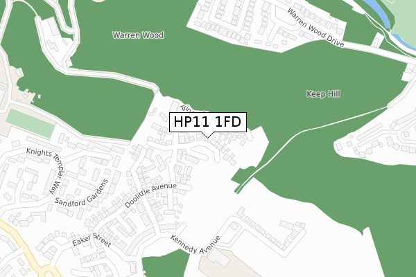
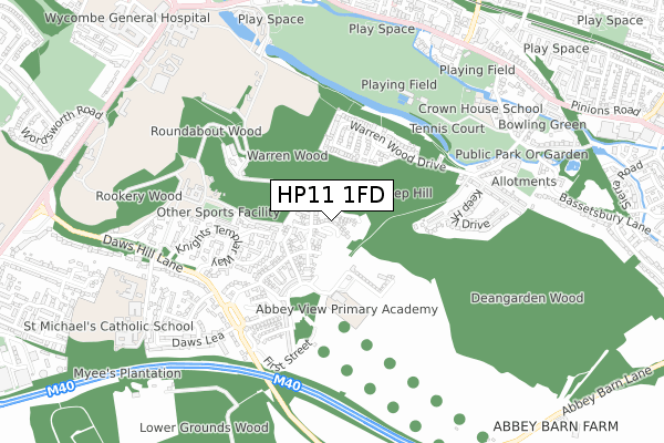
HP11 1FD is located in the Abbey electoral ward, within the unitary authority of Buckinghamshire and the English Parliamentary constituency of Wycombe. The Sub Integrated Care Board (ICB) Location is NHS Buckinghamshire, Oxfordshire and Berkshire West ICB - 14Y and the police force is Thames Valley. This postcode has been in use since November 2019.


GetTheData
Source: OS Open Zoomstack (Ordnance Survey)
Licence: Open Government Licence (requires attribution)
Attribution: Contains OS data © Crown copyright and database right 2024
Source: Open Postcode Geo
Licence: Open Government Licence (requires attribution)
Attribution: Contains OS data © Crown copyright and database right 2024; Contains Royal Mail data © Royal Mail copyright and database right 2024; Source: Office for National Statistics licensed under the Open Government Licence v.3.0
| Easting | 487118 |
| Northing | 191916 |
| Latitude | 51.619339 |
| Longitude | -0.743029 |
GetTheData
Source: Open Postcode Geo
Licence: Open Government Licence
| Country | England |
| Postcode District | HP11 |
| ➜ HP11 open data dashboard ➜ See where HP11 is on a map ➜ Where is High Wycombe? | |
GetTheData
Source: Land Registry Price Paid Data
Licence: Open Government Licence
| Ward | Abbey |
| Constituency | Wycombe |
GetTheData
Source: ONS Postcode Database
Licence: Open Government Licence
36, TRINITY CIRCLE, HIGH WYCOMBE, HP11 1FD 2021 23 JUN £676,389 |
34, TRINITY CIRCLE, HIGH WYCOMBE, HP11 1FD 2021 1 APR £721,500 |
32, TRINITY CIRCLE, HIGH WYCOMBE, HP11 1FD 2020 28 OCT £735,000 |
30, TRINITY CIRCLE, HIGH WYCOMBE, HP11 1FD 2020 27 OCT £715,000 |
42, TRINITY CIRCLE, HIGH WYCOMBE, HP11 1FD 2020 23 OCT £650,000 |
6, TRINITY CIRCLE, HIGH WYCOMBE, HP11 1FD 2020 5 OCT £700,000 |
4, TRINITY CIRCLE, HIGH WYCOMBE, HP11 1FD 2020 18 SEP £699,950 |
44, TRINITY CIRCLE, HIGH WYCOMBE, HP11 1FD 2020 23 JUL £745,000 |
24, TRINITY CIRCLE, HIGH WYCOMBE, HP11 1FD 2020 23 MAR £710,000 |
28, TRINITY CIRCLE, HIGH WYCOMBE, HP11 1FD 2020 19 MAR £715,000 |
GetTheData
Source: HM Land Registry Price Paid Data
Licence: Contains HM Land Registry data © Crown copyright and database right 2024. This data is licensed under the Open Government Licence v3.0.
| June 2022 | Anti-social behaviour | On or near Third Street | 257m |
| June 2022 | Violence and sexual offences | On or near Kennedy Avenue | 257m |
| June 2022 | Violence and sexual offences | On or near Kennedy Avenue | 257m |
| ➜ Get more crime data in our Crime section | |||
GetTheData
Source: data.police.uk
Licence: Open Government Licence
| Daws Lea (Daws Hill Lane) | High Wycombe | 567m |
| Daws Lea (Daws Hill Lane) | High Wycombe | 576m |
| St Michael's School (Daws Hill Lane) | High Wycombe | 701m |
| St Michael's School (Daws Hill Lane) | High Wycombe | 709m |
| Cricket Ground (London Road) | High Wycombe | 810m |
| High Wycombe Station | 1.2km |
| Bourne End Station | 5.2km |
GetTheData
Source: NaPTAN
Licence: Open Government Licence
GetTheData
Source: ONS Postcode Database
Licence: Open Government Licence

➜ Get more ratings from the Food Standards Agency
GetTheData
Source: Food Standards Agency
Licence: FSA terms & conditions
| Last Collection | |||
|---|---|---|---|
| Location | Mon-Fri | Sat | Distance |
| Daws Hill Lane | 16:30 | 12:00 | 525m |
| Bassetbury Lane | 17:00 | 12:00 | 733m |
| The Cricket Ground | 17:00 | 12:00 | 806m |
GetTheData
Source: Dracos
Licence: Creative Commons Attribution-ShareAlike
| Facility | Distance |
|---|---|
| Wycombe Rye Lido Warren Wood Drive, High Wycombe Swimming Pool, Outdoor Tennis Courts, Health and Fitness Gym, Studio | 546m |
| The Rye Bassetsbury Lane, High Wycombe Grass Pitches | 659m |
| St Michael's Catholic School Daws Hill Lane, High Wycombe Grass Pitches, Sports Hall | 801m |
GetTheData
Source: Active Places
Licence: Open Government Licence
| School | Phase of Education | Distance |
|---|---|---|
| Abbey View Primary Academy Kennedy Avenue, High Wycombe, HP11 1BX | Primary | 413m |
| Crown House School Bassetsbury Manor, Bassetsbury Lane, High Wycombe, HP11 1QX | Not applicable | 707m |
| The Chalfonts Independent Grammar School 19 London Road, High Wycombe, Buckinghamshire, Chalfont St Giles, HP11 1BJ | Not applicable | 846m |
GetTheData
Source: Edubase
Licence: Open Government Licence
The below table lists the International Territorial Level (ITL) codes (formerly Nomenclature of Territorial Units for Statistics (NUTS) codes) and Local Administrative Units (LAU) codes for HP11 1FD:
| ITL 1 Code | Name |
|---|---|
| TLJ | South East (England) |
| ITL 2 Code | Name |
| TLJ1 | Berkshire, Buckinghamshire and Oxfordshire |
| ITL 3 Code | Name |
| TLJ13 | Buckinghamshire |
| LAU 1 Code | Name |
| E06000060 | Buckinghamshire |
GetTheData
Source: ONS Postcode Directory
Licence: Open Government Licence
The below table lists the Census Output Area (OA), Lower Layer Super Output Area (LSOA), and Middle Layer Super Output Area (MSOA) for HP11 1FD:
| Code | Name | |
|---|---|---|
| OA | E00089995 | |
| LSOA | E01017841 | Wycombe 015F |
| MSOA | E02003710 | Wycombe 015 |
GetTheData
Source: ONS Postcode Directory
Licence: Open Government Licence
| HP11 1QS | Wallingford Gardens | 275m |
| HP11 1ED | The Briars | 292m |
| HP11 1EB | The Brackens | 310m |
| HP11 1QT | Sandford Gardens | 311m |
| HP11 1EA | Warren Wood Drive | 344m |
| HP11 1DN | Lowdon Close | 356m |
| HP11 1PX | Knights Templar Way | 381m |
| HP11 1DZ | Warren Wood Drive | 387m |
| HP11 1QR | Westminster Close | 450m |
| HP11 1BQ | Eisenhower Lower Close | 454m |
GetTheData
Source: Open Postcode Geo; Land Registry Price Paid Data
Licence: Open Government Licence