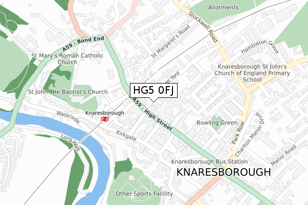
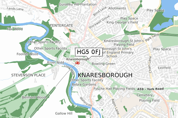
HG5 0FJ is located in the Knaresborough West electoral ward, within the unitary authority of North Yorkshire and the English Parliamentary constituency of Harrogate and Knaresborough. The Sub Integrated Care Board (ICB) Location is NHS Humber and North Yorkshire ICB - 42D and the police force is North Yorkshire. This postcode has been in use since November 2019.


GetTheData
Source: OS Open Zoomstack (Ordnance Survey)
Licence: Open Government Licence (requires attribution)
Attribution: Contains OS data © Crown copyright and database right 2024
Source: Open Postcode Geo
Licence: Open Government Licence (requires attribution)
Attribution: Contains OS data © Crown copyright and database right 2024; Contains Royal Mail data © Royal Mail copyright and database right 2024; Source: Office for National Statistics licensed under the Open Government Licence v.3.0
| Easting | 434965 |
| Northing | 457169 |
| Latitude | 54.009377 |
| Longitude | -1.467976 |
GetTheData
Source: Open Postcode Geo
Licence: Open Government Licence
| Country | England |
| Postcode District | HG5 |
| ➜ HG5 open data dashboard ➜ See where HG5 is on a map ➜ Where is Knaresborough? | |
GetTheData
Source: Land Registry Price Paid Data
Licence: Open Government Licence
| Ward | Knaresborough West |
| Constituency | Harrogate And Knaresborough |
GetTheData
Source: ONS Postcode Database
Licence: Open Government Licence
| January 2024 | Anti-social behaviour | On or near Parking Area | 294m |
| January 2024 | Public order | On or near Parking Area | 295m |
| January 2024 | Drugs | On or near Parking Area | 295m |
| ➜ Get more crime data in our Crime section | |||
GetTheData
Source: data.police.uk
Licence: Open Government Licence
| Knaresborough Centre (High Street) | Carmires | 147m |
| Knaresborough Centre (High Street) | Carmires | 180m |
| Council Offices (High Street) | Knaresborough | 189m |
| Council Offices (High Street) | Knaresborough | 197m |
| Bond End (High Street) | Knaresborough | 221m |
| Knaresborough Station | 0.2km |
| Starbeck Station | 2.5km |
| Harrogate Station | 4.9km |
GetTheData
Source: NaPTAN
Licence: Open Government Licence
GetTheData
Source: ONS Postcode Database
Licence: Open Government Licence


➜ Get more ratings from the Food Standards Agency
GetTheData
Source: Food Standards Agency
Licence: FSA terms & conditions
| Last Collection | |||
|---|---|---|---|
| Location | Mon-Fri | Sat | Distance |
| Market Place (Double Box) | 17:00 | 10:45 | 142m |
| York Place | 16:00 | 10:45 | 537m |
| 21 Princess Ave/Off Chain Lane | 16:45 | 13:30 | 783m |
GetTheData
Source: Dracos
Licence: Creative Commons Attribution-ShareAlike
| Facility | Distance |
|---|---|
| Knaresborough St John's C Of E Primary School Stockwell Road, Knaresborough Grass Pitches | 337m |
| Imagine Health And Spa (Knaresborough) Bond End, Knaresborough Health and Fitness Gym, Swimming Pool | 379m |
| St Marys School Tentergate Road, Knaresborough Grass Pitches | 510m |
GetTheData
Source: Active Places
Licence: Open Government Licence
| School | Phase of Education | Distance |
|---|---|---|
| Knaresborough St John's Church of England Primary School Stockwell Road, Knaresborough, HG5 0JN | Primary | 299m |
| St Mary's Primary School Knaresborough, A Voluntary Catholic Academy Tentergate Road, Knaresborough, HG5 9BG | Primary | 507m |
| King James's School King James Road, Knaresborough, HG5 8EB | Secondary | 663m |
GetTheData
Source: Edubase
Licence: Open Government Licence
The below table lists the International Territorial Level (ITL) codes (formerly Nomenclature of Territorial Units for Statistics (NUTS) codes) and Local Administrative Units (LAU) codes for HG5 0FJ:
| ITL 1 Code | Name |
|---|---|
| TLE | Yorkshire and The Humber |
| ITL 2 Code | Name |
| TLE2 | North Yorkshire |
| ITL 3 Code | Name |
| TLE22 | North Yorkshire CC |
| LAU 1 Code | Name |
| E07000165 | Harrogate |
GetTheData
Source: ONS Postcode Directory
Licence: Open Government Licence
The below table lists the Census Output Area (OA), Lower Layer Super Output Area (LSOA), and Middle Layer Super Output Area (MSOA) for HG5 0FJ:
| Code | Name | |
|---|---|---|
| OA | E00140914 | |
| LSOA | E01027669 | Harrogate 009B |
| MSOA | E02005769 | Harrogate 009 |
GetTheData
Source: ONS Postcode Directory
Licence: Open Government Licence
| HG5 0EF | Meadley Square | 24m |
| HG5 0EA | High Street | 26m |
| HG5 0JA | West View Terrace | 50m |
| HG5 0HB | High Street | 61m |
| HG5 0HY | Raw Gap | 68m |
| HG5 8BF | Hilton Lane | 72m |
| HG5 0HR | Prospect Terrace | 84m |
| HG5 0HF | Jockey Lane | 93m |
| HG5 0JJ | Whincup Close | 94m |
| HG5 0EG | Park Square | 97m |
GetTheData
Source: Open Postcode Geo; Land Registry Price Paid Data
Licence: Open Government Licence