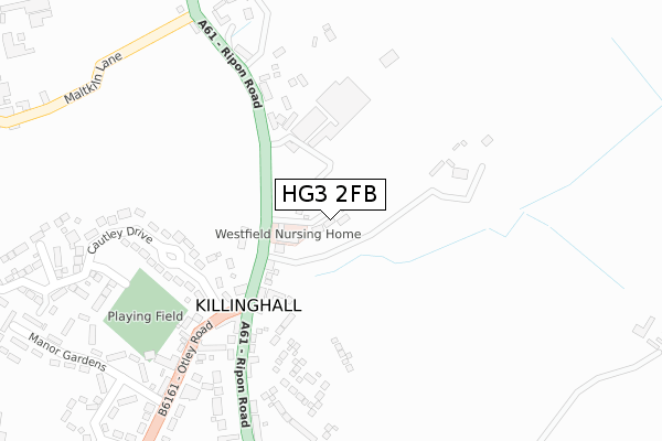
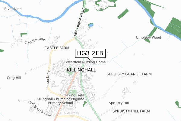
HG3 2FB is located in the Killinghall, Hampsthwaite & Saltergate electoral ward, within the unitary authority of North Yorkshire and the English Parliamentary constituency of Harrogate and Knaresborough. The Sub Integrated Care Board (ICB) Location is NHS Humber and North Yorkshire ICB - 42D and the police force is North Yorkshire. This postcode has been in use since July 2018.


GetTheData
Source: OS Open Zoomstack (Ordnance Survey)
Licence: Open Government Licence (requires attribution)
Attribution: Contains OS data © Crown copyright and database right 2024
Source: Open Postcode Geo
Licence: Open Government Licence (requires attribution)
Attribution: Contains OS data © Crown copyright and database right 2024; Contains Royal Mail data © Royal Mail copyright and database right 2024; Source: Office for National Statistics licensed under the Open Government Licence v.3.0
| Easting | 428749 |
| Northing | 458812 |
| Latitude | 54.024525 |
| Longitude | -1.562666 |
GetTheData
Source: Open Postcode Geo
Licence: Open Government Licence
| Country | England |
| Postcode District | HG3 |
| ➜ HG3 open data dashboard ➜ See where HG3 is on a map ➜ Where is Killinghall? | |
GetTheData
Source: Land Registry Price Paid Data
Licence: Open Government Licence
| Ward | Killinghall, Hampsthwaite & Saltergate |
| Constituency | Harrogate And Knaresborough |
GetTheData
Source: ONS Postcode Database
Licence: Open Government Licence
2020 10 SEP £795,000 |
3, WESTFIELD GRANGE, RIPON ROAD, KILLINGHALL, HARROGATE, HG3 2FB 2019 23 JUL £765,000 |
2, WESTFIELD GRANGE, RIPON ROAD, KILLINGHALL, HARROGATE, HG3 2FB 2019 14 JUN £925,000 |
GetTheData
Source: HM Land Registry Price Paid Data
Licence: Contains HM Land Registry data © Crown copyright and database right 2024. This data is licensed under the Open Government Licence v3.0.
| June 2022 | Violence and sexual offences | On or near Ripon Road | 162m |
| June 2022 | Violence and sexual offences | On or near Manor Road | 383m |
| June 2022 | Anti-social behaviour | On or near Manor Road | 383m |
| ➜ Get more crime data in our Crime section | |||
GetTheData
Source: data.police.uk
Licence: Open Government Licence
| Three Horse Shoes (Otley Road) | Killinghall | 204m |
| Daleside Nursery (Ripon Road) | Killinghall | 224m |
| Daleside Nursery (Ripon Road) | Killinghall | 246m |
| Three Horse Shoes (Ripon Road) | Killinghall | 261m |
| Hall Cottage (Otley Road) | Killinghall | 296m |
| Harrogate Station | 3.9km |
| Starbeck Station | 4.9km |
| Hornbeam Park Station | 5.5km |
GetTheData
Source: NaPTAN
Licence: Open Government Licence
| Percentage of properties with Next Generation Access | 100.0% |
| Percentage of properties with Superfast Broadband | 100.0% |
| Percentage of properties with Ultrafast Broadband | 100.0% |
| Percentage of properties with Full Fibre Broadband | 0.0% |
Superfast Broadband is between 30Mbps and 300Mbps
Ultrafast Broadband is > 300Mbps
| Percentage of properties unable to receive 2Mbps | 0.0% |
| Percentage of properties unable to receive 5Mbps | 0.0% |
| Percentage of properties unable to receive 10Mbps | 0.0% |
| Percentage of properties unable to receive 30Mbps | 0.0% |
GetTheData
Source: Ofcom
Licence: Ofcom Terms of Use (requires attribution)
GetTheData
Source: ONS Postcode Database
Licence: Open Government Licence


➜ Get more ratings from the Food Standards Agency
GetTheData
Source: Food Standards Agency
Licence: FSA terms & conditions
| Last Collection | |||
|---|---|---|---|
| Location | Mon-Fri | Sat | Distance |
| Nidd Bridge Station | 16:30 | 09:45 | 1,673m |
| Ripley P.o. | 17:00 | 12:15 | 1,805m |
| Almshouses | 17:45 | 09:45 | 1,969m |
GetTheData
Source: Dracos
Licence: Creative Commons Attribution-ShareAlike
| Facility | Distance |
|---|---|
| Killinghall Village Hall Otley Road, Killinghall, Harrogate Sports Hall | 329m |
| Killinghall Cricket Ground Otley Road, Killinghall, Harrogate Grass Pitches | 339m |
| Ripley Cricket Club Ripley, Harrogate Grass Pitches | 1.5km |
GetTheData
Source: Active Places
Licence: Open Government Licence
| School | Phase of Education | Distance |
|---|---|---|
| Killinghall Church of England Primary School Otley Road, Killinghall, Harrogate, HG3 2DW | Primary | 659m |
| Ripley Endowed Church of England School Main Street, Ripley, Ripley Endowed C Of E School, HARROGATE, HG3 3AY | Primary | 1.8km |
| Saltergate Community Junior School Newby Crescent, Harrogate, HG3 2TT | Primary | 2.1km |
GetTheData
Source: Edubase
Licence: Open Government Licence
The below table lists the International Territorial Level (ITL) codes (formerly Nomenclature of Territorial Units for Statistics (NUTS) codes) and Local Administrative Units (LAU) codes for HG3 2FB:
| ITL 1 Code | Name |
|---|---|
| TLE | Yorkshire and The Humber |
| ITL 2 Code | Name |
| TLE2 | North Yorkshire |
| ITL 3 Code | Name |
| TLE22 | North Yorkshire CC |
| LAU 1 Code | Name |
| E07000165 | Harrogate |
GetTheData
Source: ONS Postcode Directory
Licence: Open Government Licence
The below table lists the Census Output Area (OA), Lower Layer Super Output Area (LSOA), and Middle Layer Super Output Area (MSOA) for HG3 2FB:
| Code | Name | |
|---|---|---|
| OA | E00140886 | |
| LSOA | E01027665 | Harrogate 008C |
| MSOA | E02005768 | Harrogate 008 |
GetTheData
Source: ONS Postcode Directory
Licence: Open Government Licence
| HG3 2DH | Ripon Road | 151m |
| HG3 2DL | Cautley Grove | 165m |
| HG3 2AY | Ripon Road | 212m |
| HG3 2DG | Ripon Road | 294m |
| HG3 2DF | Ripon Road | 349m |
| HG3 2AZ | Ripon Road | 360m |
| HG3 2DJ | Cautley Drive | 392m |
| HG3 2DN | Otley Road | 396m |
| HG3 2DP | Manor Road | 407m |
| HG3 2DE | Church Lane | 412m |
GetTheData
Source: Open Postcode Geo; Land Registry Price Paid Data
Licence: Open Government Licence