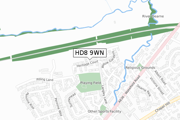
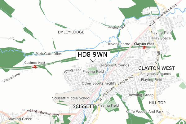
HD8 9WN is located in the Denby Dale electoral ward, within the metropolitan district of Kirklees and the English Parliamentary constituency of Dewsbury. The Sub Integrated Care Board (ICB) Location is NHS West Yorkshire ICB - X2C4Y and the police force is West Yorkshire. This postcode has been in use since February 2019.


GetTheData
Source: OS Open Zoomstack (Ordnance Survey)
Licence: Open Government Licence (requires attribution)
Attribution: Contains OS data © Crown copyright and database right 2024
Source: Open Postcode Geo
Licence: Open Government Licence (requires attribution)
Attribution: Contains OS data © Crown copyright and database right 2024; Contains Royal Mail data © Royal Mail copyright and database right 2024; Source: Office for National Statistics licensed under the Open Government Licence v.3.0
| Easting | 425083 |
| Northing | 411024 |
| Latitude | 53.595211 |
| Longitude | -1.622496 |
GetTheData
Source: Open Postcode Geo
Licence: Open Government Licence
| Country | England |
| Postcode District | HD8 |
| ➜ HD8 open data dashboard ➜ See where HD8 is on a map ➜ Where is Clayton West? | |
GetTheData
Source: Land Registry Price Paid Data
Licence: Open Government Licence
| Ward | Denby Dale |
| Constituency | Dewsbury |
GetTheData
Source: ONS Postcode Database
Licence: Open Government Licence
2021 25 JUN £307,500 |
32, HERITAGE COURT, SCISSETT, HUDDERSFIELD, HD8 9WN 2020 14 OCT £349,950 |
28, HERITAGE COURT, SCISSETT, HUDDERSFIELD, HD8 9WN 2020 30 SEP £349,950 |
30, HERITAGE COURT, SCISSETT, HUDDERSFIELD, HD8 9WN 2020 21 AUG £328,950 |
34, HERITAGE COURT, SCISSETT, HUDDERSFIELD, HD8 9WN 2020 20 MAY £325,950 |
43, HERITAGE COURT, SCISSETT, HUDDERSFIELD, HD8 9WN 2020 14 FEB £286,950 |
53, HERITAGE COURT, SCISSETT, HUDDERSFIELD, HD8 9WN 2019 6 DEC £287,950 |
63, HERITAGE COURT, SCISSETT, HUDDERSFIELD, HD8 9WN 2019 22 NOV £284,950 |
2019 22 NOV £304,950 |
67, HERITAGE COURT, SCISSETT, HUDDERSFIELD, HD8 9WN 2019 15 NOV £272,950 |
GetTheData
Source: HM Land Registry Price Paid Data
Licence: Contains HM Land Registry data © Crown copyright and database right 2024. This data is licensed under the Open Government Licence v3.0.
| June 2022 | Violence and sexual offences | On or near Sports/Recreation Area | 91m |
| June 2022 | Violence and sexual offences | On or near Sports/Recreation Area | 91m |
| June 2022 | Violence and sexual offences | On or near Sports/Recreation Area | 91m |
| ➜ Get more crime data in our Crime section | |||
GetTheData
Source: data.police.uk
Licence: Open Government Licence
| Wakefield Road Baths (Wakefield Road) | Scissett | 302m |
| Wakefield Rd Victoria Street (Wakefield Road) | Clayton West | 305m |
| Wakefield Rd Bridge Close (Wakefield Road) | Scissett | 336m |
| Wakefield Rd Albert Road (Wakefield Road) | Clayton West | 353m |
| Chapel Hill Duke Wood Road (Chapel Hill) | Clayton West | 420m |
| Denby Dale Station | 3.7km |
GetTheData
Source: NaPTAN
Licence: Open Government Licence
| Percentage of properties with Next Generation Access | 100.0% |
| Percentage of properties with Superfast Broadband | 100.0% |
| Percentage of properties with Ultrafast Broadband | 75.0% |
| Percentage of properties with Full Fibre Broadband | 75.0% |
Superfast Broadband is between 30Mbps and 300Mbps
Ultrafast Broadband is > 300Mbps
| Percentage of properties unable to receive 2Mbps | 0.0% |
| Percentage of properties unable to receive 5Mbps | 0.0% |
| Percentage of properties unable to receive 10Mbps | 0.0% |
| Percentage of properties unable to receive 30Mbps | 0.0% |
GetTheData
Source: Ofcom
Licence: Ofcom Terms of Use (requires attribution)
GetTheData
Source: ONS Postcode Database
Licence: Open Government Licence


➜ Get more ratings from the Food Standards Agency
GetTheData
Source: Food Standards Agency
Licence: FSA terms & conditions
| Last Collection | |||
|---|---|---|---|
| Location | Mon-Fri | Sat | Distance |
| Sunnymead | 16:30 | 11:00 | 315m |
| 6 Low Ings Green | 17:00 | 11:00 | 352m |
| 44 Spring Grove | 17:00 | 10:45 | 416m |
GetTheData
Source: Dracos
Licence: Creative Commons Attribution-ShareAlike
| Facility | Distance |
|---|---|
| Sunnymead Recreation Ground Sunnymead, Scissett, Huddersfield Grass Pitches | 100m |
| Scissett Baths & Fitness Centre Wakefield Road, Scissett, Huddersfield Swimming Pool, Health and Fitness Gym, Studio | 282m |
| Scissett Working Mens Club Wakefield Road, Scissett, Huddersfield Sports Hall | 337m |
GetTheData
Source: Active Places
Licence: Open Government Licence
| School | Phase of Education | Distance |
|---|---|---|
| Scissett Church of England Academy Wakefield Road, Scissett, Huddersfield, HD8 9HR | Primary | 498m |
| Scissett Middle School Wakefield Road, Scissett, Huddersfield, HD8 9JX | Middle deemed secondary | 602m |
| Kaye's Academy Holmfield, Clayton West, Huddersfield, HD8 9LZ | Primary | 795m |
GetTheData
Source: Edubase
Licence: Open Government Licence
The below table lists the International Territorial Level (ITL) codes (formerly Nomenclature of Territorial Units for Statistics (NUTS) codes) and Local Administrative Units (LAU) codes for HD8 9WN:
| ITL 1 Code | Name |
|---|---|
| TLE | Yorkshire and The Humber |
| ITL 2 Code | Name |
| TLE4 | West Yorkshire |
| ITL 3 Code | Name |
| TLE44 | Calderdale and Kirklees |
| LAU 1 Code | Name |
| E08000034 | Kirklees |
GetTheData
Source: ONS Postcode Directory
Licence: Open Government Licence
The below table lists the Census Output Area (OA), Lower Layer Super Output Area (LSOA), and Middle Layer Super Output Area (MSOA) for HD8 9WN:
| Code | Name | |
|---|---|---|
| OA | E00056011 | |
| LSOA | E01011110 | Kirklees 057A |
| MSOA | E02002327 | Kirklees 057 |
GetTheData
Source: ONS Postcode Directory
Licence: Open Government Licence
| HD8 9GT | Holly Road | 159m |
| HD8 9JF | Pilling Lane | 164m |
| HD8 9GU | Blackthorn Way | 183m |
| HD8 9JA | Sunnymead | 222m |
| HD8 9QW | The Close | 223m |
| HD8 9QN | Riverside | 255m |
| HD8 9JB | Pennine Way | 288m |
| HD8 9XB | Grove House Drive | 295m |
| HD8 9HZ | Sunnymead Bungalows | 328m |
| HD8 9LP | Pilling Lane | 331m |
GetTheData
Source: Open Postcode Geo; Land Registry Price Paid Data
Licence: Open Government Licence