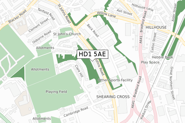
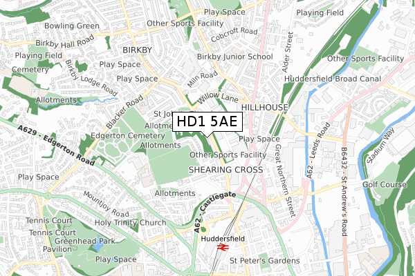
HD1 5AE is located in the Greenhead electoral ward, within the metropolitan district of Kirklees and the English Parliamentary constituency of Huddersfield. The Sub Integrated Care Board (ICB) Location is NHS West Yorkshire ICB - X2C4Y and the police force is West Yorkshire. This postcode has been in use since September 2018.


GetTheData
Source: OS Open Zoomstack (Ordnance Survey)
Licence: Open Government Licence (requires attribution)
Attribution: Contains OS data © Crown copyright and database right 2024
Source: Open Postcode Geo
Licence: Open Government Licence (requires attribution)
Attribution: Contains OS data © Crown copyright and database right 2024; Contains Royal Mail data © Royal Mail copyright and database right 2024; Source: Office for National Statistics licensed under the Open Government Licence v.3.0
| Easting | 414250 |
| Northing | 417547 |
| Latitude | 53.654243 |
| Longitude | -1.785873 |
GetTheData
Source: Open Postcode Geo
Licence: Open Government Licence
| Country | England |
| Postcode District | HD1 |
| ➜ HD1 open data dashboard ➜ See where HD1 is on a map ➜ Where is Huddersfield? | |
GetTheData
Source: Land Registry Price Paid Data
Licence: Open Government Licence
| Ward | Greenhead |
| Constituency | Huddersfield |
GetTheData
Source: ONS Postcode Database
Licence: Open Government Licence
| January 2024 | Public order | On or near Newhouse Place | 464m |
| January 2024 | Violence and sexual offences | On or near Newhouse Place | 464m |
| December 2023 | Criminal damage and arson | On or near Newhouse Place | 464m |
| ➜ Get more crime data in our Crime section | |||
GetTheData
Source: data.police.uk
Licence: Open Government Licence
| St Johns Road (St John's Road) | Birkby | 26m |
| St Johns Rd St Johns Crescent (St John's Road) | Birkby | 75m |
| St Johns Road Clare Hill (St John's Road) | Huddersfield Town Centre | 174m |
| St Johns Rd Beck Road (St John's Road) | Huddersfield Town Centre | 211m |
| Oxford St Bradford Road (Oxford Street) | Huddersfield Town Centre | 235m |
| Huddersfield Station | 0.6km |
| Lockwood Station | 2.4km |
| Deighton Station | 2.7km |
GetTheData
Source: NaPTAN
Licence: Open Government Licence
| Percentage of properties with Next Generation Access | 100.0% |
| Percentage of properties with Superfast Broadband | 100.0% |
| Percentage of properties with Ultrafast Broadband | 100.0% |
| Percentage of properties with Full Fibre Broadband | 0.0% |
Superfast Broadband is between 30Mbps and 300Mbps
Ultrafast Broadband is > 300Mbps
| Percentage of properties unable to receive 2Mbps | 0.0% |
| Percentage of properties unable to receive 5Mbps | 0.0% |
| Percentage of properties unable to receive 10Mbps | 0.0% |
| Percentage of properties unable to receive 30Mbps | 0.0% |
GetTheData
Source: Ofcom
Licence: Ofcom Terms of Use (requires attribution)
GetTheData
Source: ONS Postcode Database
Licence: Open Government Licence


➜ Get more ratings from the Food Standards Agency
GetTheData
Source: Food Standards Agency
Licence: FSA terms & conditions
| Last Collection | |||
|---|---|---|---|
| Location | Mon-Fri | Sat | Distance |
| 1 Moorfield Road | 18:30 | 11:45 | 498m |
| Huddersfield P.o. Box | 19:30 | 12:30 | 672m |
| Vernon Avenue | 17:30 | 12:00 | 810m |
GetTheData
Source: Dracos
Licence: Creative Commons Attribution-ShareAlike
| Facility | Distance |
|---|---|
| The Gym Group (Huddersfield) Beck Road, Huddersfield Health and Fitness Gym | 73m |
| Greenhead College Sports Field Clare Hill, Huddersfield Grass Pitches | 236m |
| Huddersfield Lawn Tennis And Squash Club Cemetery Road, Huddersfield Indoor Tennis Centre, Health and Fitness Gym, Squash Courts, Outdoor Tennis Courts | 494m |
GetTheData
Source: Active Places
Licence: Open Government Licence
| School | Phase of Education | Distance |
|---|---|---|
| Brambles Primary Academy Cambridge Road, Huddersfield, HD1 5BU | Primary | 451m |
| Birkby Infant and Nursery School Blacker Road, Birkby, Huddersfield, HD1 5HQ | Primary | 488m |
| Birkby Junior School Mead Street, Fartown, Huddersfield, HD1 6HE | Primary | 551m |
GetTheData
Source: Edubase
Licence: Open Government Licence
The below table lists the International Territorial Level (ITL) codes (formerly Nomenclature of Territorial Units for Statistics (NUTS) codes) and Local Administrative Units (LAU) codes for HD1 5AE:
| ITL 1 Code | Name |
|---|---|
| TLE | Yorkshire and The Humber |
| ITL 2 Code | Name |
| TLE4 | West Yorkshire |
| ITL 3 Code | Name |
| TLE44 | Calderdale and Kirklees |
| LAU 1 Code | Name |
| E08000034 | Kirklees |
GetTheData
Source: ONS Postcode Directory
Licence: Open Government Licence
The below table lists the Census Output Area (OA), Lower Layer Super Output Area (LSOA), and Middle Layer Super Output Area (MSOA) for HD1 5AE:
| Code | Name | |
|---|---|---|
| OA | E00056594 | |
| LSOA | E01011236 | Kirklees 034B |
| MSOA | E02002304 | Kirklees 034 |
GetTheData
Source: ONS Postcode Directory
Licence: Open Government Licence
| HD1 5DX | St Johns Road | 106m |
| HD1 5BP | Clare Hill | 117m |
| HD1 5DZ | St Johns Drive | 177m |
| HD1 5BS | Clare Hill | 178m |
| HD1 5DY | St Johns Crescent | 228m |
| HD1 5BW | St Johns Road | 239m |
| HD1 5BU | Cambridge Road | 251m |
| HD1 6DZ | Bradford Road | 265m |
| HD1 6JE | Bradford Road | 287m |
| HD1 6HY | Bradford Road | 300m |
GetTheData
Source: Open Postcode Geo; Land Registry Price Paid Data
Licence: Open Government Licence