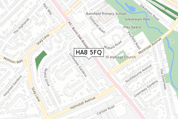
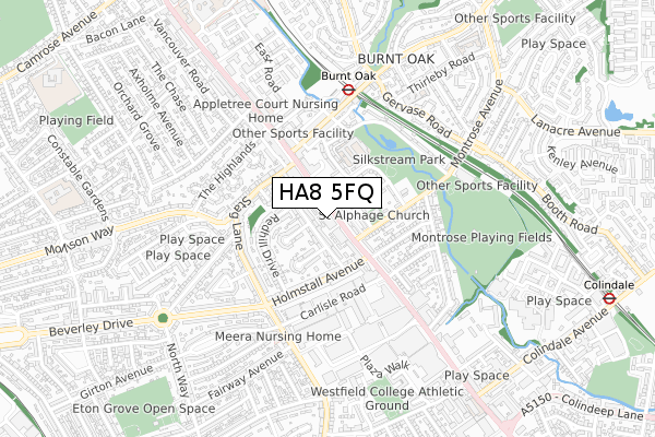
HA8 5FQ is located in the Queensbury electoral ward, within the London borough of Brent and the English Parliamentary constituency of Brent North. The Sub Integrated Care Board (ICB) Location is NHS North West London ICB - W2U3Z and the police force is Metropolitan Police. This postcode has been in use since February 2020.


GetTheData
Source: OS Open Zoomstack (Ordnance Survey)
Licence: Open Government Licence (requires attribution)
Attribution: Contains OS data © Crown copyright and database right 2024
Source: Open Postcode Geo
Licence: Open Government Licence (requires attribution)
Attribution: Contains OS data © Crown copyright and database right 2024; Contains Royal Mail data © Royal Mail copyright and database right 2024; Source: Office for National Statistics licensed under the Open Government Licence v.3.0
| Easting | 520235 |
| Northing | 190262 |
| Latitude | 51.598381 |
| Longitude | -0.265447 |
GetTheData
Source: Open Postcode Geo
Licence: Open Government Licence
| Country | England |
| Postcode District | HA8 |
| ➜ HA8 open data dashboard ➜ See where HA8 is on a map ➜ Where is London? | |
GetTheData
Source: Land Registry Price Paid Data
Licence: Open Government Licence
| Ward | Queensbury |
| Constituency | Brent North |
GetTheData
Source: ONS Postcode Database
Licence: Open Government Licence
| January 2024 | Other crime | On or near Barnfield Road | 436m |
| January 2024 | Violence and sexual offences | On or near Barnfield Road | 436m |
| December 2023 | Violence and sexual offences | On or near Gaskarth Road | 238m |
| ➜ Get more crime data in our Crime section | |||
GetTheData
Source: data.police.uk
Licence: Open Government Licence
| Montrose Avenue (Nw7) (Edgware Road) | Burnt Oak | 91m |
| Watling Avenue Burnt Oak Broadway (Burnt Oak Broadway) | Burnt Oak | 145m |
| Montrose Avenue (Nw7) (Edgware Road) | Burnt Oak | 150m |
| Stag Lane (Ha8) (Burnt Oak Broadway) | Burnt Oak | 175m |
| Oak Gardens (Stag Lane) | Burnt Oak | 233m |
| Burnt Oak Underground Station | Burnt Oak | 499m |
| Colindale Underground Station | Colindale | 1,127m |
| Queensbury Underground Station | Queensbury | 1,511m |
| Mill Hill Broadway Station | 2km |
| Hendon Station | 2.8km |
| Kenton Station | 4km |
GetTheData
Source: NaPTAN
Licence: Open Government Licence
GetTheData
Source: ONS Postcode Database
Licence: Open Government Licence


➜ Get more ratings from the Food Standards Agency
GetTheData
Source: Food Standards Agency
Licence: FSA terms & conditions
| Last Collection | |||
|---|---|---|---|
| Location | Mon-Fri | Sat | Distance |
| Holmstal Parade | 17:00 | 12:00 | 181m |
| Watling Post Office | 18:15 | 12:00 | 273m |
| Montrose Avenue | 17:00 | 12:00 | 305m |
GetTheData
Source: Dracos
Licence: Creative Commons Attribution-ShareAlike
| Facility | Distance |
|---|---|
| Minotaur Gym (Closed) Watling Avenue, Edgware Health and Fitness Gym | 298m |
| Anytime Fitness (London Colindale) Capitol Way, Capitol Way, London Health and Fitness Gym | 495m |
| Unitas Youth Zone Montrose Avenue, Edgware Artificial Grass Pitch, Sports Hall, Studio, Health and Fitness Gym | 553m |
GetTheData
Source: Active Places
Licence: Open Government Licence
| School | Phase of Education | Distance |
|---|---|---|
| Barnfield Primary School Silkstream Road, Edgware, HA8 0DA | Primary | 269m |
| Shalom Noam Primary School East Road, Edgware, HA8 0AJ | Primary | 481m |
| The Annunciation Catholic Infant School Thirleby Road, Edgware, HA8 0HQ | Primary | 611m |
GetTheData
Source: Edubase
Licence: Open Government Licence
The below table lists the International Territorial Level (ITL) codes (formerly Nomenclature of Territorial Units for Statistics (NUTS) codes) and Local Administrative Units (LAU) codes for HA8 5FQ:
| ITL 1 Code | Name |
|---|---|
| TLI | London |
| ITL 2 Code | Name |
| TLI7 | Outer London - West and North West |
| ITL 3 Code | Name |
| TLI72 | Brent |
| LAU 1 Code | Name |
| E09000005 | Brent |
GetTheData
Source: ONS Postcode Directory
Licence: Open Government Licence
The below table lists the Census Output Area (OA), Lower Layer Super Output Area (LSOA), and Middle Layer Super Output Area (MSOA) for HA8 5FQ:
| Code | Name | |
|---|---|---|
| OA | E00002850 | |
| LSOA | E01000592 | Brent 001D |
| MSOA | E02000093 | Brent 001 |
GetTheData
Source: ONS Postcode Directory
Licence: Open Government Licence
| HA8 5JA | Limesdale Gardens | 52m |
| HA8 5FB | Burnt Oak Broadway | 57m |
| HA8 0BN | Burnt Oak Broadway | 61m |
| HA8 0BL | Burnt Oak Broadway | 71m |
| HA8 0BW | Burnt Oak Broadway | 90m |
| HA8 5JD | Limesdale Gardens | 92m |
| HA8 0BJ | Burnt Oak Broadway | 108m |
| HA8 0BP | Burnt Oak Broadway | 108m |
| HA8 5HZ | Limesdale Gardens | 111m |
| HA8 0DH | Millfield Road | 113m |
GetTheData
Source: Open Postcode Geo; Land Registry Price Paid Data
Licence: Open Government Licence