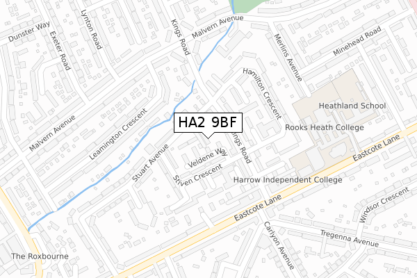
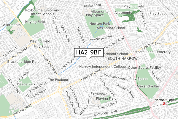
HA2 9BF is located in the Roxbourne electoral ward, within the London borough of Harrow and the English Parliamentary constituency of Harrow West. The Sub Integrated Care Board (ICB) Location is NHS North West London ICB - W2U3Z and the police force is Metropolitan Police. This postcode has been in use since August 2019.


GetTheData
Source: OS Open Zoomstack (Ordnance Survey)
Licence: Open Government Licence (requires attribution)
Attribution: Contains OS data © Crown copyright and database right 2024
Source: Open Postcode Geo
Licence: Open Government Licence (requires attribution)
Attribution: Contains OS data © Crown copyright and database right 2024; Contains Royal Mail data © Royal Mail copyright and database right 2024; Source: Office for National Statistics licensed under the Open Government Licence v.3.0
| Easting | 512763 |
| Northing | 186180 |
| Latitude | 51.563235 |
| Longitude | -0.374590 |
GetTheData
Source: Open Postcode Geo
Licence: Open Government Licence
| Country | England |
| Postcode District | HA2 |
| ➜ HA2 open data dashboard ➜ See where HA2 is on a map ➜ Where is Harrow? | |
GetTheData
Source: Land Registry Price Paid Data
Licence: Open Government Licence
| Ward | Roxbourne |
| Constituency | Harrow West |
GetTheData
Source: ONS Postcode Database
Licence: Open Government Licence
| January 2024 | Violence and sexual offences | On or near Bodmin Close | 151m |
| December 2023 | Violence and sexual offences | On or near Bodmin Close | 151m |
| November 2023 | Violence and sexual offences | On or near Bodmin Close | 151m |
| ➜ Get more crime data in our Crime section | |||
GetTheData
Source: data.police.uk
Licence: Open Government Licence
| Bodmin Close | South Harrow | 132m |
| Malvern Avenue | Rayners Lane | 197m |
| Kings Road (Ha2) | South Harrow | 244m |
| Kings Road (Ha2) | South Harrow | 246m |
| Malvern Avenue | Rayners Lane | 278m |
| Rayners Lane Underground Station | Rayners Lane | 1,347m |
| Northolt Park Station | 1.2km |
| South Ruislip Station | 1.8km |
| Sudbury Hill Harrow Station | 2.7km |
GetTheData
Source: NaPTAN
Licence: Open Government Licence
GetTheData
Source: ONS Postcode Database
Licence: Open Government Licence


➜ Get more ratings from the Food Standards Agency
GetTheData
Source: Food Standards Agency
Licence: FSA terms & conditions
| Last Collection | |||
|---|---|---|---|
| Location | Mon-Fri | Sat | Distance |
| Kings Road | 17:15 | 12:00 | 375m |
| North Harrow Station | 17:00 | 11:45 | 396m |
| Alexandra Avenue | 18:15 | 12:30 | 560m |
GetTheData
Source: Dracos
Licence: Creative Commons Attribution-ShareAlike
| Facility | Distance |
|---|---|
| Rooks Heath College Eastcote Lane, South Harrow, Harrow Sports Hall, Studio | 224m |
| Heathlands School Eastcote Lane, South Harrow, Harrow Grass Pitches | 372m |
| Newton Park West Ravenswood Crescent , Harrow Grass Pitches | 538m |
GetTheData
Source: Active Places
Licence: Open Government Licence
| School | Phase of Education | Distance |
|---|---|---|
| Rooks Heath School Eastcote Lane, South Harrow, Harrow, HA2 9AH | Secondary | 218m |
| Harrow Independent College 308-310 East Cote Lane, Harrow, Middlesex, HA2 9AH | Not applicable | 225m |
| Heathland School Eastcote Lane, South Harrow, Harrow, HA2 9AG | Primary | 270m |
GetTheData
Source: Edubase
Licence: Open Government Licence
The below table lists the International Territorial Level (ITL) codes (formerly Nomenclature of Territorial Units for Statistics (NUTS) codes) and Local Administrative Units (LAU) codes for HA2 9BF:
| ITL 1 Code | Name |
|---|---|
| TLI | London |
| ITL 2 Code | Name |
| TLI7 | Outer London - West and North West |
| ITL 3 Code | Name |
| TLI74 | Harrow and Hillingdon |
| LAU 1 Code | Name |
| E09000015 | Harrow |
GetTheData
Source: ONS Postcode Directory
Licence: Open Government Licence
The below table lists the Census Output Area (OA), Lower Layer Super Output Area (LSOA), and Middle Layer Super Output Area (MSOA) for HA2 9BF:
| Code | Name | |
|---|---|---|
| OA | E00011072 | |
| LSOA | E01002215 | Harrow 031B |
| MSOA | E02000463 | Harrow 031 |
GetTheData
Source: ONS Postcode Directory
Licence: Open Government Licence
| HA2 9BA | Stuart Avenue | 29m |
| HA2 9BH | Veldene Way | 42m |
| HA2 9JA | Kings Road | 49m |
| HA2 9AY | Stiven Crescent | 78m |
| HA2 9BB | Stuart Avenue | 84m |
| HA2 9JB | Kings Road | 88m |
| HA2 9AX | Stiven Crescent | 104m |
| HA2 9HY | Kings Road | 115m |
| HA2 9JX | Hodson Close | 117m |
| HA2 9BQ | Stradbrook Close | 133m |
GetTheData
Source: Open Postcode Geo; Land Registry Price Paid Data
Licence: Open Government Licence