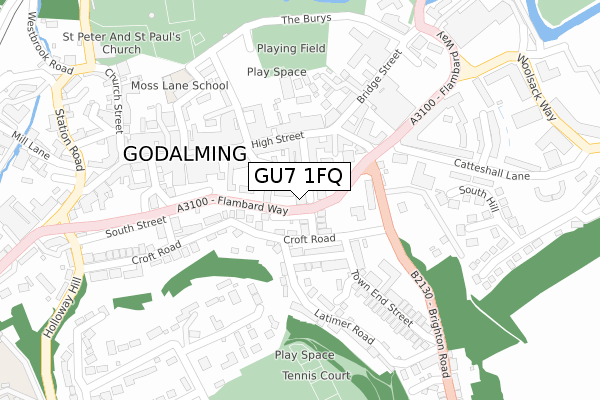
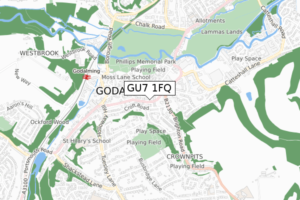
GU7 1FQ is located in the Godalming Central & Ockford electoral ward, within the local authority district of Waverley and the English Parliamentary constituency of South West Surrey. The Sub Integrated Care Board (ICB) Location is NHS Surrey Heartlands ICB - 92A and the police force is Surrey. This postcode has been in use since May 2018.


GetTheData
Source: OS Open Zoomstack (Ordnance Survey)
Licence: Open Government Licence (requires attribution)
Attribution: Contains OS data © Crown copyright and database right 2024
Source: Open Postcode Geo
Licence: Open Government Licence (requires attribution)
Attribution: Contains OS data © Crown copyright and database right 2024; Contains Royal Mail data © Royal Mail copyright and database right 2024; Source: Office for National Statistics licensed under the Open Government Licence v.3.0
| Easting | 497145 |
| Northing | 143752 |
| Latitude | 51.184749 |
| Longitude | -0.611413 |
GetTheData
Source: Open Postcode Geo
Licence: Open Government Licence
| Country | England |
| Postcode District | GU7 |
| ➜ GU7 open data dashboard ➜ See where GU7 is on a map ➜ Where is Godalming? | |
GetTheData
Source: Land Registry Price Paid Data
Licence: Open Government Licence
| Ward | Godalming Central & Ockford |
| Constituency | South West Surrey |
GetTheData
Source: ONS Postcode Database
Licence: Open Government Licence
| January 2024 | Public order | On or near Latimer Road | 226m |
| January 2024 | Anti-social behaviour | On or near Parking Area | 263m |
| January 2024 | Criminal damage and arson | On or near Parking Area | 366m |
| ➜ Get more crime data in our Crime section | |||
GetTheData
Source: data.police.uk
Licence: Open Government Licence
| The Square (High Street) | Godalming | 112m |
| Bridge Street | Godalming | 150m |
| Croft Road Turn (Brighton Road) | Godalming | 158m |
| Borough Hall (Bridge Street) | Godalming | 295m |
| Pepperpot (High Street) | Godalming | 309m |
| Godalming Station | 0.6km |
| Farncombe Station | 1.5km |
| Milford (Surrey) Station | 3km |
GetTheData
Source: NaPTAN
Licence: Open Government Licence
GetTheData
Source: ONS Postcode Database
Licence: Open Government Licence


➜ Get more ratings from the Food Standards Agency
GetTheData
Source: Food Standards Agency
Licence: FSA terms & conditions
| Last Collection | |||
|---|---|---|---|
| Location | Mon-Fri | Sat | Distance |
| High Street | 18:45 | 12:00 | 135m |
| Latimer Road | 17:15 | 12:00 | 138m |
| Croft Road | 17:15 | 12:00 | 250m |
GetTheData
Source: Dracos
Licence: Creative Commons Attribution-ShareAlike
| Facility | Distance |
|---|---|
| Snap Fitness (Godalming) High Street, Godalming Health and Fitness Gym, Studio | 121m |
| Zest Goldalming Ltd (Closed) Great George Street, Godalming Health and Fitness Gym, Studio | 191m |
| The Burys Field The Burys, Godalming Grass Pitches | 275m |
GetTheData
Source: Active Places
Licence: Open Government Licence
| School | Phase of Education | Distance |
|---|---|---|
| Moss Lane School Moss Lane, Godalming, GU7 1EF | Primary | 268m |
| The Wharf Nursery School The Wharf, Woolsack Way, Woolsack Way, Godalming, GU7 1JG | Nursery | 359m |
| St Hilary's School Holloway Hill, Godalming, GU7 1RZ | Not applicable | 608m |
GetTheData
Source: Edubase
Licence: Open Government Licence
The below table lists the International Territorial Level (ITL) codes (formerly Nomenclature of Territorial Units for Statistics (NUTS) codes) and Local Administrative Units (LAU) codes for GU7 1FQ:
| ITL 1 Code | Name |
|---|---|
| TLJ | South East (England) |
| ITL 2 Code | Name |
| TLJ2 | Surrey, East and West Sussex |
| ITL 3 Code | Name |
| TLJ25 | West Surrey |
| LAU 1 Code | Name |
| E07000216 | Waverley |
GetTheData
Source: ONS Postcode Directory
Licence: Open Government Licence
The below table lists the Census Output Area (OA), Lower Layer Super Output Area (LSOA), and Middle Layer Super Output Area (MSOA) for GU7 1FQ:
| Code | Name | |
|---|---|---|
| OA | E00157620 | |
| LSOA | E01030916 | Waverley 007A |
| MSOA | E02006445 | Waverley 007 |
GetTheData
Source: ONS Postcode Directory
Licence: Open Government Licence
| GU7 1BD | Queen Street | 43m |
| GU7 1BU | Pound Close | 56m |
| GU7 1DQ | Upper Queen Street | 58m |
| GU7 1BA | Queen Street | 66m |
| GU7 1BT | Pound Lane | 67m |
| GU7 1BX | Pound Lane | 75m |
| GU7 1BP | Carlos Street | 91m |
| GU7 1AU | High Street | 104m |
| GU7 1AZ | High Street | 115m |
| GU7 1DZ | High Street | 117m |
GetTheData
Source: Open Postcode Geo; Land Registry Price Paid Data
Licence: Open Government Licence