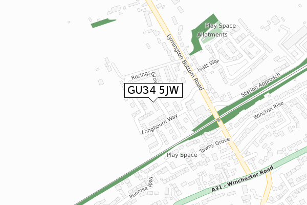
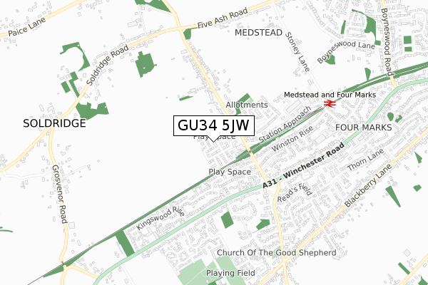
GU34 5JW is located in the Four Marks & Medstead electoral ward, within the local authority district of East Hampshire and the English Parliamentary constituency of East Hampshire. The Sub Integrated Care Board (ICB) Location is NHS Hampshire and Isle of Wight ICB - D9Y0V and the police force is Hampshire. This postcode has been in use since January 2018.


GetTheData
Source: OS Open Zoomstack (Ordnance Survey)
Licence: Open Government Licence (requires attribution)
Attribution: Contains OS data © Crown copyright and database right 2024
Source: Open Postcode Geo
Licence: Open Government Licence (requires attribution)
Attribution: Contains OS data © Crown copyright and database right 2024; Contains Royal Mail data © Royal Mail copyright and database right 2024; Source: Office for National Statistics licensed under the Open Government Licence v.3.0
| Easting | 466208 |
| Northing | 135095 |
| Latitude | 51.111330 |
| Longitude | -1.055574 |
GetTheData
Source: Open Postcode Geo
Licence: Open Government Licence
| Country | England |
| Postcode District | GU34 |
| ➜ GU34 open data dashboard ➜ See where GU34 is on a map ➜ Where is Medstead? | |
GetTheData
Source: Land Registry Price Paid Data
Licence: Open Government Licence
| Ward | Four Marks & Medstead |
| Constituency | East Hampshire |
GetTheData
Source: ONS Postcode Database
Licence: Open Government Licence
| August 2023 | Other theft | On or near Drummond Close | 476m |
| June 2022 | Public order | On or near Tawny Grove | 215m |
| June 2022 | Criminal damage and arson | On or near Tawny Grove | 215m |
| ➜ Get more crime data in our Crime section | |||
GetTheData
Source: data.police.uk
Licence: Open Government Licence
| Lymington Bottom (Winchester Road) | Four Marks | 414m |
| Lymington Bottom (Winchester Road) | Four Marks | 448m |
| Kingswood Rise (Winchester Road) | Four Marks | 474m |
| Kingswood Rise (Winchester Road) | Four Marks | 495m |
| The Gospel Hall (Winchester Road) | Four Marks | 600m |
| Medstead & Four Marks (Mid Hants Railway) | Four Marks | 733m |
GetTheData
Source: NaPTAN
Licence: Open Government Licence
| Percentage of properties with Next Generation Access | 0.0% |
| Percentage of properties with Superfast Broadband | 0.0% |
| Percentage of properties with Ultrafast Broadband | 0.0% |
| Percentage of properties with Full Fibre Broadband | 0.0% |
Superfast Broadband is between 30Mbps and 300Mbps
Ultrafast Broadband is > 300Mbps
| Median download speed | 21.1Mbps |
| Average download speed | 20.5Mbps |
| Maximum download speed | 23.16Mbps |
| Median upload speed | 1.2Mbps |
| Average upload speed | 1.2Mbps |
| Maximum upload speed | 1.26Mbps |
| Percentage of properties unable to receive 2Mbps | 0.0% |
| Percentage of properties unable to receive 5Mbps | 0.0% |
| Percentage of properties unable to receive 10Mbps | 0.0% |
| Percentage of properties unable to receive 30Mbps | 100.0% |
GetTheData
Source: Ofcom
Licence: Ofcom Terms of Use (requires attribution)
GetTheData
Source: ONS Postcode Database
Licence: Open Government Licence


➜ Get more ratings from the Food Standards Agency
GetTheData
Source: Food Standards Agency
Licence: FSA terms & conditions
| Last Collection | |||
|---|---|---|---|
| Location | Mon-Fri | Sat | Distance |
| Lymington Bottom Road | 16:30 | 08:45 | 353m |
| Winchester Road | 16:30 | 08:30 | 524m |
| Brislands Lane | 16:15 | 08:45 | 830m |
GetTheData
Source: Dracos
Licence: Creative Commons Attribution-ShareAlike
| Facility | Distance |
|---|---|
| Fourmarks Recreation Ground Uplands Lane, Four Marks, Alton Grass Pitches, Outdoor Tennis Courts | 672m |
| Four Marks Village Hall Lymington Bottom, Four Marks, Alton Sports Hall | 690m |
| Bk (Body Kare) Health And Fitness (Closed) Winchester Road, Four Marks, Alton Health and Fitness Gym | 724m |
GetTheData
Source: Active Places
Licence: Open Government Licence
| School | Phase of Education | Distance |
|---|---|---|
| Four Marks Church of England Primary School Five Lanes End, Four Marks, Alton, GU34 5AS | Primary | 1.6km |
| Medstead Church of England Primary School Roedowns Road, Medstead, Alton, GU34 5LG | Primary | 1.7km |
| Compass Community School Hampshire Tull Park, Coley Avenue, Woking, GU22 7BT | Not applicable | 2km |
GetTheData
Source: Edubase
Licence: Open Government Licence
The below table lists the International Territorial Level (ITL) codes (formerly Nomenclature of Territorial Units for Statistics (NUTS) codes) and Local Administrative Units (LAU) codes for GU34 5JW:
| ITL 1 Code | Name |
|---|---|
| TLJ | South East (England) |
| ITL 2 Code | Name |
| TLJ3 | Hampshire and Isle of Wight |
| ITL 3 Code | Name |
| TLJ36 | Central Hampshire |
| LAU 1 Code | Name |
| E07000085 | East Hampshire |
GetTheData
Source: ONS Postcode Directory
Licence: Open Government Licence
The below table lists the Census Output Area (OA), Lower Layer Super Output Area (LSOA), and Middle Layer Super Output Area (MSOA) for GU34 5JW:
| Code | Name | |
|---|---|---|
| OA | E00114874 | |
| LSOA | E01022596 | East Hampshire 007E |
| MSOA | E02004703 | East Hampshire 007 |
GetTheData
Source: ONS Postcode Directory
Licence: Open Government Licence
| GU34 5FN | Lymington Bottom Road | 111m |
| GU34 5EW | Lymington Bottom Road | 125m |
| GU34 5DU | Tawny Grove | 192m |
| GU34 5DW | Lymington Bottom Road | 205m |
| GU34 5BG | Penrose Way | 253m |
| GU34 5HF | Kirtle Drive | 287m |
| GU34 5HU | Winchester Road | 299m |
| GU34 5GA | Lelant Drive | 312m |
| GU34 5DL | Lymington Bottom Road | 318m |
| GU34 5HP | Winston Rise | 365m |
GetTheData
Source: Open Postcode Geo; Land Registry Price Paid Data
Licence: Open Government Licence