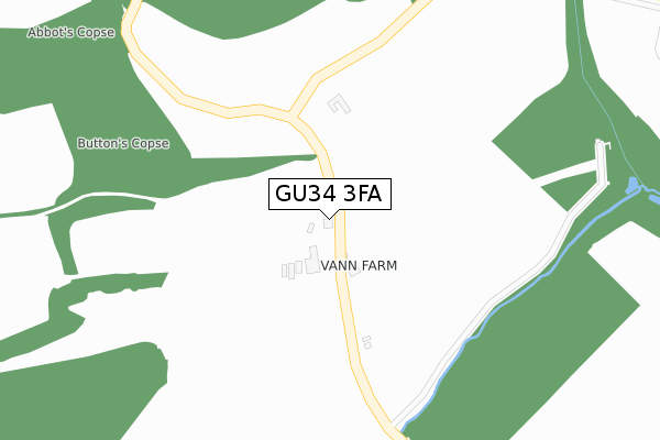
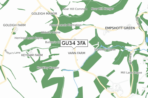
GU34 3FA is located in the Ropley, Hawkley & Hangers electoral ward, within the local authority district of East Hampshire and the English Parliamentary constituency of East Hampshire. The Sub Integrated Care Board (ICB) Location is NHS Hampshire and Isle of Wight ICB - D9Y0V and the police force is Hampshire. This postcode has been in use since July 2019.


GetTheData
Source: OS Open Zoomstack (Ordnance Survey)
Licence: Open Government Licence (requires attribution)
Attribution: Contains OS data © Crown copyright and database right 2024
Source: Open Postcode Geo
Licence: Open Government Licence (requires attribution)
Attribution: Contains OS data © Crown copyright and database right 2024; Contains Royal Mail data © Royal Mail copyright and database right 2024; Source: Office for National Statistics licensed under the Open Government Licence v.3.0
| Easting | 473966 |
| Northing | 130671 |
| Latitude | 51.070608 |
| Longitude | -0.945673 |
GetTheData
Source: Open Postcode Geo
Licence: Open Government Licence
| Country | England |
| Postcode District | GU34 |
| ➜ GU34 open data dashboard ➜ See where GU34 is on a map | |
GetTheData
Source: Land Registry Price Paid Data
Licence: Open Government Licence
| Ward | Ropley, Hawkley & Hangers |
| Constituency | East Hampshire |
GetTheData
Source: ONS Postcode Database
Licence: Open Government Licence
| Lower Green Telephone Box (Hawkley Road) | Hawkley | 1,166m |
| Bradshott Turn (B3006) | Empshott | 1,891m |
| Bradshott Turn (B3006) | Empshott | 1,906m |
| Liss Station | 4.8km |
GetTheData
Source: NaPTAN
Licence: Open Government Licence
GetTheData
Source: ONS Postcode Database
Licence: Open Government Licence


➜ Get more ratings from the Food Standards Agency
GetTheData
Source: Food Standards Agency
Licence: FSA terms & conditions
| Last Collection | |||
|---|---|---|---|
| Location | Mon-Fri | Sat | Distance |
| Hawkley Mill | 16:00 | 09:30 | 984m |
| Lower Green | 16:00 | 09:30 | 1,163m |
| Empshott Green | 16:00 | 08:45 | 1,165m |
GetTheData
Source: Dracos
Licence: Creative Commons Attribution-ShareAlike
| Facility | Distance |
|---|---|
| Hawkley Cricket Club Upper Green, Hawkley, Liss Grass Pitches | 1.6km |
| Hawkley Fields Hawkley Road, Liss Grass Pitches | 3.7km |
| Spread Eagle Football Pitch Farnham Road, Liss Grass Pitches | 3.8km |
GetTheData
Source: Active Places
Licence: Open Government Licence
| School | Phase of Education | Distance |
|---|---|---|
| Selborne Church of England Primary School School Lane, Selborne, Alton, GU34 3JA | Primary | 3.1km |
| Greatham Primary School Petersfield Road, Greatham, Liss, GU33 6HA | Primary | 3.6km |
| Froxfield Church of England Primary and Pre-School High Cross, Froxfield, Petersfield, GU32 1EG | Primary | 5km |
GetTheData
Source: Edubase
Licence: Open Government Licence
The below table lists the International Territorial Level (ITL) codes (formerly Nomenclature of Territorial Units for Statistics (NUTS) codes) and Local Administrative Units (LAU) codes for GU34 3FA:
| ITL 1 Code | Name |
|---|---|
| TLJ | South East (England) |
| ITL 2 Code | Name |
| TLJ3 | Hampshire and Isle of Wight |
| ITL 3 Code | Name |
| TLJ36 | Central Hampshire |
| LAU 1 Code | Name |
| E07000085 | East Hampshire |
GetTheData
Source: ONS Postcode Directory
Licence: Open Government Licence
The below table lists the Census Output Area (OA), Lower Layer Super Output Area (LSOA), and Middle Layer Super Output Area (MSOA) for GU34 3FA:
| Code | Name | |
|---|---|---|
| OA | E00115034 | |
| LSOA | E01022627 | East Hampshire 007F |
| MSOA | E02004703 | East Hampshire 007 |
GetTheData
Source: ONS Postcode Directory
Licence: Open Government Licence
| GU34 3SF | 0m | |
| GU33 6HU | Empshott Green | 885m |
| GU34 3SB | 910m | |
| GU33 6NW | 1131m | |
| GU33 6NL | Greenfield | 1159m |
| GU33 6NU | 1199m | |
| GU33 6NG | 1221m | |
| GU33 6NR | 1273m | |
| GU33 6NS | 1370m | |
| GU33 6NQ | 1424m |
GetTheData
Source: Open Postcode Geo; Land Registry Price Paid Data
Licence: Open Government Licence