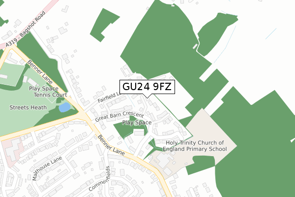
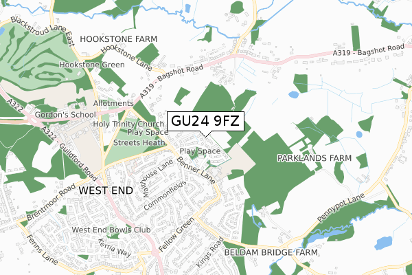
GU24 9FZ is located in the Bisley & West End electoral ward, within the local authority district of Surrey Heath and the English Parliamentary constituency of Surrey Heath. The Sub Integrated Care Board (ICB) Location is NHS Surrey Heartlands ICB - 92A and the police force is Surrey. This postcode has been in use since October 2019.


GetTheData
Source: OS Open Zoomstack (Ordnance Survey)
Licence: Open Government Licence (requires attribution)
Attribution: Contains OS data © Crown copyright and database right 2024
Source: Open Postcode Geo
Licence: Open Government Licence (requires attribution)
Attribution: Contains OS data © Crown copyright and database right 2024; Contains Royal Mail data © Royal Mail copyright and database right 2024; Source: Office for National Statistics licensed under the Open Government Licence v.3.0
| Easting | 495159 |
| Northing | 161295 |
| Latitude | 51.342784 |
| Longitude | -0.635160 |
GetTheData
Source: Open Postcode Geo
Licence: Open Government Licence
| Country | England |
| Postcode District | GU24 |
| ➜ GU24 open data dashboard ➜ See where GU24 is on a map ➜ Where is West End? | |
GetTheData
Source: Land Registry Price Paid Data
Licence: Open Government Licence
| Ward | Bisley & West End |
| Constituency | Surrey Heath |
GetTheData
Source: ONS Postcode Database
Licence: Open Government Licence
| June 2022 | Violence and sexual offences | On or near Benner Lane | 207m |
| June 2022 | Vehicle crime | On or near Oldacre | 408m |
| June 2022 | Other theft | On or near Bagshot Road | 426m |
| ➜ Get more crime data in our Crime section | |||
GetTheData
Source: data.police.uk
Licence: Open Government Licence
| Benner Lane School (Benner Lane) | West End | 250m |
| Bagshot Road | West End | 543m |
| Bagshot Road | West End | 554m |
| The Inn (Guildford Road) | West End | 686m |
| Fellow Green (Guildford Road) | West End | 697m |
| Brookwood Station | 4.3km |
| Bagshot Station | 4.4km |
| Longcross Station | 5.5km |
GetTheData
Source: NaPTAN
Licence: Open Government Licence
GetTheData
Source: ONS Postcode Database
Licence: Open Government Licence


➜ Get more ratings from the Food Standards Agency
GetTheData
Source: Food Standards Agency
Licence: FSA terms & conditions
| Last Collection | |||
|---|---|---|---|
| Location | Mon-Fri | Sat | Distance |
| West End School | 16:30 | 08:15 | 521m |
| Clappers | 16:30 | 07:15 | 1,423m |
| Bisley Post Office | 17:45 | 11:30 | 1,744m |
GetTheData
Source: Dracos
Licence: Creative Commons Attribution-ShareAlike
| Facility | Distance |
|---|---|
| Holy Trinity C Of E Primary School Benner Lane, West End, Woking Sports Hall, Grass Pitches, Outdoor Tennis Courts | 216m |
| West End Recreation Ground (Woking) Benner Lane, West End, Woking Grass Pitches, Outdoor Tennis Courts | 420m |
| Gordons School Bagshot Road, West End, Woking Sports Hall, Health and Fitness Gym, Swimming Pool, Artificial Grass Pitch, Grass Pitches | 763m |
GetTheData
Source: Active Places
Licence: Open Government Licence
| School | Phase of Education | Distance |
|---|---|---|
| Holy Trinity CofE Primary School Benner Lane, West End, Woking, GU24 9JQ | Primary | 216m |
| Gordon's School Bagshot Road, West End, Woking, GU24 9PT | Secondary | 797m |
| Bisley CofE Primary School Hawthorn Way, Bisley, Woking, GU24 9DF | Primary | 2km |
GetTheData
Source: Edubase
Licence: Open Government Licence
The below table lists the International Territorial Level (ITL) codes (formerly Nomenclature of Territorial Units for Statistics (NUTS) codes) and Local Administrative Units (LAU) codes for GU24 9FZ:
| ITL 1 Code | Name |
|---|---|
| TLJ | South East (England) |
| ITL 2 Code | Name |
| TLJ2 | Surrey, East and West Sussex |
| ITL 3 Code | Name |
| TLJ25 | West Surrey |
| LAU 1 Code | Name |
| E07000214 | Surrey Heath |
GetTheData
Source: ONS Postcode Directory
Licence: Open Government Licence
The below table lists the Census Output Area (OA), Lower Layer Super Output Area (LSOA), and Middle Layer Super Output Area (MSOA) for GU24 9FZ:
| Code | Name | |
|---|---|---|
| OA | E00157079 | |
| LSOA | E01030807 | Surrey Heath 006D |
| MSOA | E02006421 | Surrey Heath 006 |
GetTheData
Source: ONS Postcode Directory
Licence: Open Government Licence
| GU24 9QX | Fairfield Lane | 85m |
| GU24 9JR | Benner Lane | 234m |
| GU24 9JS | Benner Lane | 236m |
| GU24 9QU | Streets Heath | 277m |
| GU24 9HY | Commonfields | 290m |
| GU24 9JF | Malthouse Lane | 305m |
| GU24 9HX | Barnsford Crescent | 319m |
| GU24 9QY | Streets Heath | 355m |
| GU24 9JQ | Benner Lane | 366m |
| GU24 9HU | Jenner Drive | 399m |
GetTheData
Source: Open Postcode Geo; Land Registry Price Paid Data
Licence: Open Government Licence