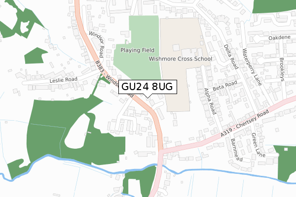
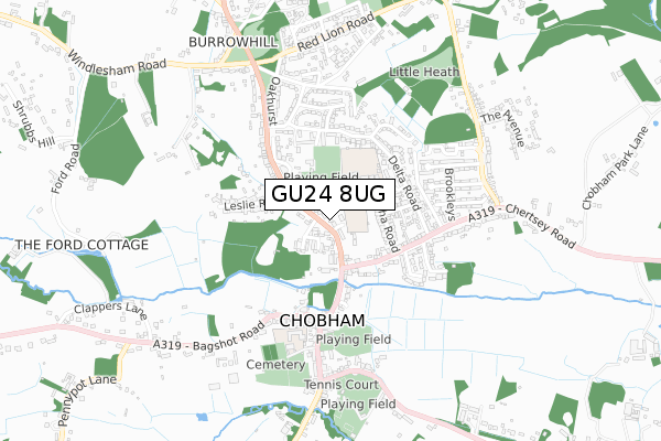
GU24 8UG is located in the Windlesham & Chobham electoral ward, within the local authority district of Surrey Heath and the English Parliamentary constituency of Surrey Heath. The Sub Integrated Care Board (ICB) Location is NHS Surrey Heartlands ICB - 92A and the police force is Surrey. This postcode has been in use since November 2018.


GetTheData
Source: OS Open Zoomstack (Ordnance Survey)
Licence: Open Government Licence (requires attribution)
Attribution: Contains OS data © Crown copyright and database right 2024
Source: Open Postcode Geo
Licence: Open Government Licence (requires attribution)
Attribution: Contains OS data © Crown copyright and database right 2024; Contains Royal Mail data © Royal Mail copyright and database right 2024; Source: Office for National Statistics licensed under the Open Government Licence v.3.0
| Easting | 497394 |
| Northing | 162252 |
| Latitude | 51.351009 |
| Longitude | -0.602820 |
GetTheData
Source: Open Postcode Geo
Licence: Open Government Licence
| Country | England |
| Postcode District | GU24 |
| ➜ GU24 open data dashboard ➜ See where GU24 is on a map ➜ Where is Chobham? | |
GetTheData
Source: Land Registry Price Paid Data
Licence: Open Government Licence
| Ward | Windlesham & Chobham |
| Constituency | Surrey Heath |
GetTheData
Source: ONS Postcode Database
Licence: Open Government Licence
| June 2022 | Other theft | On or near Sports/Recreation Area | 178m |
| June 2022 | Violence and sexual offences | On or near Windsor Court Road | 357m |
| June 2022 | Other crime | On or near Windsor Court Road | 357m |
| ➜ Get more crime data in our Crime section | |||
GetTheData
Source: data.police.uk
Licence: Open Government Licence
| Post Office (Windsor Road) | Chobham | 34m |
| Fowlers Mead (Windsor Road) | Chobham | 261m |
| Delta Road | Chobham | 330m |
| Windsor Court Road | Chobham | 344m |
| Delta Road | Chobham | 345m |
| Longcross Station | 3.8km |
| Woking Station | 4.8km |
| Sunningdale Station | 5km |
GetTheData
Source: NaPTAN
Licence: Open Government Licence
GetTheData
Source: ONS Postcode Database
Licence: Open Government Licence


➜ Get more ratings from the Food Standards Agency
GetTheData
Source: Food Standards Agency
Licence: FSA terms & conditions
| Last Collection | |||
|---|---|---|---|
| Location | Mon-Fri | Sat | Distance |
| Chobham Post Office | 17:45 | 12:00 | 21m |
| Benhams Corner | 17:45 | 09:15 | 330m |
| Station Road | 17:00 | 09:15 | 588m |
GetTheData
Source: Dracos
Licence: Creative Commons Attribution-ShareAlike
| Facility | Distance |
|---|---|
| Fowlers Wells Windsor Road, Chobham, Woking Grass Pitches | 230m |
| Wishmore Cross Academy Alpha Road, Chobham, Woking Grass Pitches | 235m |
| Chobham Cricket Club High Street, Chobham, Woking Grass Pitches | 389m |
GetTheData
Source: Active Places
Licence: Open Government Licence
| School | Phase of Education | Distance |
|---|---|---|
| Wishmore Cross Academy Alpha Road, Chobham, Woking, GU24 8NE | Not applicable | 183m |
| St Lawrence CofE (Aided) Primary School Bagshot Road, Chobham, Woking, GU24 8AB | Primary | 446m |
| Holy Trinity CofE Primary School Benner Lane, West End, Woking, GU24 9JQ | Primary | 2.5km |
GetTheData
Source: Edubase
Licence: Open Government Licence
The below table lists the International Territorial Level (ITL) codes (formerly Nomenclature of Territorial Units for Statistics (NUTS) codes) and Local Administrative Units (LAU) codes for GU24 8UG:
| ITL 1 Code | Name |
|---|---|
| TLJ | South East (England) |
| ITL 2 Code | Name |
| TLJ2 | Surrey, East and West Sussex |
| ITL 3 Code | Name |
| TLJ25 | West Surrey |
| LAU 1 Code | Name |
| E07000214 | Surrey Heath |
GetTheData
Source: ONS Postcode Directory
Licence: Open Government Licence
The below table lists the Census Output Area (OA), Lower Layer Super Output Area (LSOA), and Middle Layer Super Output Area (MSOA) for GU24 8UG:
| Code | Name | |
|---|---|---|
| OA | E00156888 | |
| LSOA | E01030763 | Surrey Heath 001A |
| MSOA | E02006416 | Surrey Heath 001 |
GetTheData
Source: ONS Postcode Directory
Licence: Open Government Licence
| GU24 8NG | Macmahon Close | 60m |
| GU24 8LA | Windsor Road | 96m |
| GU24 8NQ | The Grange | 99m |
| GU24 8NA | Windsor Road | 135m |
| GU24 8NE | Alpha Road | 184m |
| GU24 8ND | Chertsey Road | 221m |
| GU24 8NF | Alpha Road | 222m |
| GU24 8NB | Chertsey Road | 236m |
| GU24 8QH | Delta Close | 265m |
| GU24 8PX | Beta Road | 278m |
GetTheData
Source: Open Postcode Geo; Land Registry Price Paid Data
Licence: Open Government Licence