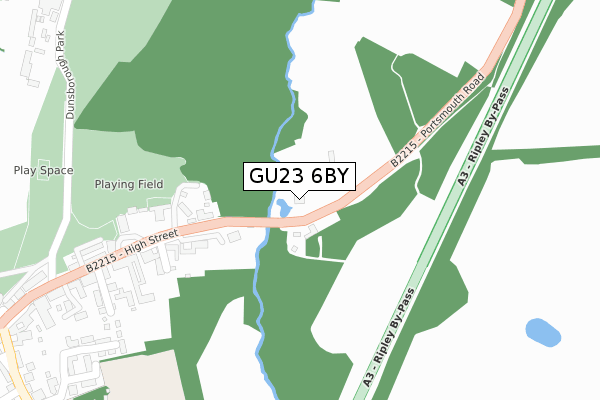
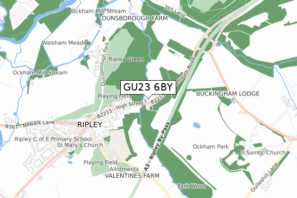
GU23 6BY is located in the Send & Lovelace electoral ward, within the local authority district of Guildford and the English Parliamentary constituency of Mole Valley. The Sub Integrated Care Board (ICB) Location is NHS Surrey Heartlands ICB - 92A and the police force is Surrey. This postcode has been in use since October 2018.


GetTheData
Source: OS Open Zoomstack (Ordnance Survey)
Licence: Open Government Licence (requires attribution)
Attribution: Contains OS data © Crown copyright and database right 2024
Source: Open Postcode Geo
Licence: Open Government Licence (requires attribution)
Attribution: Contains OS data © Crown copyright and database right 2024; Contains Royal Mail data © Royal Mail copyright and database right 2024; Source: Office for National Statistics licensed under the Open Government Licence v.3.0
| Easting | 503676 |
| Northing | 156209 |
| Latitude | 51.295578 |
| Longitude | -0.514397 |
GetTheData
Source: Open Postcode Geo
Licence: Open Government Licence
| Country | England |
| Postcode District | GU23 |
| ➜ GU23 open data dashboard ➜ See where GU23 is on a map | |
GetTheData
Source: Land Registry Price Paid Data
Licence: Open Government Licence
| Ward | Send & Lovelace |
| Constituency | Mole Valley |
GetTheData
Source: ONS Postcode Database
Licence: Open Government Licence
| December 2023 | Other crime | On or near Danesfield | 398m |
| November 2023 | Burglary | On or near Park/Open Space | 236m |
| October 2023 | Other theft | On or near Park/Open Space | 236m |
| ➜ Get more crime data in our Crime section | |||
GetTheData
Source: data.police.uk
Licence: Open Government Licence
| Sendmarsh Green (Send Marsh Road) | Send Marsh | 547m |
| Sendmarsh Green (Send Marsh Road) | Send Marsh | 552m |
| Old Hall (Send Marsh Road) | Send Marsh | 732m |
| Old Hall (Send Marsh Road) | Send Marsh | 741m |
| Tuckey Grove (Send Marsh Road) | Send Marsh | 770m |
| Clandon Station | 3.6km |
| Woking Station | 3.9km |
| Worplesdon Station | 4.8km |
GetTheData
Source: NaPTAN
Licence: Open Government Licence
GetTheData
Source: ONS Postcode Database
Licence: Open Government Licence

➜ Get more ratings from the Food Standards Agency
GetTheData
Source: Food Standards Agency
Licence: FSA terms & conditions
| Last Collection | |||
|---|---|---|---|
| Location | Mon-Fri | Sat | Distance |
| Ripley Post Office | 17:15 | 11:45 | 1,605m |
| Grove Heath Court | 16:30 | 09:00 | 1,800m |
| St Peters Road | 17:00 | 11:45 | 1,892m |
GetTheData
Source: Dracos
Licence: Creative Commons Attribution-ShareAlike
| Facility | Distance |
|---|---|
| Send C Of E School Send Barns Lane, Send, Woking Grass Pitches, Sports Hall | 1.2km |
| Ripley C Of E Primary School (Closed) Wentworth Close, Ripley, Woking Swimming Pool, Sports Hall | 1.3km |
| Send Recreation Ground Send Road, Send Grass Pitches, Outdoor Tennis Courts | 1.4km |
GetTheData
Source: Active Places
Licence: Open Government Licence
| School | Phase of Education | Distance |
|---|---|---|
| Send CofE Primary School Send Barns Lane, Send, Woking, GU23 7BS | Primary | 1.2km |
| Ripley Court School Rose Lane, Ripley, Woking, Surrey, GU23 6NE | Not applicable | 1.7km |
| Hoe Bridge School Hoe Place, Old Woking Road, Woking, Surrey, GU22 8JE | Not applicable | 2.1km |
GetTheData
Source: Edubase
Licence: Open Government Licence
The below table lists the International Territorial Level (ITL) codes (formerly Nomenclature of Territorial Units for Statistics (NUTS) codes) and Local Administrative Units (LAU) codes for GU23 6BY:
| ITL 1 Code | Name |
|---|---|
| TLJ | South East (England) |
| ITL 2 Code | Name |
| TLJ2 | Surrey, East and West Sussex |
| ITL 3 Code | Name |
| TLJ25 | West Surrey |
| LAU 1 Code | Name |
| E07000209 | Guildford |
GetTheData
Source: ONS Postcode Directory
Licence: Open Government Licence
The below table lists the Census Output Area (OA), Lower Layer Super Output Area (LSOA), and Middle Layer Super Output Area (MSOA) for GU23 6BY:
| Code | Name | |
|---|---|---|
| OA | E00155363 | |
| LSOA | E01030458 | Guildford 001B |
| MSOA | E02006344 | Guildford 001 |
GetTheData
Source: ONS Postcode Directory
Licence: Open Government Licence
| GU23 6JX | Polesdon Lane | 291m |
| GU23 7EG | Prews Cottages | 374m |
| GU23 6LS | Danesfield | 397m |
| GU23 7EQ | Prews Farm Cottages | 431m |
| GU23 6JS | Send Marsh Green | 468m |
| GU23 6JP | Send Marsh Green | 513m |
| GU23 6DX | Polesden Lane | 558m |
| GU23 6JT | Send Marsh Road | 568m |
| GU23 6LA | Send Marsh Green | 576m |
| GU23 6JN | Send Marsh Road | 602m |
GetTheData
Source: Open Postcode Geo; Land Registry Price Paid Data
Licence: Open Government Licence