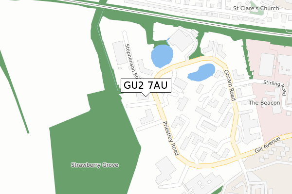
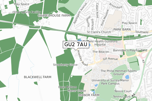
GU2 7AU is located in the Westborough electoral ward, within the local authority district of Guildford and the English Parliamentary constituency of Guildford. The Sub Integrated Care Board (ICB) Location is NHS Surrey Heartlands ICB - 92A and the police force is Surrey. This postcode has been in use since March 2019.


GetTheData
Source: OS Open Zoomstack (Ordnance Survey)
Licence: Open Government Licence (requires attribution)
Attribution: Contains OS data © Crown copyright and database right 2024
Source: Open Postcode Geo
Licence: Open Government Licence (requires attribution)
Attribution: Contains OS data © Crown copyright and database right 2024; Contains Royal Mail data © Royal Mail copyright and database right 2024; Source: Office for National Statistics licensed under the Open Government Licence v.3.0
| Easting | 496636 |
| Northing | 150006 |
| Latitude | 51.241054 |
| Longitude | -0.617011 |
GetTheData
Source: Open Postcode Geo
Licence: Open Government Licence
| Country | England |
| Postcode District | GU2 |
| ➜ GU2 open data dashboard ➜ See where GU2 is on a map ➜ Where is Guildford? | |
GetTheData
Source: Land Registry Price Paid Data
Licence: Open Government Licence
| Ward | Westborough |
| Constituency | Guildford |
GetTheData
Source: ONS Postcode Database
Licence: Open Government Licence
| January 2024 | Anti-social behaviour | On or near Homestall | 484m |
| October 2023 | Anti-social behaviour | On or near Homestall | 484m |
| October 2023 | Violence and sexual offences | On or near Homestall | 484m |
| ➜ Get more crime data in our Crime section | |||
GetTheData
Source: data.police.uk
Licence: Open Government Licence
| Rickyard (Applegarth Avenue) | Park Barn | 401m |
| Rosalind Franklin Close (Tapners Road) | Guildford | 415m |
| Gill Avenue | Guildford | 418m |
| Rickyard (Applegarth Avenue) | Park Barn | 419m |
| Francis Crick Road | Guildford | 429m |
| Guildford Station | 2.6km |
| Wanborough Station | 3.6km |
| London Road (Guildford) Station | 3.6km |
GetTheData
Source: NaPTAN
Licence: Open Government Licence
GetTheData
Source: ONS Postcode Database
Licence: Open Government Licence


➜ Get more ratings from the Food Standards Agency
GetTheData
Source: Food Standards Agency
Licence: FSA terms & conditions
| Last Collection | |||
|---|---|---|---|
| Location | Mon-Fri | Sat | Distance |
| Surrey Research Park | 18:30 | 329m | |
| Surrey Research Park | 18:30 | 12:15 | 329m |
| Park Barn Post Office | 16:45 | 12:00 | 517m |
GetTheData
Source: Dracos
Licence: Creative Commons Attribution-ShareAlike
| Facility | Distance |
|---|---|
| Kings College Guildford Southway, Guildford Artificial Grass Pitch, Grass Pitches, Sports Hall, Studio | 785m |
| Unisport - Varsity Centre (Closed) Egerton Road, Guildford Grass Pitches, Squash Courts | 911m |
| Surrey Sports Park Richard Meyjes Road, Guildford Artificial Grass Pitch, Swimming Pool, Health and Fitness Gym, Sports Hall, Squash Courts, Studio, Grass Pitches, Outdoor Tennis Courts | 949m |
GetTheData
Source: Active Places
Licence: Open Government Licence
| School | Phase of Education | Distance |
|---|---|---|
| Guildford Grove Primary School Southway, Guildford, GU2 8YD | Primary | 628m |
| Kings College Guildford Southway, Guildford, GU2 8DU | Secondary | 782m |
| Wood Street Infant School Wood Street, Guildford, GU3 3DA | Primary | 1.1km |
GetTheData
Source: Edubase
Licence: Open Government Licence
The below table lists the International Territorial Level (ITL) codes (formerly Nomenclature of Territorial Units for Statistics (NUTS) codes) and Local Administrative Units (LAU) codes for GU2 7AU:
| ITL 1 Code | Name |
|---|---|
| TLJ | South East (England) |
| ITL 2 Code | Name |
| TLJ2 | Surrey, East and West Sussex |
| ITL 3 Code | Name |
| TLJ25 | West Surrey |
| LAU 1 Code | Name |
| E07000209 | Guildford |
GetTheData
Source: ONS Postcode Directory
Licence: Open Government Licence
The below table lists the Census Output Area (OA), Lower Layer Super Output Area (LSOA), and Middle Layer Super Output Area (MSOA) for GU2 7AU:
| Code | Name | |
|---|---|---|
| OA | E00167779 | |
| LSOA | E01030470 | Guildford 012A |
| MSOA | E02006355 | Guildford 012 |
GetTheData
Source: ONS Postcode Directory
Licence: Open Government Licence
| GU2 8LX | Applegarth Avenue | 315m |
| GU2 8LY | Applegarth Avenue | 372m |
| GU2 8LZ | Applegarth Avenue | 421m |
| GU2 8JP | Rickyard | 440m |
| GU2 8LU | Blackwell Avenue | 452m |
| GU2 8JS | Homestall | 459m |
| GU2 8LT | Applegarth Avenue | 482m |
| GU2 8DX | Southway Court | 500m |
| GU2 8DY | Park Barn Parade | 528m |
| GU2 8LS | Hunts Close | 539m |
GetTheData
Source: Open Postcode Geo; Land Registry Price Paid Data
Licence: Open Government Licence