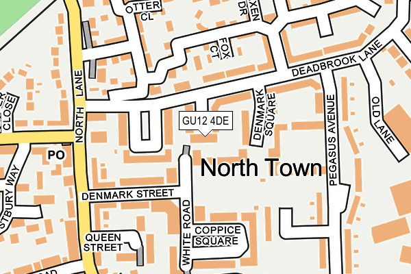
GU12 4DE is located in the North Town electoral ward, within the local authority district of Rushmoor and the English Parliamentary constituency of Aldershot. The Sub Integrated Care Board (ICB) Location is NHS Frimley ICB - D4U1Y and the police force is Hampshire. This postcode has been in use since July 2017.


GetTheData
Source: OS OpenMap – Local (Ordnance Survey)
Source: OS VectorMap District (Ordnance Survey)
Licence: Open Government Licence (requires attribution)
| Easting | 488026 |
| Northing | 150991 |
| Latitude | 51.251302 |
| Longitude | -0.740079 |
GetTheData
Source: Open Postcode Geo
Licence: Open Government Licence
| Country | England |
| Postcode District | GU12 |
| ➜ GU12 open data dashboard ➜ See where GU12 is on a map ➜ Where is Aldershot? | |
GetTheData
Source: Land Registry Price Paid Data
Licence: Open Government Licence
| Ward | North Town |
| Constituency | Aldershot |
GetTheData
Source: ONS Postcode Database
Licence: Open Government Licence
| September 2022 | Other crime | On or near Westbury Way | 316m |
| June 2022 | Violence and sexual offences | On or near Denmark Square | 44m |
| June 2022 | Drugs | On or near Denmark Square | 44m |
| ➜ Get more crime data in our Crime section | |||
GetTheData
Source: data.police.uk
Licence: Open Government Licence
| Blacksmith Close (Deadbrook Lane) | North Town | 103m |
| Blacksmith Close (Deadbrook Lane) | North Town | 105m |
| Denmark Square (Deadbrook Lane) | North Town | 123m |
| Denmark Square (Deadbrook Lane) | North Town | 155m |
| North Lane Shops (North Lane) | North Town | 201m |
| Aldershot Station | 1.5km |
| Ash Station | 1.9km |
| Ash Vale Station | 2.7km |
GetTheData
Source: NaPTAN
Licence: Open Government Licence
➜ Broadband speed and availability dashboard for GU12 4DE
| Percentage of properties with Next Generation Access | 100.0% |
| Percentage of properties with Superfast Broadband | 100.0% |
| Percentage of properties with Ultrafast Broadband | 100.0% |
| Percentage of properties with Full Fibre Broadband | 0.0% |
Superfast Broadband is between 30Mbps and 300Mbps
Ultrafast Broadband is > 300Mbps
| Median download speed | 78.5Mbps |
| Average download speed | 89.0Mbps |
| Maximum download speed | 350.00Mbps |
| Median upload speed | 9.8Mbps |
| Average upload speed | 8.4Mbps |
| Maximum upload speed | 20.00Mbps |
| Percentage of properties unable to receive 2Mbps | 0.0% |
| Percentage of properties unable to receive 5Mbps | 0.0% |
| Percentage of properties unable to receive 10Mbps | 0.0% |
| Percentage of properties unable to receive 30Mbps | 0.0% |
➜ Broadband speed and availability dashboard for GU12 4DE
GetTheData
Source: Ofcom
Licence: Ofcom Terms of Use (requires attribution)
GetTheData
Source: ONS Postcode Database
Licence: Open Government Licence


➜ Get more ratings from the Food Standards Agency
GetTheData
Source: Food Standards Agency
Licence: FSA terms & conditions
| Last Collection | |||
|---|---|---|---|
| Location | Mon-Fri | Sat | Distance |
| North Lane | 18:45 | 11:30 | 493m |
| Mount Pleasant Road | 17:30 | 11:00 | 913m |
| Shawfield Road | 17:30 | 12:30 | 965m |
GetTheData
Source: Dracos
Licence: Creative Commons Attribution-ShareAlike
| Facility | Distance |
|---|---|
| Ivy Lane Playing Fields Ivy Road, Aldershot Grass Pitches | 431m |
| Alpine Snowsports Centre Aldershot Gallwey Road, Aldershot Ski Slopes | 864m |
| Ash United Football Club Shawfield Road, Ash Grass Pitches | 882m |
GetTheData
Source: Active Places
Licence: Open Government Licence
| School | Phase of Education | Distance |
|---|---|---|
| Alderwood School Belle Vue Road, Aldershot, GU12 4RZ | All-through | 415m |
| Walsh CofE Infant School Ash Street, Ash, GU12 6LT | Primary | 1.2km |
| Walsh CofE Junior School Ash Street, Ash, GU12 6LT | Primary | 1.2km |
GetTheData
Source: Edubase
Licence: Open Government Licence
The below table lists the International Territorial Level (ITL) codes (formerly Nomenclature of Territorial Units for Statistics (NUTS) codes) and Local Administrative Units (LAU) codes for GU12 4DE:
| ITL 1 Code | Name |
|---|---|
| TLJ | South East (England) |
| ITL 2 Code | Name |
| TLJ3 | Hampshire and Isle of Wight |
| ITL 3 Code | Name |
| TLJ37 | North Hampshire |
| LAU 1 Code | Name |
| E07000092 | Rushmoor |
GetTheData
Source: ONS Postcode Directory
Licence: Open Government Licence
The below table lists the Census Output Area (OA), Lower Layer Super Output Area (LSOA), and Middle Layer Super Output Area (MSOA) for GU12 4DE:
| Code | Name | |
|---|---|---|
| OA | E00117499 | |
| LSOA | E01032858 | Rushmoor 009F |
| MSOA | E02004810 | Rushmoor 009 |
GetTheData
Source: ONS Postcode Directory
Licence: Open Government Licence
| GU12 4FA | Fox Court | 82m |
| GU12 4TY | Deadbrook Lane | 122m |
| GU12 4TL | Denmark Street | 123m |
| GU12 4GA | Badger Way | 131m |
| GU12 4FQ | Woodland Walk | 144m |
| GU12 4UE | Pegasus Avenue | 155m |
| GU12 4FY | Woodland Walk | 162m |
| GU12 4TJ | North Lane | 183m |
| GU12 4TQ | Queen Street | 200m |
| GU12 4GB | Squirrel Court | 202m |
GetTheData
Source: Open Postcode Geo; Land Registry Price Paid Data
Licence: Open Government Licence