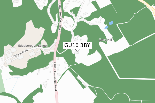
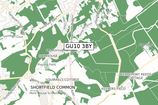
GU10 3BY is located in the Farnham Bourne electoral ward, within the local authority district of Waverley and the English Parliamentary constituency of South West Surrey. The Sub Integrated Care Board (ICB) Location is NHS Frimley ICB - D4U1Y and the police force is Surrey. This postcode has been in use since April 2020.


GetTheData
Source: OS Open Zoomstack (Ordnance Survey)
Licence: Open Government Licence (requires attribution)
Attribution: Contains OS data © Crown copyright and database right 2024
Source: Open Postcode Geo
Licence: Open Government Licence (requires attribution)
Attribution: Contains OS data © Crown copyright and database right 2024; Contains Royal Mail data © Royal Mail copyright and database right 2024; Source: Office for National Statistics licensed under the Open Government Licence v.3.0
| Easting | 485331 |
| Northing | 144836 |
| Latitude | 51.196378 |
| Longitude | -0.780149 |
GetTheData
Source: Open Postcode Geo
Licence: Open Government Licence
| Country | England |
| Postcode District | GU10 |
| ➜ GU10 open data dashboard ➜ See where GU10 is on a map ➜ Where is Farnham? | |
GetTheData
Source: Land Registry Price Paid Data
Licence: Open Government Licence
| Ward | Farnham Bourne |
| Constituency | South West Surrey |
GetTheData
Source: ONS Postcode Database
Licence: Open Government Licence
HORIZON HOUSE, 4, RAVENSWOOD GROVE, LOWER BOURNE, FARNHAM, GU10 3BY 2022 6 JAN £1,650,000 |
GetTheData
Source: HM Land Registry Price Paid Data
Licence: Contains HM Land Registry data © Crown copyright and database right 2024. This data is licensed under the Open Government Licence v3.0.
| June 2022 | Violence and sexual offences | On or near Dene Lane West | 449m |
| June 2022 | Violence and sexual offences | On or near Dene Lane West | 449m |
| April 2022 | Anti-social behaviour | On or near Cricket Lane | 450m |
| ➜ Get more crime data in our Crime section | |||
GetTheData
Source: data.police.uk
Licence: Open Government Licence
| Bourne Grove (Lodge Hill Road) | Lower Bourne | 244m |
| Bourne Grove (Lodge Hill Road) | Lower Bourne | 250m |
| Lower Bourne (Frensham Road) | Lower Bourne | 658m |
| Lower Bourne (Frensham Road) | Lower Bourne | 659m |
| Beech Avenue (Frensham Road) | The Bourne | 746m |
| Farnham Station | 1.9km |
GetTheData
Source: NaPTAN
Licence: Open Government Licence
GetTheData
Source: ONS Postcode Database
Licence: Open Government Licence


➜ Get more ratings from the Food Standards Agency
GetTheData
Source: Food Standards Agency
Licence: FSA terms & conditions
| Last Collection | |||
|---|---|---|---|
| Location | Mon-Fri | Sat | Distance |
| Bourne Grove | 17:00 | 07:15 | 497m |
| Frensham Road, Lower Bourne | 17:00 | 09:30 | 679m |
| Swingate Road | 17:00 | 12:00 | 908m |
GetTheData
Source: Dracos
Licence: Creative Commons Attribution-ShareAlike
| Facility | Distance |
|---|---|
| The Bourne Recreation Ground Old Frensham Road, Lower Bourne, Farnham Grass Pitches, Outdoor Tennis Courts | 493m |
| Bourne Club Limited Frensham Road, Farnham Sports Hall, Health and Fitness Gym, Squash Courts, Outdoor Tennis Courts | 1.2km |
| The Abbey School Menin Way, Farnham Grass Pitches | 1.5km |
GetTheData
Source: Active Places
Licence: Open Government Licence
| School | Phase of Education | Distance |
|---|---|---|
| The Ridgeway School 14 Frensham Road, Farnham, GU9 8HB | Not applicable | 1.1km |
| The Abbey School Menin Way, Farnham, GU9 8DY | Not applicable | 1.5km |
| South Farnham School Menin Way, Farnham, GU9 8DY | Primary | 1.5km |
GetTheData
Source: Edubase
Licence: Open Government Licence
The below table lists the International Territorial Level (ITL) codes (formerly Nomenclature of Territorial Units for Statistics (NUTS) codes) and Local Administrative Units (LAU) codes for GU10 3BY:
| ITL 1 Code | Name |
|---|---|
| TLJ | South East (England) |
| ITL 2 Code | Name |
| TLJ2 | Surrey, East and West Sussex |
| ITL 3 Code | Name |
| TLJ25 | West Surrey |
| LAU 1 Code | Name |
| E07000216 | Waverley |
GetTheData
Source: ONS Postcode Directory
Licence: Open Government Licence
The below table lists the Census Output Area (OA), Lower Layer Super Output Area (LSOA), and Middle Layer Super Output Area (MSOA) for GU10 3BY:
| Code | Name | |
|---|---|---|
| OA | E00157462 | |
| LSOA | E01030881 | Waverley 004A |
| MSOA | E02006442 | Waverley 004 |
GetTheData
Source: ONS Postcode Directory
Licence: Open Government Licence
| GU10 3RH | Dene Lane | 202m |
| GU10 3RJ | Dene Lane | 213m |
| GU10 3RG | Pine Grove | 260m |
| GU10 3PP | Dene Close | 266m |
| GU10 3RD | Lodge Hill Road | 274m |
| GU10 3RE | Lodge Hill Road | 311m |
| GU10 3RF | Lodge Hill Road | 318m |
| GU10 3PW | Dene Lane | 367m |
| GU10 3RQ | Grovelands | 367m |
| GU10 3QX | Bourne Grove Drive | 395m |
GetTheData
Source: Open Postcode Geo; Land Registry Price Paid Data
Licence: Open Government Licence