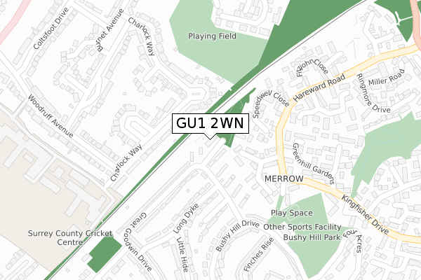
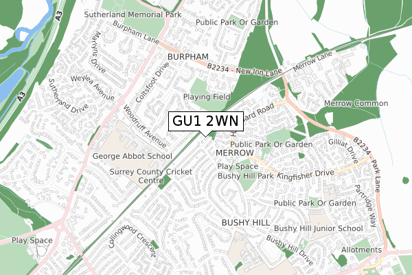
GU1 2WN is located in the Merrow electoral ward, within the local authority district of Guildford and the English Parliamentary constituency of Guildford. The Sub Integrated Care Board (ICB) Location is NHS Surrey Heartlands ICB - 92A and the police force is Surrey. This postcode has been in use since December 2018.


GetTheData
Source: OS Open Zoomstack (Ordnance Survey)
Licence: Open Government Licence (requires attribution)
Attribution: Contains OS data © Crown copyright and database right 2024
Source: Open Postcode Geo
Licence: Open Government Licence (requires attribution)
Attribution: Contains OS data © Crown copyright and database right 2024; Contains Royal Mail data © Royal Mail copyright and database right 2024; Source: Office for National Statistics licensed under the Open Government Licence v.3.0
| Easting | 501912 |
| Northing | 151506 |
| Latitude | 51.253620 |
| Longitude | -0.541028 |
GetTheData
Source: Open Postcode Geo
Licence: Open Government Licence
| Country | England |
| Postcode District | GU1 |
| ➜ GU1 open data dashboard ➜ See where GU1 is on a map ➜ Where is Guildford? | |
GetTheData
Source: Land Registry Price Paid Data
Licence: Open Government Licence
| Ward | Merrow |
| Constituency | Guildford |
GetTheData
Source: ONS Postcode Database
Licence: Open Government Licence
| August 2023 | Vehicle crime | On or near Charlock Way | 199m |
| May 2023 | Drugs | On or near New Inn Lane | 430m |
| December 2022 | Criminal damage and arson | On or near Charlock Way | 199m |
| ➜ Get more crime data in our Crime section | |||
GetTheData
Source: data.police.uk
Licence: Open Government Licence
| Long Dyke (Great Goodwin Drive) | Merrow | 79m |
| Community Centre (Bushy Hill Drive) | Merrow | 252m |
| Greenhill Gardens (Kingfisher Drive) | Merrow | 256m |
| George Abbot School (Woodruff Avenue) | Merrow | 258m |
| Greenhill Gardens (Kingfisher Drive) | Merrow | 276m |
| London Road (Guildford) Station | 2.2km |
| Clandon Station | 2.9km |
| Guildford Station | 3.3km |
GetTheData
Source: NaPTAN
Licence: Open Government Licence
GetTheData
Source: ONS Postcode Database
Licence: Open Government Licence


➜ Get more ratings from the Food Standards Agency
GetTheData
Source: Food Standards Agency
Licence: FSA terms & conditions
| Last Collection | |||
|---|---|---|---|
| Location | Mon-Fri | Sat | Distance |
| Great Goodwin Drive | 17:30 | 12:15 | 336m |
| Fitzjohn Close | 17:00 | 12:15 | 346m |
| New Inn Lane | 16:00 | 12:15 | 418m |
GetTheData
Source: Dracos
Licence: Creative Commons Attribution-ShareAlike
| Facility | Distance |
|---|---|
| George Abbot School Playing Fields Coniers Way, Guildford Grass Pitches | 330m |
| Surrey County Cricket Centre Woodruff Avenue, Guildford Sports Hall | 415m |
| George Abbot School Woodruff Avenue, Guildford Grass Pitches, Health and Fitness Gym, Sports Hall, Studio, Artificial Grass Pitch | 479m |
GetTheData
Source: Active Places
Licence: Open Government Licence
| School | Phase of Education | Distance |
|---|---|---|
| George Abbot School Woodruff Avenue, Guildford, GU1 1XX | Secondary | 479m |
| St Peter's Catholic School Horseshoe Lane East, Merrow, Guildford, GU1 2TN | Secondary | 811m |
| Merrow CofE Controlled Infant School Kingfisher Drive, Merrow, Guildford, GU4 7EA | Primary | 830m |
GetTheData
Source: Edubase
Licence: Open Government Licence
The below table lists the International Territorial Level (ITL) codes (formerly Nomenclature of Territorial Units for Statistics (NUTS) codes) and Local Administrative Units (LAU) codes for GU1 2WN:
| ITL 1 Code | Name |
|---|---|
| TLJ | South East (England) |
| ITL 2 Code | Name |
| TLJ2 | Surrey, East and West Sussex |
| ITL 3 Code | Name |
| TLJ25 | West Surrey |
| LAU 1 Code | Name |
| E07000209 | Guildford |
GetTheData
Source: ONS Postcode Directory
Licence: Open Government Licence
The below table lists the Census Output Area (OA), Lower Layer Super Output Area (LSOA), and Middle Layer Super Output Area (MSOA) for GU1 2WN:
| Code | Name | |
|---|---|---|
| OA | E00155370 | |
| LSOA | E01030464 | Guildford 008E |
| MSOA | E02006351 | Guildford 008 |
GetTheData
Source: ONS Postcode Directory
Licence: Open Government Licence
| GU4 7HF | Sturt Court | 80m |
| GU1 1XY | Charlock Way | 111m |
| GU1 2UB | Great Goodwin Drive | 111m |
| GU4 7HQ | Broke Court | 119m |
| GU1 2TZ | Great Goodwin Drive | 136m |
| GU4 7HE | Speedwell Close | 149m |
| GU4 7HG | Ashbury Crescent | 158m |
| GU1 1XZ | Charlock Way | 164m |
| GU1 2UD | Long Dyke | 182m |
| GU4 7EX | Hareward Road | 201m |
GetTheData
Source: Open Postcode Geo; Land Registry Price Paid Data
Licence: Open Government Licence