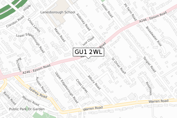
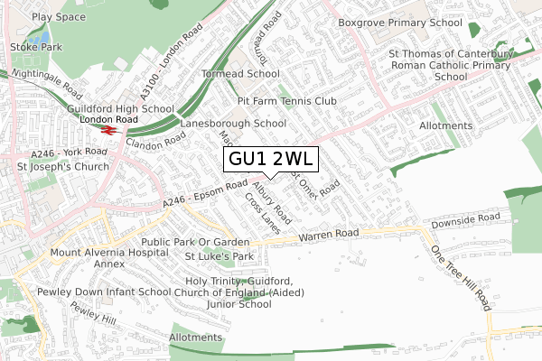
GU1 2WL is located in the Castle electoral ward, within the local authority district of Guildford and the English Parliamentary constituency of Guildford. The Sub Integrated Care Board (ICB) Location is NHS Surrey Heartlands ICB - 92A and the police force is Surrey. This postcode has been in use since January 2018.


GetTheData
Source: OS Open Zoomstack (Ordnance Survey)
Licence: Open Government Licence (requires attribution)
Attribution: Contains OS data © Crown copyright and database right 2024
Source: Open Postcode Geo
Licence: Open Government Licence (requires attribution)
Attribution: Contains OS data © Crown copyright and database right 2024; Contains Royal Mail data © Royal Mail copyright and database right 2024; Source: Office for National Statistics licensed under the Open Government Licence v.3.0
| Easting | 501013 |
| Northing | 149812 |
| Latitude | 51.238553 |
| Longitude | -0.554383 |
GetTheData
Source: Open Postcode Geo
Licence: Open Government Licence
| Country | England |
| Postcode District | GU1 |
| ➜ GU1 open data dashboard ➜ See where GU1 is on a map ➜ Where is Guildford? | |
GetTheData
Source: Land Registry Price Paid Data
Licence: Open Government Licence
| Ward | Castle |
| Constituency | Guildford |
GetTheData
Source: ONS Postcode Database
Licence: Open Government Licence
FLAT 9, 80, EPSOM ROAD, GUILDFORD, GU1 2WL 2014 11 MAR £1,504,741 |
GetTheData
Source: HM Land Registry Price Paid Data
Licence: Contains HM Land Registry data © Crown copyright and database right 2024. This data is licensed under the Open Government Licence v3.0.
| November 2023 | Burglary | On or near Cross Lanes | 306m |
| November 2023 | Burglary | On or near Cross Lanes | 306m |
| May 2023 | Other crime | On or near Cross Lanes | 306m |
| ➜ Get more crime data in our Crime section | |||
GetTheData
Source: data.police.uk
Licence: Open Government Licence
| Albury Road North (Epsom Road) | Guildford | 97m |
| St. Omer Road (Epsom Road) | Guildford | 135m |
| St. Omer Road (Epsom Road) | Guildford | 149m |
| Albury Road North (Epsom Road) | Guildford | 171m |
| Upper Edgeborough Road (Warren Road) | Guildford | 291m |
| London Road (Guildford) Station | 0.8km |
| Guildford Station | 1.8km |
| Shalford (Surrey) Station | 2.8km |
GetTheData
Source: NaPTAN
Licence: Open Government Licence
GetTheData
Source: ONS Postcode Database
Licence: Open Government Licence


➜ Get more ratings from the Food Standards Agency
GetTheData
Source: Food Standards Agency
Licence: FSA terms & conditions
| Last Collection | |||
|---|---|---|---|
| Location | Mon-Fri | Sat | Distance |
| St Omer Road | 17:30 | 12:30 | 93m |
| Albury Road | 17:30 | 12:30 | 127m |
| Austin Road | 17:45 | 12:30 | 319m |
GetTheData
Source: Dracos
Licence: Creative Commons Attribution-ShareAlike
| Facility | Distance |
|---|---|
| Rgs Prep School Maori Road, Guildford Grass Pitches, Sports Hall, Artificial Grass Pitch | 347m |
| Pit Farm Tennis Club Hillier Road, Guildford Outdoor Tennis Courts | 374m |
| Tormead School Cranley Road, Guildford Health and Fitness Gym, Sports Hall | 475m |
GetTheData
Source: Active Places
Licence: Open Government Licence
| School | Phase of Education | Distance |
|---|---|---|
| Tormead School Cranley Road, Guildford, GU1 2JD | Not applicable | 488m |
| Holy Trinity, Guildford, CofE Aided Junior School Addison Road, Guildford, GU1 3QF | Primary | 563m |
| Guildford High School London Road, Guildford, GU1 1SJ | Not applicable | 774m |
GetTheData
Source: Edubase
Licence: Open Government Licence
The below table lists the International Territorial Level (ITL) codes (formerly Nomenclature of Territorial Units for Statistics (NUTS) codes) and Local Administrative Units (LAU) codes for GU1 2WL:
| ITL 1 Code | Name |
|---|---|
| TLJ | South East (England) |
| ITL 2 Code | Name |
| TLJ2 | Surrey, East and West Sussex |
| ITL 3 Code | Name |
| TLJ25 | West Surrey |
| LAU 1 Code | Name |
| E07000209 | Guildford |
GetTheData
Source: ONS Postcode Directory
Licence: Open Government Licence
The below table lists the Census Output Area (OA), Lower Layer Super Output Area (LSOA), and Middle Layer Super Output Area (MSOA) for GU1 2WL:
| Code | Name | |
|---|---|---|
| OA | E00155262 | |
| LSOA | E01030437 | Guildford 011B |
| MSOA | E02006354 | Guildford 011 |
GetTheData
Source: ONS Postcode Directory
Licence: Open Government Licence
| GU1 2BX | Epsom Road | 33m |
| GU1 2BY | Albury Road | 43m |
| GU1 2AH | Albury Road | 63m |
| GU1 2BP | Epsom Road | 68m |
| GU1 2ET | Ivor Close | 74m |
| GU1 2BN | Albury Road | 85m |
| GU1 2BW | Albury Road | 87m |
| GU1 2BS | Albury Road | 90m |
| GU1 2DW | Ferndown Close | 111m |
| GU1 2EJ | Easington Place | 129m |
GetTheData
Source: Open Postcode Geo; Land Registry Price Paid Data
Licence: Open Government Licence