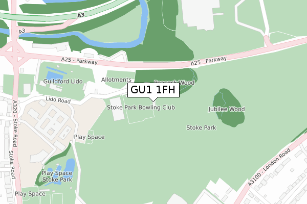
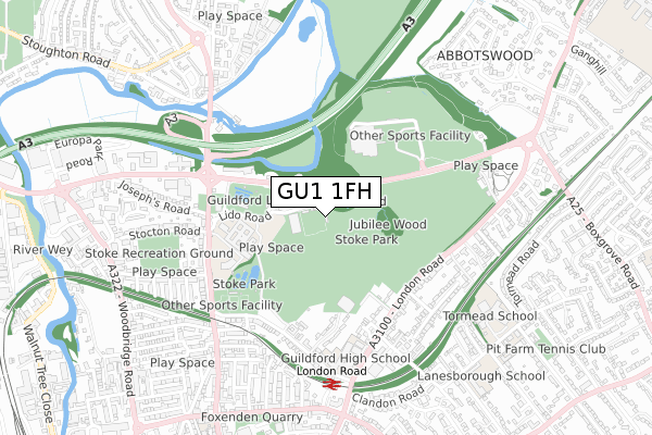
GU1 1FH is located in the Stoke electoral ward, within the local authority district of Guildford and the English Parliamentary constituency of Guildford. The Sub Integrated Care Board (ICB) Location is NHS Surrey Heartlands ICB - 92A and the police force is Surrey. This postcode has been in use since February 2020.


GetTheData
Source: OS Open Zoomstack (Ordnance Survey)
Licence: Open Government Licence (requires attribution)
Attribution: Contains OS data © Crown copyright and database right 2024
Source: Open Postcode Geo
Licence: Open Government Licence (requires attribution)
Attribution: Contains OS data © Crown copyright and database right 2024; Contains Royal Mail data © Royal Mail copyright and database right 2024; Source: Office for National Statistics licensed under the Open Government Licence v.3.0
| Easting | 500243 |
| Northing | 150683 |
| Latitude | 51.246518 |
| Longitude | -0.565166 |
GetTheData
Source: Open Postcode Geo
Licence: Open Government Licence
| Country | England |
| Postcode District | GU1 |
| ➜ GU1 open data dashboard ➜ See where GU1 is on a map ➜ Where is Guildford? | |
GetTheData
Source: Land Registry Price Paid Data
Licence: Open Government Licence
| Ward | Stoke |
| Constituency | Guildford |
GetTheData
Source: ONS Postcode Database
Licence: Open Government Licence
| January 2024 | Public order | On or near Further/Higher Educational Building | 331m |
| January 2024 | Other theft | On or near Further/Higher Educational Building | 331m |
| January 2024 | Drugs | On or near Further/Higher Educational Building | 331m |
| ➜ Get more crime data in our Crime section | |||
GetTheData
Source: data.police.uk
Licence: Open Government Licence
| Spectrum Leisure Centre | Guildford | 374m |
| Ennismore Avenue (London Road) | Guildford | 424m |
| Ennismore Avenue (London Road) | Guildford | 429m |
| Guildford College (Stoke Road) | Guildford | 459m |
| Spectrum Leisure Centre | Guildford | 462m |
| London Road (Guildford) Station | 0.7km |
| Guildford Station | 1.5km |
| Shalford (Surrey) Station | 3.6km |
GetTheData
Source: NaPTAN
Licence: Open Government Licence
GetTheData
Source: ONS Postcode Database
Licence: Open Government Licence


➜ Get more ratings from the Food Standards Agency
GetTheData
Source: Food Standards Agency
Licence: FSA terms & conditions
| Last Collection | |||
|---|---|---|---|
| Location | Mon-Fri | Sat | Distance |
| Josephs Road | 18:00 | 12:00 | 460m |
| Cross Lanes | 17:30 | 12:30 | 470m |
| Nightingale Road | 17:45 | 12:30 | 521m |
GetTheData
Source: Dracos
Licence: Creative Commons Attribution-ShareAlike
| Facility | Distance |
|---|---|
| Wey Valley Indoor Bowls Club Stoke Road, Guildford Indoor Bowls | 75m |
| Guildford Lido Stoke Road, Guildford Swimming Pool, Health and Fitness Gym | 230m |
| Activzone Stoke Road, Guildford Health and Fitness Gym, Studio | 331m |
GetTheData
Source: Active Places
Licence: Open Government Licence
| School | Phase of Education | Distance |
|---|---|---|
| Guildford High School London Road, Guildford, GU1 1SJ | Not applicable | 531m |
| Tormead School Cranley Road, Guildford, GU1 2JD | Not applicable | 780m |
| Sandfield Primary School Stoke Road, Guildford, GU1 4DT | Primary | 913m |
GetTheData
Source: Edubase
Licence: Open Government Licence
The below table lists the International Territorial Level (ITL) codes (formerly Nomenclature of Territorial Units for Statistics (NUTS) codes) and Local Administrative Units (LAU) codes for GU1 1FH:
| ITL 1 Code | Name |
|---|---|
| TLJ | South East (England) |
| ITL 2 Code | Name |
| TLJ2 | Surrey, East and West Sussex |
| ITL 3 Code | Name |
| TLJ25 | West Surrey |
| LAU 1 Code | Name |
| E07000209 | Guildford |
GetTheData
Source: ONS Postcode Directory
Licence: Open Government Licence
The below table lists the Census Output Area (OA), Lower Layer Super Output Area (LSOA), and Middle Layer Super Output Area (MSOA) for GU1 1FH:
| Code | Name | |
|---|---|---|
| OA | E00155250 | |
| LSOA | E01030438 | Guildford 013A |
| MSOA | E02006356 | Guildford 013 |
GetTheData
Source: ONS Postcode Directory
Licence: Open Government Licence
| GU1 1HB | Stoke Road | 336m |
| GU1 1UP | Parkway | 338m |
| GU1 1SW | London Road | 407m |
| GU1 1ES | Park Chase | 415m |
| GU1 1TH | London Road | 461m |
| GU1 1SS | London Road | 465m |
| GU1 1SN | London Road | 467m |
| GU1 1SL | Avington Close | 473m |
| GU1 1EY | Stoke Road | 487m |
| GU1 1EP | Nightingale Road | 488m |
GetTheData
Source: Open Postcode Geo; Land Registry Price Paid Data
Licence: Open Government Licence