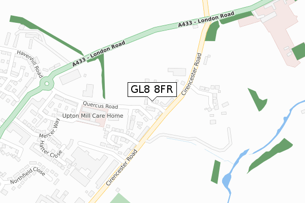
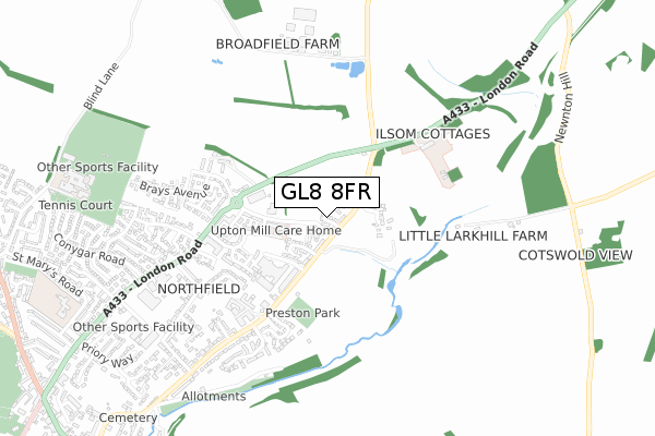
GL8 8FR is located in the Tetbury East & Rural electoral ward, within the local authority district of Cotswold and the English Parliamentary constituency of The Cotswolds. The Sub Integrated Care Board (ICB) Location is NHS Gloucestershire ICB - 11M and the police force is Gloucestershire. This postcode has been in use since December 2018.


GetTheData
Source: OS Open Zoomstack (Ordnance Survey)
Licence: Open Government Licence (requires attribution)
Attribution: Contains OS data © Crown copyright and database right 2024
Source: Open Postcode Geo
Licence: Open Government Licence (requires attribution)
Attribution: Contains OS data © Crown copyright and database right 2024; Contains Royal Mail data © Royal Mail copyright and database right 2024; Source: Office for National Statistics licensed under the Open Government Licence v.3.0
| Easting | 389984 |
| Northing | 194066 |
| Latitude | 51.645303 |
| Longitude | -2.146145 |
GetTheData
Source: Open Postcode Geo
Licence: Open Government Licence
| Country | England |
| Postcode District | GL8 |
| ➜ GL8 open data dashboard ➜ See where GL8 is on a map ➜ Where is Tetbury? | |
GetTheData
Source: Land Registry Price Paid Data
Licence: Open Government Licence
| Ward | Tetbury East & Rural |
| Constituency | The Cotswolds |
GetTheData
Source: ONS Postcode Database
Licence: Open Government Licence
2023 24 FEB £595,000 |
2022 14 SEP £470,000 |
2020 3 DEC £475,000 |
20, JASMINE GARDENS, TETBURY, GL8 8FR 2019 15 MAR £395,000 |
2019 8 MAR £365,000 |
22, JASMINE GARDENS, TETBURY, GL8 8FR 2019 11 FEB £485,000 |
23, JASMINE GARDENS, TETBURY, GL8 8FR 2018 14 DEC £470,000 |
21, JASMINE GARDENS, TETBURY, GL8 8FR 2018 14 DEC £395,000 |
GetTheData
Source: HM Land Registry Price Paid Data
Licence: Contains HM Land Registry data © Crown copyright and database right 2024. This data is licensed under the Open Government Licence v3.0.
| June 2022 | Public order | On or near Conference/Exhibition Centre | 308m |
| May 2022 | Violence and sexual offences | On or near Northfield Close | 493m |
| May 2022 | Violence and sexual offences | On or near Northfield Close | 493m |
| ➜ Get more crime data in our Crime section | |||
GetTheData
Source: data.police.uk
Licence: Open Government Licence
| Ilsom House (London Road) | Tetbury | 340m |
| Ilsom House (London Road) | Tetbury | 360m |
| Industrial Estate (London Road) | Tetbury | 452m |
| Northfield Close (Northfield Road) | Tetbury | 568m |
| Springfields (Cirencester Road) | Tetbury | 573m |
GetTheData
Source: NaPTAN
Licence: Open Government Licence
| Percentage of properties with Next Generation Access | 100.0% |
| Percentage of properties with Superfast Broadband | 100.0% |
| Percentage of properties with Ultrafast Broadband | 100.0% |
| Percentage of properties with Full Fibre Broadband | 100.0% |
Superfast Broadband is between 30Mbps and 300Mbps
Ultrafast Broadband is > 300Mbps
| Percentage of properties unable to receive 2Mbps | 0.0% |
| Percentage of properties unable to receive 5Mbps | 0.0% |
| Percentage of properties unable to receive 10Mbps | 0.0% |
| Percentage of properties unable to receive 30Mbps | 0.0% |
GetTheData
Source: Ofcom
Licence: Ofcom Terms of Use (requires attribution)
GetTheData
Source: ONS Postcode Database
Licence: Open Government Licence


➜ Get more ratings from the Food Standards Agency
GetTheData
Source: Food Standards Agency
Licence: FSA terms & conditions
| Last Collection | |||
|---|---|---|---|
| Location | Mon-Fri | Sat | Distance |
| Northfield | 17:00 | 11:45 | 674m |
| Conygar Road | 17:00 | 11:45 | 846m |
| Police Station Long Street | 17:00 | 12:00 | 1,286m |
GetTheData
Source: Dracos
Licence: Creative Commons Attribution-ShareAlike
| Facility | Distance |
|---|---|
| Tetbury Town Fc Cirencester Road, Tetbury Grass Pitches | 316m |
| Priory Gym (Closed) Priory Industrial Estate, Tetbury Health and Fitness Gym | 864m |
| Swr Leisure Lowfield Road, Tetbury Sports Hall, Swimming Pool, Health and Fitness Gym, Grass Pitches, Outdoor Tennis Courts | 990m |
GetTheData
Source: Active Places
Licence: Open Government Licence
| School | Phase of Education | Distance |
|---|---|---|
| St Mary's Church of England Primary School St Mary's Road, Tetbury, GL8 8BW | Primary | 966m |
| Sir William Romney's School Lowfield Road, Tetbury, GL8 8AE | Secondary | 1km |
| Avening Primary School High Street, Avening, Avening Primary School, Tetbury, GL8 8NF | Primary | 4.4km |
GetTheData
Source: Edubase
Licence: Open Government Licence
The below table lists the International Territorial Level (ITL) codes (formerly Nomenclature of Territorial Units for Statistics (NUTS) codes) and Local Administrative Units (LAU) codes for GL8 8FR:
| ITL 1 Code | Name |
|---|---|
| TLK | South West (England) |
| ITL 2 Code | Name |
| TLK1 | Gloucestershire, Wiltshire and Bath/Bristol area |
| ITL 3 Code | Name |
| TLK13 | Gloucestershire CC |
| LAU 1 Code | Name |
| E07000079 | Cotswold |
GetTheData
Source: ONS Postcode Directory
Licence: Open Government Licence
The below table lists the Census Output Area (OA), Lower Layer Super Output Area (LSOA), and Middle Layer Super Output Area (MSOA) for GL8 8FR:
| Code | Name | |
|---|---|---|
| OA | E00112862 | |
| LSOA | E01022206 | Cotswold 011B |
| MSOA | E02004625 | Cotswold 011 |
GetTheData
Source: ONS Postcode Directory
Licence: Open Government Licence
| GL8 8HJ | Love Lane | 457m |
| GL8 8GW | London Road | 463m |
| GL8 8RX | Ilsom Court Cottages | 470m |
| GL8 8HF | Northfield Close | 474m |
| GL8 8GZ | Braybrooke Close | 503m |
| GL8 8SD | 532m | |
| GL8 8HH | London Road | 567m |
| GL8 8FA | Hardie Close | 573m |
| GL8 8HQ | Northfield Road | 577m |
| GL8 8EN | Springfields | 607m |
GetTheData
Source: Open Postcode Geo; Land Registry Price Paid Data
Licence: Open Government Licence