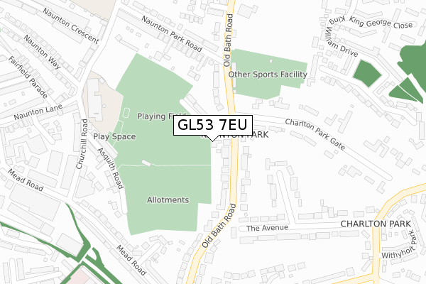
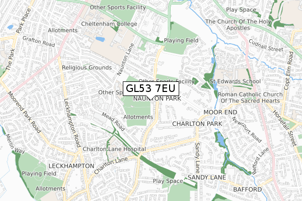
GL53 7EU is located in the College electoral ward, within the local authority district of Cheltenham and the English Parliamentary constituency of Cheltenham. The Sub Integrated Care Board (ICB) Location is NHS Gloucestershire ICB - 11M and the police force is Gloucestershire. This postcode has been in use since April 2018.


GetTheData
Source: OS Open Zoomstack (Ordnance Survey)
Licence: Open Government Licence (requires attribution)
Attribution: Contains OS data © Crown copyright and database right 2024
Source: Open Postcode Geo
Licence: Open Government Licence (requires attribution)
Attribution: Contains OS data © Crown copyright and database right 2024; Contains Royal Mail data © Royal Mail copyright and database right 2024; Source: Office for National Statistics licensed under the Open Government Licence v.3.0
| Easting | 395357 |
| Northing | 220618 |
| Latitude | 51.884110 |
| Longitude | -2.068855 |
GetTheData
Source: Open Postcode Geo
Licence: Open Government Licence
| Country | England |
| Postcode District | GL53 |
| ➜ GL53 open data dashboard ➜ See where GL53 is on a map ➜ Where is Cheltenham? | |
GetTheData
Source: Land Registry Price Paid Data
Licence: Open Government Licence
| Ward | College |
| Constituency | Cheltenham |
GetTheData
Source: ONS Postcode Database
Licence: Open Government Licence
| June 2022 | Burglary | On or near The Avenue | 212m |
| June 2022 | Violence and sexual offences | On or near Verney Close | 320m |
| May 2022 | Violence and sexual offences | On or near Verney Close | 320m |
| ➜ Get more crime data in our Crime section | |||
GetTheData
Source: data.police.uk
Licence: Open Government Licence
| Naunton Park Close (Old Bath Road) | Charlton Park | 12m |
| Naunton Park Close (Old Bath Road) | Charlton Park | 57m |
| Croquet Club (Old Bath Road) | Charlton Park | 190m |
| Croquet Club (Old Bath Road) | Charlton Park | 237m |
| Mead Road (Old Bath Road) | Pilley | 346m |
| Cheltenham Spa Station | 2.6km |
GetTheData
Source: NaPTAN
Licence: Open Government Licence
GetTheData
Source: ONS Postcode Database
Licence: Open Government Licence


➜ Get more ratings from the Food Standards Agency
GetTheData
Source: Food Standards Agency
Licence: FSA terms & conditions
| Last Collection | |||
|---|---|---|---|
| Location | Mon-Fri | Sat | Distance |
| Old Bath Road | 17:45 | 12:30 | 105m |
| Naunton Lane | 17:30 | 12:30 | 404m |
| Sandy Lane | 17:30 | 12:45 | 472m |
GetTheData
Source: Dracos
Licence: Creative Commons Attribution-ShareAlike
| Facility | Distance |
|---|---|
| Naunton Park Asquith Road, Cheltenham Grass Pitches | 170m |
| East Gloucestershire Club Old Bath Road, Cheltenham Squash Courts, Outdoor Tennis Courts | 316m |
| Cheltenham College Thirlestaine Road, Cheltenham Sports Hall, Swimming Pool, Health and Fitness Gym, Grass Pitches, Squash Courts, Outdoor Tennis Courts, Artificial Grass Pitch | 605m |
GetTheData
Source: Active Places
Licence: Open Government Licence
| School | Phase of Education | Distance |
|---|---|---|
| Naunton Park Primary School Naunton Lane, Cheltenham, GL53 7BT | Primary | 366m |
| St Edward's School Cirencester Road, Charlton Kings, Cheltenham, GL53 8EY | Not applicable | 610m |
| Cheltenham College Bath Road, Cheltenham, GL53 7LD | Not applicable | 1km |
GetTheData
Source: Edubase
Licence: Open Government Licence
The below table lists the International Territorial Level (ITL) codes (formerly Nomenclature of Territorial Units for Statistics (NUTS) codes) and Local Administrative Units (LAU) codes for GL53 7EU:
| ITL 1 Code | Name |
|---|---|
| TLK | South West (England) |
| ITL 2 Code | Name |
| TLK1 | Gloucestershire, Wiltshire and Bath/Bristol area |
| ITL 3 Code | Name |
| TLK13 | Gloucestershire CC |
| LAU 1 Code | Name |
| E07000078 | Cheltenham |
GetTheData
Source: ONS Postcode Directory
Licence: Open Government Licence
The below table lists the Census Output Area (OA), Lower Layer Super Output Area (LSOA), and Middle Layer Super Output Area (MSOA) for GL53 7EU:
| Code | Name | |
|---|---|---|
| OA | E00112392 | |
| LSOA | E01022118 | Cheltenham 014D |
| MSOA | E02004613 | Cheltenham 014 |
GetTheData
Source: ONS Postcode Directory
Licence: Open Government Licence
| GL53 7DP | Old Bath Road | 86m |
| GL53 7DN | Old Bath Road | 98m |
| GL53 7DL | Naunton Park Close | 100m |
| GL53 7DH | Old Bath Road | 122m |
| GL53 9BL | The Avenue | 218m |
| GL53 7DJ | Charlton Park Gate | 240m |
| GL53 7DE | Old Bath Road | 266m |
| GL53 9BJ | The Avenue | 287m |
| GL53 7EL | Asquith Road | 288m |
| GL53 7DR | Old Bath Road | 293m |
GetTheData
Source: Open Postcode Geo; Land Registry Price Paid Data
Licence: Open Government Licence