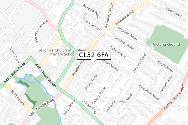
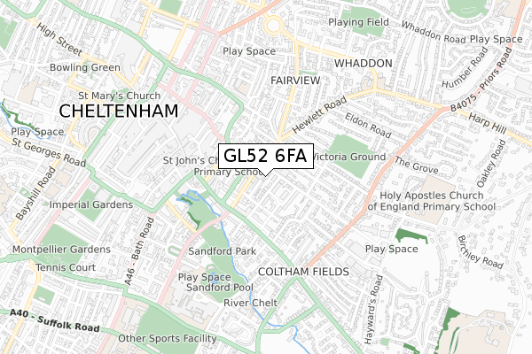
GL52 6FA is located in the All Saints electoral ward, within the local authority district of Cheltenham and the English Parliamentary constituency of Cheltenham. The Sub Integrated Care Board (ICB) Location is NHS Gloucestershire ICB - 11M and the police force is Gloucestershire. This postcode has been in use since September 2017.


GetTheData
Source: OS Open Zoomstack (Ordnance Survey)
Licence: Open Government Licence (requires attribution)
Attribution: Contains OS data © Crown copyright and database right 2024
Source: Open Postcode Geo
Licence: Open Government Licence (requires attribution)
Attribution: Contains OS data © Crown copyright and database right 2024; Contains Royal Mail data © Royal Mail copyright and database right 2024; Source: Office for National Statistics licensed under the Open Government Licence v.3.0
| Easting | 395512 |
| Northing | 222155 |
| Latitude | 51.897930 |
| Longitude | -2.066624 |
GetTheData
Source: Open Postcode Geo
Licence: Open Government Licence
| Country | England |
| Postcode District | GL52 |
| ➜ GL52 open data dashboard ➜ See where GL52 is on a map ➜ Where is Cheltenham? | |
GetTheData
Source: Land Registry Price Paid Data
Licence: Open Government Licence
| Ward | All Saints |
| Constituency | Cheltenham |
GetTheData
Source: ONS Postcode Database
Licence: Open Government Licence
| January 2024 | Anti-social behaviour | On or near Westdown Gardens | 316m |
| December 2023 | Violence and sexual offences | On or near Parking Area | 209m |
| November 2023 | Vehicle crime | On or near Parking Area | 209m |
| ➜ Get more crime data in our Crime section | |||
GetTheData
Source: data.police.uk
Licence: Open Government Licence
| Carlton Street (Hewlett Road) | Fairview | 90m |
| All Saints' Road (Hewlett Road) | Fairview | 149m |
| Hewlett Road (London Road) | Cheltenham | 217m |
| Berkeley Place (High Street) | Cheltenham | 247m |
| St James Street | Cheltenham | 270m |
| Cheltenham Spa Station | 2.3km |
GetTheData
Source: NaPTAN
Licence: Open Government Licence
| Percentage of properties with Next Generation Access | 100.0% |
| Percentage of properties with Superfast Broadband | 100.0% |
| Percentage of properties with Ultrafast Broadband | 0.0% |
| Percentage of properties with Full Fibre Broadband | 0.0% |
Superfast Broadband is between 30Mbps and 300Mbps
Ultrafast Broadband is > 300Mbps
| Percentage of properties unable to receive 2Mbps | 0.0% |
| Percentage of properties unable to receive 5Mbps | 0.0% |
| Percentage of properties unable to receive 10Mbps | 0.0% |
| Percentage of properties unable to receive 30Mbps | 0.0% |
GetTheData
Source: Ofcom
Licence: Ofcom Terms of Use (requires attribution)
GetTheData
Source: ONS Postcode Database
Licence: Open Government Licence


➜ Get more ratings from the Food Standards Agency
GetTheData
Source: Food Standards Agency
Licence: FSA terms & conditions
| Last Collection | |||
|---|---|---|---|
| Location | Mon-Fri | Sat | Distance |
| Hewlett Road P.o. | 17:30 | 12:45 | 154m |
| Sydenham Road | 17:00 | 12:45 | 213m |
| Priory Road | 18:00 | 12:45 | 214m |
GetTheData
Source: Dracos
Licence: Creative Commons Attribution-ShareAlike
| Facility | Distance |
|---|---|
| Cheltenham Cricket Club Princes Street, Cheltenham Grass Pitches | 321m |
| Welcome Gym (Cheltenham) Grosvenor Terrace, Cheltenham Health and Fitness Gym, Studio | 340m |
| Sandford Park Sandford Park Place, Cheltenham Grass Pitches | 430m |
GetTheData
Source: Active Places
Licence: Open Government Licence
| School | Phase of Education | Distance |
|---|---|---|
| St John's Church of England Primary School Albion Street, Cheltenham, GL52 2SN | Primary | 174m |
| Holy Trinity Church of England Primary School Jersey Street, Cheltenham, GL52 2JP | Primary | 458m |
| Berkhampstead School Pittville Circus Road, Cheltenham, GL52 2QA | Not applicable | 658m |
GetTheData
Source: Edubase
Licence: Open Government Licence
The below table lists the International Territorial Level (ITL) codes (formerly Nomenclature of Territorial Units for Statistics (NUTS) codes) and Local Administrative Units (LAU) codes for GL52 6FA:
| ITL 1 Code | Name |
|---|---|
| TLK | South West (England) |
| ITL 2 Code | Name |
| TLK1 | Gloucestershire, Wiltshire and Bath/Bristol area |
| ITL 3 Code | Name |
| TLK13 | Gloucestershire CC |
| LAU 1 Code | Name |
| E07000078 | Cheltenham |
GetTheData
Source: ONS Postcode Directory
Licence: Open Government Licence
The below table lists the Census Output Area (OA), Lower Layer Super Output Area (LSOA), and Middle Layer Super Output Area (MSOA) for GL52 6FA:
| Code | Name | |
|---|---|---|
| OA | E00112303 | |
| LSOA | E01022102 | Cheltenham 008C |
| MSOA | E02004607 | Cheltenham 008 |
GetTheData
Source: ONS Postcode Directory
Licence: Open Government Licence
| GL52 6AD | Hewlett Road | 58m |
| GL52 6DJ | Sidney Street | 62m |
| GL52 6DR | Priory Street | 75m |
| GL52 6AG | Carlton Street | 82m |
| GL52 6AA | Hewlett Road | 89m |
| GL52 2SY | Berkeley Street | 94m |
| GL52 6AE | Hewlett Road | 98m |
| GL52 6AF | Hewlett Road | 99m |
| GL52 6AQ | Carlton Street | 104m |
| GL52 2SU | Albion Street | 107m |
GetTheData
Source: Open Postcode Geo; Land Registry Price Paid Data
Licence: Open Government Licence