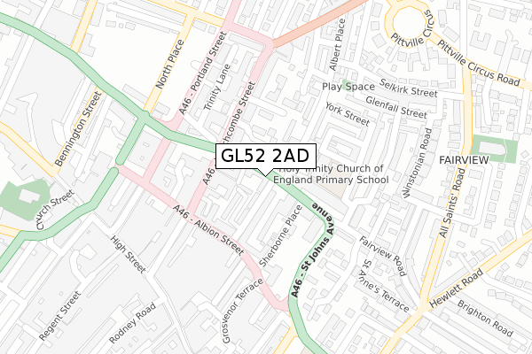
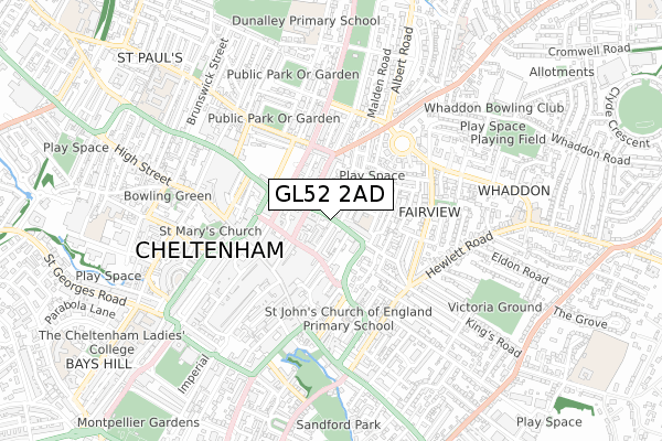
GL52 2AD is located in the All Saints electoral ward, within the local authority district of Cheltenham and the English Parliamentary constituency of Cheltenham. The Sub Integrated Care Board (ICB) Location is NHS Gloucestershire ICB - 11M and the police force is Gloucestershire. This postcode has been in use since November 2017.


GetTheData
Source: OS Open Zoomstack (Ordnance Survey)
Licence: Open Government Licence (requires attribution)
Attribution: Contains OS data © Crown copyright and database right 2024
Source: Open Postcode Geo
Licence: Open Government Licence (requires attribution)
Attribution: Contains OS data © Crown copyright and database right 2024; Contains Royal Mail data © Royal Mail copyright and database right 2024; Source: Office for National Statistics licensed under the Open Government Licence v.3.0
| Easting | 395278 |
| Northing | 222578 |
| Latitude | 51.901731 |
| Longitude | -2.070030 |
GetTheData
Source: Open Postcode Geo
Licence: Open Government Licence
| Country | England |
| Postcode District | GL52 |
| ➜ GL52 open data dashboard ➜ See where GL52 is on a map ➜ Where is Cheltenham? | |
GetTheData
Source: Land Registry Price Paid Data
Licence: Open Government Licence
| Ward | All Saints |
| Constituency | Cheltenham |
GetTheData
Source: ONS Postcode Database
Licence: Open Government Licence
| December 2023 | Bicycle theft | On or near Parking Area | 349m |
| December 2023 | Criminal damage and arson | On or near Parking Area | 349m |
| December 2023 | Violence and sexual offences | On or near Parking Area | 389m |
| ➜ Get more crime data in our Crime section | |||
GetTheData
Source: data.police.uk
Licence: Open Government Licence
| Fairview Road (Winchcombe Street) | Cheltenham | 97m |
| Beechwood Centre (Albion Street) | Cheltenham | 144m |
| Robert Harvey House (Winchcombe Street) | Cheltenham | 177m |
| Warwick Place (Portland Street) | Cheltenham | 200m |
| Pittville Gates (Winchcombe Street) | Cheltenham | 231m |
| Cheltenham Spa Station | 2.1km |
GetTheData
Source: NaPTAN
Licence: Open Government Licence
➜ Broadband speed and availability dashboard for GL52 2AD
| Percentage of properties with Next Generation Access | 100.0% |
| Percentage of properties with Superfast Broadband | 100.0% |
| Percentage of properties with Ultrafast Broadband | 100.0% |
| Percentage of properties with Full Fibre Broadband | 0.0% |
Superfast Broadband is between 30Mbps and 300Mbps
Ultrafast Broadband is > 300Mbps
| Median download speed | 100.0Mbps |
| Average download speed | 114.7Mbps |
| Maximum download speed | 350.00Mbps |
| Median upload speed | 1.2Mbps |
| Average upload speed | 1.2Mbps |
| Maximum upload speed | 1.26Mbps |
| Percentage of properties unable to receive 2Mbps | 0.0% |
| Percentage of properties unable to receive 5Mbps | 0.0% |
| Percentage of properties unable to receive 10Mbps | 0.0% |
| Percentage of properties unable to receive 30Mbps | 0.0% |
➜ Broadband speed and availability dashboard for GL52 2AD
GetTheData
Source: Ofcom
Licence: Ofcom Terms of Use (requires attribution)
GetTheData
Source: ONS Postcode Database
Licence: Open Government Licence


➜ Get more ratings from the Food Standards Agency
GetTheData
Source: Food Standards Agency
Licence: FSA terms & conditions
| Last Collection | |||
|---|---|---|---|
| Location | Mon-Fri | Sat | Distance |
| Albion Street | 17:30 | 12:15 | 135m |
| Upper High Street | 17:30 | 13:00 | 291m |
| St Margarets Terrace (Bus Stn) | 17:45 | 12:00 | 314m |
GetTheData
Source: Dracos
Licence: Creative Commons Attribution-ShareAlike
| Facility | Distance |
|---|---|
| Chapel Spa (Closed) North Place, Cheltenham Health and Fitness Gym, Studio | 235m |
| Lady Tone (Closed) Pittville Street, Cheltenham Health and Fitness Gym, Studio | 251m |
| Welcome Gym (Cheltenham) Grosvenor Terrace, Cheltenham Health and Fitness Gym, Studio | 282m |
GetTheData
Source: Active Places
Licence: Open Government Licence
| School | Phase of Education | Distance |
|---|---|---|
| Holy Trinity Church of England Primary School Jersey Street, Cheltenham, GL52 2JP | Primary | 100m |
| St John's Church of England Primary School Albion Street, Cheltenham, GL52 2SN | Primary | 353m |
| Berkhampstead School Pittville Circus Road, Cheltenham, GL52 2QA | Not applicable | 724m |
GetTheData
Source: Edubase
Licence: Open Government Licence
The below table lists the International Territorial Level (ITL) codes (formerly Nomenclature of Territorial Units for Statistics (NUTS) codes) and Local Administrative Units (LAU) codes for GL52 2AD:
| ITL 1 Code | Name |
|---|---|
| TLK | South West (England) |
| ITL 2 Code | Name |
| TLK1 | Gloucestershire, Wiltshire and Bath/Bristol area |
| ITL 3 Code | Name |
| TLK13 | Gloucestershire CC |
| LAU 1 Code | Name |
| E07000078 | Cheltenham |
GetTheData
Source: ONS Postcode Directory
Licence: Open Government Licence
The below table lists the Census Output Area (OA), Lower Layer Super Output Area (LSOA), and Middle Layer Super Output Area (MSOA) for GL52 2AD:
| Code | Name | |
|---|---|---|
| OA | E00112310 | |
| LSOA | E01022102 | Cheltenham 008C |
| MSOA | E02004607 | Cheltenham 008 |
GetTheData
Source: ONS Postcode Directory
Licence: Open Government Licence
| GL52 2RN | Gloucester Place | 54m |
| GL52 2NR | Sheldons Court | 64m |
| GL52 2RJ | Gloucester Place | 70m |
| GL52 2NF | Tebbit Mews | 77m |
| GL52 2JZ | Sherborne Street | 94m |
| GL52 2RS | Sherborne Place | 96m |
| GL52 2NN | Sheldons Court | 102m |
| GL52 2NE | Winchcombe Street | 104m |
| GL52 2EH | Fairview Road | 114m |
| GL52 2NH | Sheldons Court | 122m |
GetTheData
Source: Open Postcode Geo; Land Registry Price Paid Data
Licence: Open Government Licence