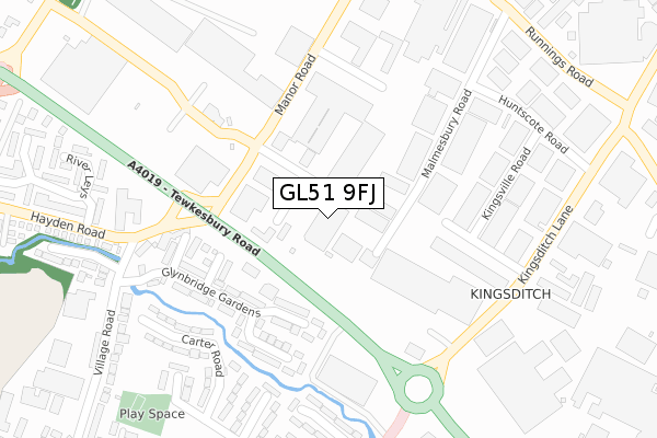
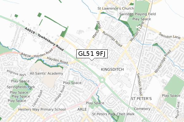
GL51 9FJ is located in the Swindon Village electoral ward, within the local authority district of Cheltenham and the English Parliamentary constituency of Tewkesbury. The Sub Integrated Care Board (ICB) Location is NHS Gloucestershire ICB - 11M and the police force is Gloucestershire. This postcode has been in use since October 2018.


GetTheData
Source: OS Open Zoomstack (Ordnance Survey)
Licence: Open Government Licence (requires attribution)
Attribution: Contains OS data © Crown copyright and database right 2024
Source: Open Postcode Geo
Licence: Open Government Licence (requires attribution)
Attribution: Contains OS data © Crown copyright and database right 2024; Contains Royal Mail data © Royal Mail copyright and database right 2024; Source: Office for National Statistics licensed under the Open Government Licence v.3.0
| Easting | 393066 |
| Northing | 224163 |
| Latitude | 51.915958 |
| Longitude | -2.102214 |
GetTheData
Source: Open Postcode Geo
Licence: Open Government Licence
| Country | England |
| Postcode District | GL51 |
| ➜ GL51 open data dashboard ➜ See where GL51 is on a map ➜ Where is Cheltenham? | |
GetTheData
Source: Land Registry Price Paid Data
Licence: Open Government Licence
| Ward | Swindon Village |
| Constituency | Tewkesbury |
GetTheData
Source: ONS Postcode Database
Licence: Open Government Licence
| January 2024 | Shoplifting | On or near Parking Area | 208m |
| January 2024 | Shoplifting | On or near Parking Area | 208m |
| December 2023 | Criminal damage and arson | On or near Petrol Station | 83m |
| ➜ Get more crime data in our Crime section | |||
GetTheData
Source: data.police.uk
Licence: Open Government Licence
| Hayden Road (Tewkesbury Road) | Kingsditch | 90m |
| Retail Park (Tewkesbury Road) | Kingsditch | 176m |
| Retail Park (Tewkesbury Road) | Kingsditch | 198m |
| Gallagher Retail Park (Manor Road) | Kingsditch | 243m |
| Gallagher Retail Park (Manor Road) | Kingsditch | 245m |
| Cheltenham Spa Station | 2.1km |
GetTheData
Source: NaPTAN
Licence: Open Government Licence
GetTheData
Source: ONS Postcode Database
Licence: Open Government Licence


➜ Get more ratings from the Food Standards Agency
GetTheData
Source: Food Standards Agency
Licence: FSA terms & conditions
| Last Collection | |||
|---|---|---|---|
| Location | Mon-Fri | Sat | Distance |
| Village Road | 17:00 | 12:30 | 234m |
| Sainsbury's Tewkeabury Road | 18:30 | 12:30 | 349m |
| Huntscote Road | 18:30 | 12:30 | 415m |
GetTheData
Source: Dracos
Licence: Creative Commons Attribution-ShareAlike
| Facility | Distance |
|---|---|
| Xtreme Csc Ltd (Cheltenham) (Closed) Malmesbury Road, Cheltenham Health and Fitness Gym | 221m |
| Sports Direct Fitness (Cheltenham) (Closed) Tewkesbury Road, Uckington, Cheltenham Swimming Pool, Health and Fitness Gym, Studio | 610m |
| Christ College (Howell Road Site) (Closed) Howell Road, Cheltenham Artificial Grass Pitch, Grass Pitches, Sports Hall, Swimming Pool | 631m |
GetTheData
Source: Active Places
Licence: Open Government Licence
| School | Phase of Education | Distance |
|---|---|---|
| All Saints' Academy, Cheltenham Blaisdon Way, Cheltenham, GL51 0WH | Secondary | 584m |
| Hesters Way Primary School Dill Avenue, Cheltenham, GL51 0ES | Primary | 873m |
| Rowanfield Infant School Alstone Lane, Cheltenham, GL51 8HY | Primary | 1.1km |
GetTheData
Source: Edubase
Licence: Open Government Licence
The below table lists the International Territorial Level (ITL) codes (formerly Nomenclature of Territorial Units for Statistics (NUTS) codes) and Local Administrative Units (LAU) codes for GL51 9FJ:
| ITL 1 Code | Name |
|---|---|
| TLK | South West (England) |
| ITL 2 Code | Name |
| TLK1 | Gloucestershire, Wiltshire and Bath/Bristol area |
| ITL 3 Code | Name |
| TLK13 | Gloucestershire CC |
| LAU 1 Code | Name |
| E07000078 | Cheltenham |
GetTheData
Source: ONS Postcode Directory
Licence: Open Government Licence
The below table lists the Census Output Area (OA), Lower Layer Super Output Area (LSOA), and Middle Layer Super Output Area (MSOA) for GL51 9FJ:
| Code | Name | |
|---|---|---|
| OA | E00112637 | |
| LSOA | E01022165 | Cheltenham 001C |
| MSOA | E02004600 | Cheltenham 001 |
GetTheData
Source: ONS Postcode Directory
Licence: Open Government Licence
| GL51 9SG | Tewkesbury Road | 97m |
| GL51 0UN | Summerfield Close | 111m |
| GL51 0BZ | Glynbridge Gardens | 117m |
| GL51 0UL | Patterdale Close | 170m |
| GL51 0AF | Riverview Way | 171m |
| GL51 9TW | Gara Close | 217m |
| GL51 9PL | Malmesbury Road | 221m |
| GL51 0US | Carter Road | 229m |
| GL51 9DU | Tewkesbury Road | 235m |
| GL51 0UT | George Readings Way | 262m |
GetTheData
Source: Open Postcode Geo; Land Registry Price Paid Data
Licence: Open Government Licence