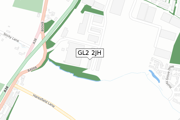
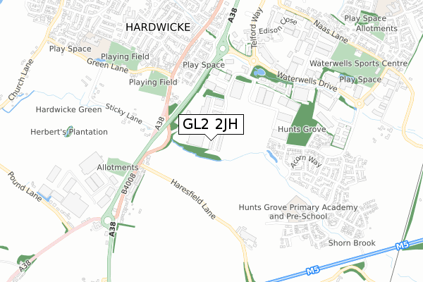
GL2 2JH is located in the Hardwicke electoral ward, within the local authority district of Stroud and the English Parliamentary constituency of Stroud. The Sub Integrated Care Board (ICB) Location is NHS Gloucestershire ICB - 11M and the police force is Gloucestershire. This postcode has been in use since July 2018.


GetTheData
Source: OS Open Zoomstack (Ordnance Survey)
Licence: Open Government Licence (requires attribution)
Attribution: Contains OS data © Crown copyright and database right 2024
Source: Open Postcode Geo
Licence: Open Government Licence (requires attribution)
Attribution: Contains OS data © Crown copyright and database right 2024; Contains Royal Mail data © Royal Mail copyright and database right 2024; Source: Office for National Statistics licensed under the Open Government Licence v.3.0
| Easting | 380738 |
| Northing | 212400 |
| Latitude | 51.809905 |
| Longitude | -2.280791 |
GetTheData
Source: Open Postcode Geo
Licence: Open Government Licence
| Country | England |
| Postcode District | GL2 |
| ➜ GL2 open data dashboard ➜ See where GL2 is on a map ➜ Where is Hardwicke? | |
GetTheData
Source: Land Registry Price Paid Data
Licence: Open Government Licence
| Ward | Hardwicke |
| Constituency | Stroud |
GetTheData
Source: ONS Postcode Database
Licence: Open Government Licence
| June 2022 | Violence and sexual offences | On or near Bristol Road | 421m |
| June 2022 | Other theft | On or near Bristol Road | 421m |
| April 2022 | Anti-social behaviour | On or near Bristol Road | 421m |
| ➜ Get more crime data in our Crime section | |||
GetTheData
Source: data.police.uk
Licence: Open Government Licence
| Bypass Bridge (B4008) | Hardwicke | 295m |
| Bypass Bridge | Hardwicke | 342m |
| Bath Road School Stop | Hardwicke | 440m |
| The Starting Gate (Bristol Road B4008) | Hardwicke | 517m |
| Mobility Centre (Bath Road) | Hardwicke | 523m |
GetTheData
Source: NaPTAN
Licence: Open Government Licence
GetTheData
Source: ONS Postcode Database
Licence: Open Government Licence


➜ Get more ratings from the Food Standards Agency
GetTheData
Source: Food Standards Agency
Licence: FSA terms & conditions
| Last Collection | |||
|---|---|---|---|
| Location | Mon-Fri | Sat | Distance |
| Hardwickepo | 16:40 | 09:45 | 763m |
| Four Mile Elm Hardwicke | 16:50 | 09:15 | 950m |
| Westlands Road Hardwicke | 16:35 | 10:15 | 994m |
GetTheData
Source: Dracos
Licence: Creative Commons Attribution-ShareAlike
| Facility | Distance |
|---|---|
| Rob Dawe Memorial Close Green Lane, Green Lane, Hardwicke, Gloucester Grass Pitches | 480m |
| Gloucestershire Constabulary Headquarters Waterwells Drive, Waterwells Business Park, Quedgeley, Gloucester Sports Hall | 602m |
| Hardwicke Village Hall Playing Fields Green Lane, Hardwicke, Gloucester Grass Pitches | 682m |
GetTheData
Source: Active Places
Licence: Open Government Licence
| School | Phase of Education | Distance |
|---|---|---|
| Hunts Grove Primary Academy Harrier Way, Hunts Grove, Hardwicke, Gloucester, GL2 4EP | Primary | 699m |
| Hardwicke Parochial Primary Academy Poplar Way, Hardwicke, Gloucester, GL2 4QG | Primary | 910m |
| Field Court Junior School Courtfield Road, Quedgeley, Gloucester, GL2 4UF | Primary | 1.4km |
GetTheData
Source: Edubase
Licence: Open Government Licence
The below table lists the International Territorial Level (ITL) codes (formerly Nomenclature of Territorial Units for Statistics (NUTS) codes) and Local Administrative Units (LAU) codes for GL2 2JH:
| ITL 1 Code | Name |
|---|---|
| TLK | South West (England) |
| ITL 2 Code | Name |
| TLK1 | Gloucestershire, Wiltshire and Bath/Bristol area |
| ITL 3 Code | Name |
| TLK13 | Gloucestershire CC |
| LAU 1 Code | Name |
| E07000082 | Stroud |
GetTheData
Source: ONS Postcode Directory
Licence: Open Government Licence
The below table lists the Census Output Area (OA), Lower Layer Super Output Area (LSOA), and Middle Layer Super Output Area (MSOA) for GL2 2JH:
| Code | Name | |
|---|---|---|
| OA | E00113765 | |
| LSOA | E01022380 | Stroud 001C |
| MSOA | E02004651 | Stroud 001 |
GetTheData
Source: ONS Postcode Directory
Licence: Open Government Licence
| GL2 4RA | Bristol Road | 374m |
| GL2 4RB | Bristol Road | 376m |
| GL2 4AX | Shorn Brook Close | 377m |
| GL2 2AD | Davy Way | 391m |
| GL2 4QZ | Bristol Road | 447m |
| GL2 4RF | Bristol Road | 452m |
| GL2 4DA | Foxwhelp Way | 472m |
| GL2 4BH | Hunts Grove Drive | 490m |
| GL2 4BW | Meerbrook Way | 507m |
| GL2 2AQ | Wheatstone Court | 511m |
GetTheData
Source: Open Postcode Geo; Land Registry Price Paid Data
Licence: Open Government Licence