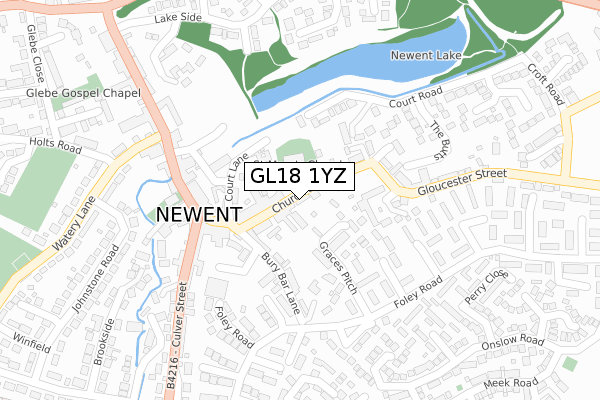
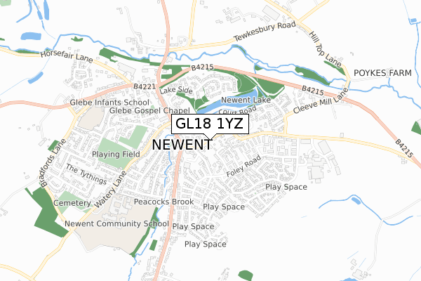
GL18 1YZ is located in the Newent & Taynton electoral ward, within the local authority district of Forest of Dean and the English Parliamentary constituency of Forest of Dean. The Sub Integrated Care Board (ICB) Location is NHS Gloucestershire ICB - 11M and the police force is Gloucestershire. This postcode has been in use since June 2019.


GetTheData
Source: OS Open Zoomstack (Ordnance Survey)
Licence: Open Government Licence (requires attribution)
Attribution: Contains OS data © Crown copyright and database right 2024
Source: Open Postcode Geo
Licence: Open Government Licence (requires attribution)
Attribution: Contains OS data © Crown copyright and database right 2024; Contains Royal Mail data © Royal Mail copyright and database right 2024; Source: Office for National Statistics licensed under the Open Government Licence v.3.0
| Easting | 372358 |
| Northing | 225890 |
| Latitude | 51.930839 |
| Longitude | -2.403425 |
GetTheData
Source: Open Postcode Geo
Licence: Open Government Licence
| Country | England |
| Postcode District | GL18 |
| ➜ GL18 open data dashboard ➜ See where GL18 is on a map ➜ Where is Newent? | |
GetTheData
Source: Land Registry Price Paid Data
Licence: Open Government Licence
| Ward | Newent & Taynton |
| Constituency | Forest Of Dean |
GetTheData
Source: ONS Postcode Database
Licence: Open Government Licence
| November 2023 | Violence and sexual offences | On or near Park/Open Space | 261m |
| November 2023 | Vehicle crime | On or near Onslow Road | 417m |
| October 2023 | Vehicle crime | On or near Church Way | 156m |
| ➜ Get more crime data in our Crime section | |||
GetTheData
Source: data.police.uk
Licence: Open Government Licence
| Post Office School Stop | Newent | 15m |
| The Black Dog (Church Street) | Newent | 144m |
| The Black Dog (Gloucester Street) | Newent | 168m |
| Budgens Forecourt | Newent | 182m |
| Co-op (Broad Street) | Newent | 217m |
GetTheData
Source: NaPTAN
Licence: Open Government Licence
GetTheData
Source: ONS Postcode Database
Licence: Open Government Licence


➜ Get more ratings from the Food Standards Agency
GetTheData
Source: Food Standards Agency
Licence: FSA terms & conditions
| Last Collection | |||
|---|---|---|---|
| Location | Mon-Fri | Sat | Distance |
| Health Centre | 17:40 | 09:30 | 241m |
| Onslow Road | 16:00 | 08:30 | 392m |
| Lakeside | 17:15 | 08:00 | 411m |
GetTheData
Source: Dracos
Licence: Creative Commons Attribution-ShareAlike
| Facility | Distance |
|---|---|
| Newent Recreation Ground Watery Lane, Watery Lane, Newent Grass Pitches | 500m |
| Forest Leisure Newent Watery Lane, Newent Sports Hall, Swimming Pool, Health and Fitness Gym, Grass Pitches, Artificial Grass Pitch, Squash Courts | 622m |
| The Federation Of Newent Schools (Glebe Infant & Picklenash Junior) Ross Road, Newent Grass Pitches | 689m |
GetTheData
Source: Active Places
Licence: Open Government Licence
| School | Phase of Education | Distance |
|---|---|---|
| Picklenash Junior School Ross Road, Newent, GL18 1BG | Primary | 611m |
| Glebe Infants' School Glebe Way, Newent, GL18 1BL | Primary | 614m |
| Newent Community School and Sixth Form Centre Watery Lane, Newent, GL18 1QF | Secondary | 754m |
GetTheData
Source: Edubase
Licence: Open Government Licence
The below table lists the International Territorial Level (ITL) codes (formerly Nomenclature of Territorial Units for Statistics (NUTS) codes) and Local Administrative Units (LAU) codes for GL18 1YZ:
| ITL 1 Code | Name |
|---|---|
| TLK | South West (England) |
| ITL 2 Code | Name |
| TLK1 | Gloucestershire, Wiltshire and Bath/Bristol area |
| ITL 3 Code | Name |
| TLK13 | Gloucestershire CC |
| LAU 1 Code | Name |
| E07000080 | Forest of Dean |
GetTheData
Source: ONS Postcode Directory
Licence: Open Government Licence
The below table lists the Census Output Area (OA), Lower Layer Super Output Area (LSOA), and Middle Layer Super Output Area (MSOA) for GL18 1YZ:
| Code | Name | |
|---|---|---|
| OA | E00113165 | |
| LSOA | E01022262 | Forest of Dean 002B |
| MSOA | E02004627 | Forest of Dean 002 |
GetTheData
Source: ONS Postcode Directory
Licence: Open Government Licence
| GL18 1AA | Church Street | 43m |
| GL18 1PU | Church Street | 65m |
| GL18 1AB | Church Street | 66m |
| GL18 1PP | Church Street | 68m |
| GL18 1AP | Church Street | 118m |
| GL18 1SU | Graces Pitch | 119m |
| GL18 1PS | Market Square | 127m |
| GL18 1AR | Court Lane | 130m |
| GL18 1EW | The Walled Garden | 130m |
| GL18 1SY | Court Road | 141m |
GetTheData
Source: Open Postcode Geo; Land Registry Price Paid Data
Licence: Open Government Licence