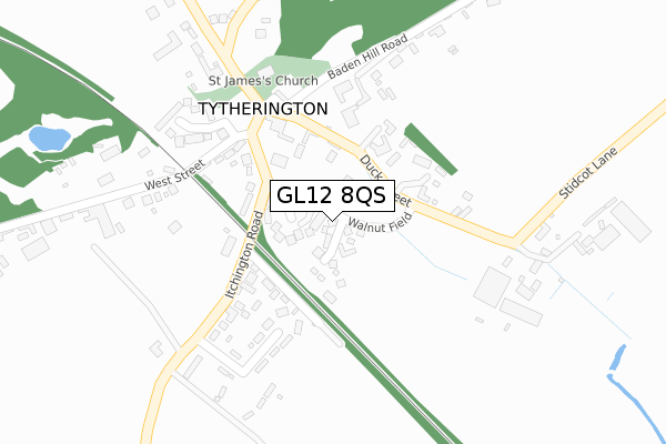
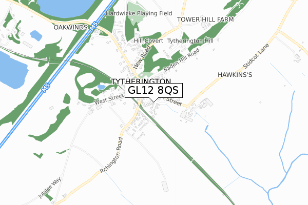
GL12 8QS is located in the Frampton Cotterell electoral ward, within the unitary authority of South Gloucestershire and the English Parliamentary constituency of Thornbury and Yate. The Sub Integrated Care Board (ICB) Location is NHS Bristol, North Somerset and South Gloucestershire ICB - 15C and the police force is Avon and Somerset. This postcode has been in use since December 2019.


GetTheData
Source: OS Open Zoomstack (Ordnance Survey)
Licence: Open Government Licence (requires attribution)
Attribution: Contains OS data © Crown copyright and database right 2024
Source: Open Postcode Geo
Licence: Open Government Licence (requires attribution)
Attribution: Contains OS data © Crown copyright and database right 2024; Contains Royal Mail data © Royal Mail copyright and database right 2024; Source: Office for National Statistics licensed under the Open Government Licence v.3.0
| Easting | 366946 |
| Northing | 188117 |
| Latitude | 51.590927 |
| Longitude | -2.478527 |
GetTheData
Source: Open Postcode Geo
Licence: Open Government Licence
| Country | England |
| Postcode District | GL12 |
| ➜ GL12 open data dashboard ➜ See where GL12 is on a map ➜ Where is Tytherington? | |
GetTheData
Source: Land Registry Price Paid Data
Licence: Open Government Licence
| Ward | Frampton Cotterell |
| Constituency | Thornbury And Yate |
GetTheData
Source: ONS Postcode Database
Licence: Open Government Licence
2023 10 FEB £580,100 |
2022 21 NOV £705,000 |
21, WALNUT FIELD, TYTHERINGTON, WOTTON-UNDER-EDGE, GL12 8QS 2020 23 OCT £505,000 |
12, WALNUT FIELD, TYTHERINGTON, WOTTON-UNDER-EDGE, GL12 8QS 2020 23 OCT £397,000 |
2020 28 SEP £620,000 |
14, WALNUT FIELD, TYTHERINGTON, WOTTON-UNDER-EDGE, GL12 8QS 2020 25 SEP £398,000 |
5, WALNUT FIELD, TYTHERINGTON, WOTTON-UNDER-EDGE, GL12 8QS 2020 18 SEP £600,000 |
19, WALNUT FIELD, TYTHERINGTON, WOTTON-UNDER-EDGE, GL12 8QS 2020 28 AUG £470,000 |
4, WALNUT FIELD, TYTHERINGTON, WOTTON-UNDER-EDGE, GL12 8QS 2020 31 JUL £511,500 |
3, WALNUT FIELD, TYTHERINGTON, WOTTON-UNDER-EDGE, GL12 8QS 2020 24 JUL £519,000 |
GetTheData
Source: HM Land Registry Price Paid Data
Licence: Contains HM Land Registry data © Crown copyright and database right 2024. This data is licensed under the Open Government Licence v3.0.
| March 2022 | Public order | On or near The Nurseries | 95m |
| March 2022 | Violence and sexual offences | On or near The Nurseries | 95m |
| March 2022 | Violence and sexual offences | On or near The Orchard | 251m |
| ➜ Get more crime data in our Crime section | |||
GetTheData
Source: data.police.uk
Licence: Open Government Licence
| Duck Street | Tytherington | 197m |
| Duck Street | Tytherington | 198m |
| The Swan (West Street) | Tytherington | 208m |
| Stowell Hill Road (Tytherington Road) | Tytherington | 692m |
| Stowell Hill Road (Tytherington Road) | Tytherington | 692m |
GetTheData
Source: NaPTAN
Licence: Open Government Licence
GetTheData
Source: ONS Postcode Database
Licence: Open Government Licence

➜ Get more ratings from the Food Standards Agency
GetTheData
Source: Food Standards Agency
Licence: FSA terms & conditions
| Last Collection | |||
|---|---|---|---|
| Location | Mon-Fri | Sat | Distance |
| West Street Tytherington | 16:30 | 09:10 | 216m |
| Baden Hill Tytherington | 16:00 | 07:30 | 1,321m |
| Itchington | 16:00 | 08:15 | 1,673m |
GetTheData
Source: Dracos
Licence: Creative Commons Attribution-ShareAlike
| Facility | Distance |
|---|---|
| Hardwicke Road Playing Field Woodlands Road, Tytherington, Wotton-under-edge Grass Pitches | 732m |
| Rangeworthy Recreation Ground Wotton Road, Rangeworthy, Bristol Grass Pitches | 2.8km |
| Christ The King Catholic Primary School Easton Hill Road, Thornbury, Bristol Grass Pitches | 3.3km |
GetTheData
Source: Active Places
Licence: Open Government Licence
| School | Phase of Education | Distance |
|---|---|---|
| Rangeworthy Church of England Primary School Wotton Road, Rangeworthy, Bristol, BS37 7ND | Primary | 2.7km |
| Crossways Junior School Knapp Road, Thornbury, Bristol, BS35 2HQ | Primary | 3km |
| Crossways Infant School Knapp Road, Thornbury, Bristol, BS35 2HQ | Primary | 3km |
GetTheData
Source: Edubase
Licence: Open Government Licence
The below table lists the International Territorial Level (ITL) codes (formerly Nomenclature of Territorial Units for Statistics (NUTS) codes) and Local Administrative Units (LAU) codes for GL12 8QS:
| ITL 1 Code | Name |
|---|---|
| TLK | South West (England) |
| ITL 2 Code | Name |
| TLK1 | Gloucestershire, Wiltshire and Bath/Bristol area |
| ITL 3 Code | Name |
| TLK12 | Bath and North East Somerset, North Somerset and South Gloucestershire |
| LAU 1 Code | Name |
| E06000025 | South Gloucestershire |
GetTheData
Source: ONS Postcode Directory
Licence: Open Government Licence
The below table lists the Census Output Area (OA), Lower Layer Super Output Area (LSOA), and Middle Layer Super Output Area (MSOA) for GL12 8QS:
| Code | Name | |
|---|---|---|
| OA | E00075751 | |
| LSOA | E01014993 | South Gloucestershire 002D |
| MSOA | E02003091 | South Gloucestershire 002 |
GetTheData
Source: ONS Postcode Directory
Licence: Open Government Licence
| GL12 8QP | The Nurseries | 98m |
| GL12 8QE | Itchington Road | 149m |
| GL12 8QB | Duck Street | 163m |
| GL12 8QF | Southlands | 199m |
| GL12 8UX | The Orchard | 284m |
| GL12 8UQ | West Street | 348m |
| GL12 8UG | Baden Hill Road | 405m |
| GL12 8UP | New Road | 416m |
| GL12 8UH | Stowell Hill Road | 473m |
| GL12 8UR | Tytherington Hill | 521m |
GetTheData
Source: Open Postcode Geo; Land Registry Price Paid Data
Licence: Open Government Licence