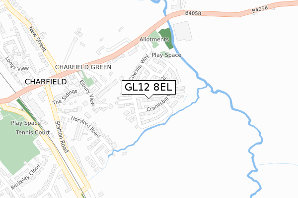
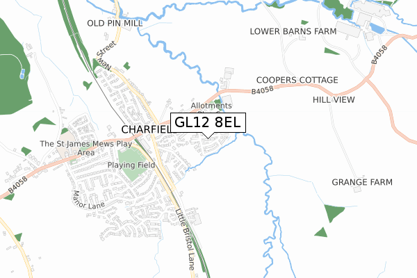
GL12 8EL is located in the Charfield electoral ward, within the unitary authority of South Gloucestershire and the English Parliamentary constituency of Thornbury and Yate. The Sub Integrated Care Board (ICB) Location is NHS Bristol, North Somerset and South Gloucestershire ICB - 15C and the police force is Avon and Somerset. This postcode has been in use since October 2017.


GetTheData
Source: OS Open Zoomstack (Ordnance Survey)
Licence: Open Government Licence (requires attribution)
Attribution: Contains OS data © Crown copyright and database right 2024
Source: Open Postcode Geo
Licence: Open Government Licence (requires attribution)
Attribution: Contains OS data © Crown copyright and database right 2024; Contains Royal Mail data © Royal Mail copyright and database right 2024; Source: Office for National Statistics licensed under the Open Government Licence v.3.0
| Easting | 372797 |
| Northing | 192284 |
| Latitude | 51.628708 |
| Longitude | -2.394394 |
GetTheData
Source: Open Postcode Geo
Licence: Open Government Licence
| Country | England |
| Postcode District | GL12 |
| ➜ GL12 open data dashboard ➜ See where GL12 is on a map | |
GetTheData
Source: Land Registry Price Paid Data
Licence: Open Government Licence
| Ward | Charfield |
| Constituency | Thornbury And Yate |
GetTheData
Source: ONS Postcode Database
Licence: Open Government Licence
| January 2024 | Public order | On or near Longs View | 480m |
| August 2023 | Other theft | On or near Longs View | 480m |
| June 2023 | Violence and sexual offences | On or near Longs View | 480m |
| ➜ Get more crime data in our Crime section | |||
GetTheData
Source: data.police.uk
Licence: Open Government Licence
| The Limes (Wotton Road) | Charfield | 194m |
| The Limes (Wotton Road) | Charfield | 195m |
| Railway Tavern (Wotton Road) | Charfield | 278m |
| Railway Tavern (Wotton Road) | Charfield | 293m |
| Manor Lane | Charfield | 380m |
GetTheData
Source: NaPTAN
Licence: Open Government Licence
| Percentage of properties with Next Generation Access | 100.0% |
| Percentage of properties with Superfast Broadband | 100.0% |
| Percentage of properties with Ultrafast Broadband | 100.0% |
| Percentage of properties with Full Fibre Broadband | 100.0% |
Superfast Broadband is between 30Mbps and 300Mbps
Ultrafast Broadband is > 300Mbps
| Percentage of properties unable to receive 2Mbps | 0.0% |
| Percentage of properties unable to receive 5Mbps | 0.0% |
| Percentage of properties unable to receive 10Mbps | 0.0% |
| Percentage of properties unable to receive 30Mbps | 0.0% |
GetTheData
Source: Ofcom
Licence: Ofcom Terms of Use (requires attribution)
GetTheData
Source: ONS Postcode Database
Licence: Open Government Licence

➜ Get more ratings from the Food Standards Agency
GetTheData
Source: Food Standards Agency
Licence: FSA terms & conditions
| Last Collection | |||
|---|---|---|---|
| Location | Mon-Fri | Sat | Distance |
| Wotton Road Charfield | 17:15 | 09:30 | 293m |
| Charfield Green | 17:00 | 10:00 | 450m |
| Mill Road Charfield | 17:15 | 07:00 | 820m |
GetTheData
Source: Dracos
Licence: Creative Commons Attribution-ShareAlike
| Facility | Distance |
|---|---|
| Charfield Memorial Hall & Playing Field Wotton Road, Charfield, Wotton-under-edge Grass Pitches, Outdoor Tennis Courts | 503m |
| Kingswood Playing Fields Wickwar Road, Kingswood Grass Pitches | 1.7km |
| Wotton Community Parc New Road, Wotton-under-edge Grass Pitches, Artificial Grass Pitch | 1.8km |
GetTheData
Source: Active Places
Licence: Open Government Licence
| School | Phase of Education | Distance |
|---|---|---|
| Charfield Primary School Wotton Road, Charfield, Wotton-Under-Edge, GL12 8TG | Primary | 698m |
| Kingswood Primary School Abbey Street, Kingswood, GL12 8RN | Primary | 1.9km |
| Katharine Lady Berkeley's School Kingswood Road, Wotton-under-Edge, GL12 8RB | Secondary | 2.1km |
GetTheData
Source: Edubase
Licence: Open Government Licence
The below table lists the International Territorial Level (ITL) codes (formerly Nomenclature of Territorial Units for Statistics (NUTS) codes) and Local Administrative Units (LAU) codes for GL12 8EL:
| ITL 1 Code | Name |
|---|---|
| TLK | South West (England) |
| ITL 2 Code | Name |
| TLK1 | Gloucestershire, Wiltshire and Bath/Bristol area |
| ITL 3 Code | Name |
| TLK12 | Bath and North East Somerset, North Somerset and South Gloucestershire |
| LAU 1 Code | Name |
| E06000025 | South Gloucestershire |
GetTheData
Source: ONS Postcode Directory
Licence: Open Government Licence
The below table lists the Census Output Area (OA), Lower Layer Super Output Area (LSOA), and Middle Layer Super Output Area (MSOA) for GL12 8EL:
| Code | Name | |
|---|---|---|
| OA | E00075209 | |
| LSOA | E01014885 | South Gloucestershire 003B |
| MSOA | E02003092 | South Gloucestershire 003 |
GetTheData
Source: ONS Postcode Directory
Licence: Open Government Licence
| GL12 8SJ | Elbury View | 155m |
| GL12 8UB | Kings Meadow | 171m |
| GL12 8SR | Wotton Road | 211m |
| GL12 8SU | Horsford Road | 230m |
| GL12 8ST | Cotswold View | 255m |
| GL12 8UF | The Sidings | 260m |
| GL12 8SX | May Grove | 261m |
| GL12 8SN | Station Close | 291m |
| GL12 8SY | Station Road | 326m |
| GL12 8SZ | Charfield Green | 440m |
GetTheData
Source: Open Postcode Geo; Land Registry Price Paid Data
Licence: Open Government Licence