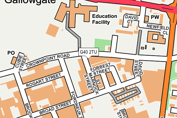
G40 2TU is located in the Calton electoral ward, within the council area of Glasgow City and the Scottish Parliamentary constituency of Glasgow Central. The Community Health Partnership is Glasgow City Community Health & Care Partnership and the police force is Scotland. This postcode has been in use since January 1980.


GetTheData
Source: OS OpenMap – Local (Ordnance Survey)
Source: OS VectorMap District (Ordnance Survey)
Licence: Open Government Licence (requires attribution)
| Easting | 261153 |
| Northing | 664374 |
| Latitude | 55.852508 |
| Longitude | -4.219519 |
GetTheData
Source: Open Postcode Geo
Licence: Open Government Licence
| Country | Scotland |
| Postcode District | G40 |
| ➜ G40 open data dashboard ➜ See where G40 is on a map ➜ Where is Glasgow? | |
GetTheData
Source: Land Registry Price Paid Data
Licence: Open Government Licence
| Ward | Calton |
| Constituency | Glasgow Central |
GetTheData
Source: ONS Postcode Database
Licence: Open Government Licence
| St Mungo's Academy (Gallowgate) | Gallowgate | 207m |
| St Mungo's Academy (Gallowgate) | Gallowgate | 230m |
| Alma Street (Fielden Street) | Gallowgate | 257m |
| Mountainblue Street (Fielden Street) | Gallowgate | 268m |
| Millerston Street (Gallowgate) | Gallowgate | 284m |
| Bellgrove Station | 0.6km |
| Bridgeton Station | 0.6km |
| Duke Street Station | 0.8km |
GetTheData
Source: NaPTAN
Licence: Open Government Licence
GetTheData
Source: ONS Postcode Database
Licence: Open Government Licence


➜ Get more ratings from the Food Standards Agency
GetTheData
Source: Food Standards Agency
Licence: FSA terms & conditions
| Last Collection | |||
|---|---|---|---|
| Location | Mon-Fri | Sat | Distance |
| Gallowgate / Sword Street | 17:30 | 12:30 | 377m |
| Millroad Street | 17:30 | 12:30 | 540m |
| Queen Mary Street | 17:30 | 12:00 | 585m |
GetTheData
Source: Dracos
Licence: Creative Commons Attribution-ShareAlike
The below table lists the International Territorial Level (ITL) codes (formerly Nomenclature of Territorial Units for Statistics (NUTS) codes) and Local Administrative Units (LAU) codes for G40 2TU:
| ITL 1 Code | Name |
|---|---|
| TLM | Scotland |
| ITL 2 Code | Name |
| TLM8 | West Central Scotland |
| ITL 3 Code | Name |
| TLM82 | Glasgow City |
| LAU 1 Code | Name |
| S30000052 | Glasgow City |
GetTheData
Source: ONS Postcode Directory
Licence: Open Government Licence
The below table lists the Census Output Area (OA), Lower Layer Super Output Area (LSOA), and Middle Layer Super Output Area (MSOA) for G40 2TU:
| Code | Name | |
|---|---|---|
| OA | S00114360 | |
| LSOA | S01010055 | Parkhead West and Barrowfield - 07 |
| MSOA | S02001894 | Parkhead West and Barrowfield |
GetTheData
Source: ONS Postcode Directory
Licence: Open Government Licence