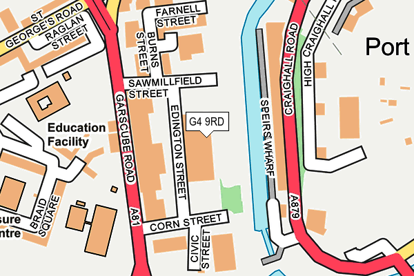
G4 9RD is located in the Hillhead electoral ward, within the council area of Glasgow City and the Scottish Parliamentary constituency of Glasgow North. The Community Health Partnership is Glasgow City Community Health & Care Partnership and the police force is Scotland. This postcode has been in use since December 1997.


GetTheData
Source: OS OpenMap – Local (Ordnance Survey)
Source: OS VectorMap District (Ordnance Survey)
Licence: Open Government Licence (requires attribution)
| Easting | 258747 |
| Northing | 666695 |
| Latitude | 55.872651 |
| Longitude | -4.259143 |
GetTheData
Source: Open Postcode Geo
Licence: Open Government Licence
| Country | Scotland |
| Postcode District | G4 |
| ➜ G4 open data dashboard ➜ See where G4 is on a map ➜ Where is Glasgow? | |
GetTheData
Source: Land Registry Price Paid Data
Licence: Open Government Licence
| Ward | Hillhead |
| Constituency | Glasgow North |
GetTheData
Source: ONS Postcode Database
Licence: Open Government Licence
| St Josephs Pr School (Garscube Road) | Port Dundas | 113m |
| St Josephs Pr School (Garscube Road) | Port Dundas | 133m |
| Speirs Wharf (Craighall Road) | Port Dundas | 135m |
| Corn Street (Garscube Road) | Port Dundas | 221m |
| Garscube Cross (St Georges Road) | Firhill | 267m |
| Cowcaddens Spt Subway Station (Cowcaddens Road) | Glasgow | 512m |
| St Georges Cross Spt Subway Station (Off Great Western Road) | St Georges Cross | 649m |
| Buchanan Street Spt Subway Station (Buchanan Street) | Glasgow | 1,190m |
| Kelvinbridge Spt Subway Station (Off Great Western Road) | Kelvinbridge | 1,293m |
| Charing Cross (Glasgow) Station | 1.1km |
| Glasgow Queen Street Station | 1.3km |
| Glasgow Queen Street Low Level Station | 1.3km |
GetTheData
Source: NaPTAN
Licence: Open Government Licence
GetTheData
Source: ONS Postcode Database
Licence: Open Government Licence


➜ Get more ratings from the Food Standards Agency
GetTheData
Source: Food Standards Agency
Licence: FSA terms & conditions
| Last Collection | |||
|---|---|---|---|
| Location | Mon-Fri | Sat | Distance |
| Speirs Wharf | 18:30 | 13:00 | 163m |
| Possil Road | 18:30 | 12:45 | 300m |
| Payne Street | 18:30 | 13:00 | 356m |
GetTheData
Source: Dracos
Licence: Creative Commons Attribution-ShareAlike
The below table lists the International Territorial Level (ITL) codes (formerly Nomenclature of Territorial Units for Statistics (NUTS) codes) and Local Administrative Units (LAU) codes for G4 9RD:
| ITL 1 Code | Name |
|---|---|
| TLM | Scotland |
| ITL 2 Code | Name |
| TLM8 | West Central Scotland |
| ITL 3 Code | Name |
| TLM82 | Glasgow City |
| LAU 1 Code | Name |
| S30000052 | Glasgow City |
GetTheData
Source: ONS Postcode Directory
Licence: Open Government Licence
The below table lists the Census Output Area (OA), Lower Layer Super Output Area (LSOA), and Middle Layer Super Output Area (MSOA) for G4 9RD:
| Code | Name | |
|---|---|---|
| OA | S00112306 | |
| LSOA | S01010297 | Woodside - 01 |
| MSOA | S02001938 | Woodside |
GetTheData
Source: ONS Postcode Directory
Licence: Open Government Licence