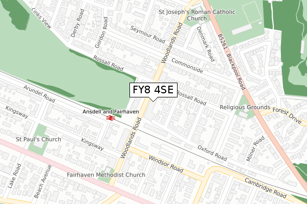
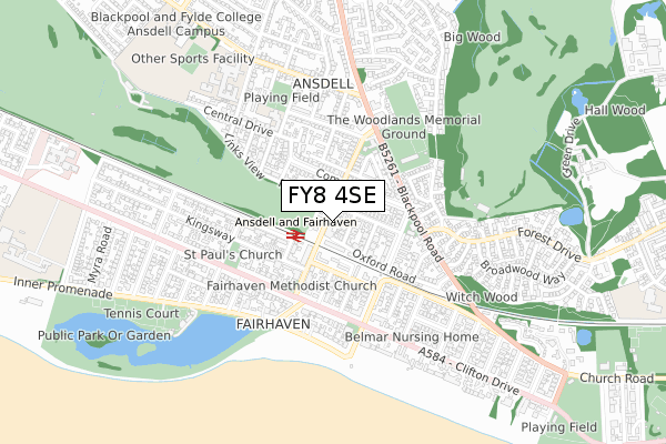
FY8 4SE is located in the Ansdell & Fairhaven electoral ward, within the local authority district of Fylde and the English Parliamentary constituency of Fylde. The Sub Integrated Care Board (ICB) Location is NHS Lancashire and South Cumbria ICB - 02M and the police force is Lancashire. This postcode has been in use since September 2017.


GetTheData
Source: OS Open Zoomstack (Ordnance Survey)
Licence: Open Government Licence (requires attribution)
Attribution: Contains OS data © Crown copyright and database right 2024
Source: Open Postcode Geo
Licence: Open Government Licence (requires attribution)
Attribution: Contains OS data © Crown copyright and database right 2024; Contains Royal Mail data © Royal Mail copyright and database right 2024; Source: Office for National Statistics licensed under the Open Government Licence v.3.0
| Easting | 334685 |
| Northing | 427766 |
| Latitude | 53.742178 |
| Longitude | -2.991774 |
GetTheData
Source: Open Postcode Geo
Licence: Open Government Licence
| Country | England |
| Postcode District | FY8 |
| ➜ FY8 open data dashboard ➜ See where FY8 is on a map ➜ Where is Lytham St Anne's? | |
GetTheData
Source: Land Registry Price Paid Data
Licence: Open Government Licence
| Ward | Ansdell & Fairhaven |
| Constituency | Fylde |
GetTheData
Source: ONS Postcode Database
Licence: Open Government Licence
| January 2024 | Violence and sexual offences | On or near Princes Road | 200m |
| January 2024 | Anti-social behaviour | On or near Princes Road | 200m |
| November 2023 | Anti-social behaviour | On or near Princes Road | 200m |
| ➜ Get more crime data in our Crime section | |||
GetTheData
Source: data.police.uk
Licence: Open Government Licence
| Library (Commonside) | Ansdell | 168m |
| Library (Commonside) | Ansdell | 170m |
| South Footbridge (Ansdell Road South) | Fairhaven | 291m |
| Methodist Church (Woodlands Road) | Fairhaven | 296m |
| Fairhaven Hotel (Clifton Drive) | Fairhaven | 307m |
| Ansdell & Fairhaven Station | 0.1km |
| Lytham Station | 1.9km |
| St Annes-on-the-Sea Station | 2.7km |
GetTheData
Source: NaPTAN
Licence: Open Government Licence
GetTheData
Source: ONS Postcode Database
Licence: Open Government Licence


➜ Get more ratings from the Food Standards Agency
GetTheData
Source: Food Standards Agency
Licence: FSA terms & conditions
| Last Collection | |||
|---|---|---|---|
| Location | Mon-Fri | Sat | Distance |
| Woodlands Road | 17:00 | 11:30 | 126m |
| Ansdell Post Office | 17:15 | 11:30 | 165m |
| Lansdown Road | 17:15 | 11:30 | 405m |
GetTheData
Source: Dracos
Licence: Creative Commons Attribution-ShareAlike
| Facility | Distance |
|---|---|
| Fylde Rufc Blackpool Road, Lytham St. Annes Grass Pitches, Health and Fitness Gym, Artificial Grass Pitch | 378m |
| Fairhaven Golf Club Oakwood Avenue, Lytham St. Annes Golf | 569m |
| Ansdell Ymca Arena Worsley Road, Lytham St. Annes Sports Hall, Artificial Grass Pitch, Grass Pitches, Studio | 689m |
GetTheData
Source: Active Places
Licence: Open Government Licence
| School | Phase of Education | Distance |
|---|---|---|
| Ansdell Primary School Lansdowne Road, Ansdell, Lytham St Annes, FY8 4DR | Primary | 442m |
| Lytham St Annes High School Albany Road, Lytham St. Annes, FY8 4GW | Secondary | 689m |
| AKS Lytham Clifton Drive South, Lytham St Annes, FY8 1DT | Not applicable | 1.2km |
GetTheData
Source: Edubase
Licence: Open Government Licence
The below table lists the International Territorial Level (ITL) codes (formerly Nomenclature of Territorial Units for Statistics (NUTS) codes) and Local Administrative Units (LAU) codes for FY8 4SE:
| ITL 1 Code | Name |
|---|---|
| TLD | North West (England) |
| ITL 2 Code | Name |
| TLD4 | Lancashire |
| ITL 3 Code | Name |
| TLD45 | Mid Lancashire |
| LAU 1 Code | Name |
| E07000119 | Fylde |
GetTheData
Source: ONS Postcode Directory
Licence: Open Government Licence
The below table lists the Census Output Area (OA), Lower Layer Super Output Area (LSOA), and Middle Layer Super Output Area (MSOA) for FY8 4SE:
| Code | Name | |
|---|---|---|
| OA | E00126792 | |
| LSOA | E01024982 | Fylde 008B |
| MSOA | E02005210 | Fylde 008 |
GetTheData
Source: ONS Postcode Directory
Licence: Open Government Licence
| FY8 4BX | Woodlands Road | 0m |
| FY8 4EG | Oxford Road | 56m |
| FY8 4EA | Woodlands Road | 66m |
| FY8 4EU | Buckingham Road | 87m |
| FY8 4EB | Oxford Road | 106m |
| FY8 4ES | Rossall Road | 136m |
| FY8 1XU | Windsor Road | 148m |
| FY8 4EX | Commonside | 151m |
| FY8 4ET | Kensington Road | 173m |
| FY8 1AE | Princes Road | 178m |
GetTheData
Source: Open Postcode Geo; Land Registry Price Paid Data
Licence: Open Government Licence