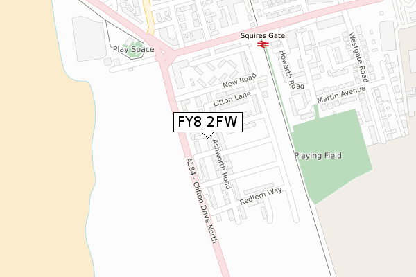
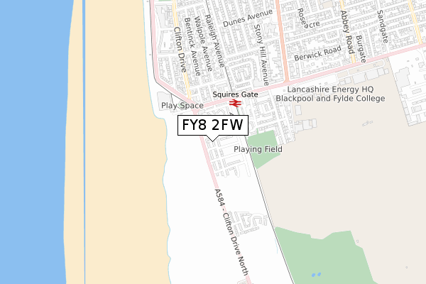
FY8 2FW is located in the Kilgrimol electoral ward, within the local authority district of Fylde and the English Parliamentary constituency of Fylde. The Sub Integrated Care Board (ICB) Location is NHS Lancashire and South Cumbria ICB - 02M and the police force is Lancashire. This postcode has been in use since April 2018.


GetTheData
Source: OS Open Zoomstack (Ordnance Survey)
Licence: Open Government Licence (requires attribution)
Attribution: Contains OS data © Crown copyright and database right 2024
Source: Open Postcode Geo
Licence: Open Government Licence (requires attribution)
Attribution: Contains OS data © Crown copyright and database right 2024; Contains Royal Mail data © Royal Mail copyright and database right 2024; Source: Office for National Statistics licensed under the Open Government Licence v.3.0
| Easting | 330752 |
| Northing | 431503 |
| Latitude | 53.775252 |
| Longitude | -3.052234 |
GetTheData
Source: Open Postcode Geo
Licence: Open Government Licence
| Country | England |
| Postcode District | FY8 |
| ➜ FY8 open data dashboard ➜ See where FY8 is on a map ➜ Where is Blackpool? | |
GetTheData
Source: Land Registry Price Paid Data
Licence: Open Government Licence
| Ward | Kilgrimol |
| Constituency | Fylde |
GetTheData
Source: ONS Postcode Database
Licence: Open Government Licence
2, ASHWORTH ROAD, LYTHAM ST ANNES, FY8 2FW 2021 24 SEP £210,000 |
60, ASHWORTH ROAD, LYTHAM ST ANNES, FY8 2FW 2020 16 OCT £210,000 |
2, ASHWORTH ROAD, LYTHAM ST ANNES, FY8 2FW 2020 15 JUL £197,500 |
82, ASHWORTH ROAD, LYTHAM ST ANNES, FY8 2FW 2020 13 MAR £209,000 |
58, ASHWORTH ROAD, LYTHAM ST ANNES, FY8 2FW 2020 28 FEB £214,995 |
80, ASHWORTH ROAD, LYTHAM ST ANNES, FY8 2FW 2019 15 NOV £214,995 |
56, ASHWORTH ROAD, LYTHAM ST ANNES, FY8 2FW 2019 25 OCT £214,995 |
84, ASHWORTH ROAD, LYTHAM ST ANNES, FY8 2FW 2019 10 OCT £219,995 |
86, ASHWORTH ROAD, LYTHAM ST ANNES, FY8 2FW 2019 15 AUG £199,995 |
88, ASHWORTH ROAD, LYTHAM ST ANNES, FY8 2FW 2019 26 JUL £199,995 |
GetTheData
Source: HM Land Registry Price Paid Data
Licence: Contains HM Land Registry data © Crown copyright and database right 2024. This data is licensed under the Open Government Licence v3.0.
| January 2024 | Violence and sexual offences | On or near Hillcrest Road | 430m |
| December 2023 | Public order | On or near Hillcrest Road | 430m |
| October 2023 | Violence and sexual offences | On or near Hillcrest Road | 430m |
| ➜ Get more crime data in our Crime section | |||
GetTheData
Source: data.police.uk
Licence: Open Government Licence
| New Road (Clifton Drive North) | Stony Hill | 74m |
| Starr Gate (Clifton Drive North) | Squires Gate | 152m |
| Clifton Drive North | Stony Hill | 210m |
| Starr Gate (Squires Gate Lane) | Squires Gate | 239m |
| Squires Gate Station (Squires Gate Lane) | Squires Gate | 275m |
| Starr Gate (Blackpool Tramway) (A584 Clifton Drive) | Squires Gate | 389m |
| Harrow Place (Blackpool Tramway) (Harrow Place) | Squires Gate | 890m |
| Burlington Road West (Blackpool Tramway) (Burlington Road West) | South Shore | 1,395m |
| Squires Gate Station | 0.3km |
| Blackpool Pleasure Beach Station | 1.4km |
| Blackpool South Station | 2.6km |
GetTheData
Source: NaPTAN
Licence: Open Government Licence
| Percentage of properties with Next Generation Access | 100.0% |
| Percentage of properties with Superfast Broadband | 100.0% |
| Percentage of properties with Ultrafast Broadband | 100.0% |
| Percentage of properties with Full Fibre Broadband | 100.0% |
Superfast Broadband is between 30Mbps and 300Mbps
Ultrafast Broadband is > 300Mbps
| Percentage of properties unable to receive 2Mbps | 0.0% |
| Percentage of properties unable to receive 5Mbps | 0.0% |
| Percentage of properties unable to receive 10Mbps | 0.0% |
| Percentage of properties unable to receive 30Mbps | 0.0% |
GetTheData
Source: Ofcom
Licence: Ofcom Terms of Use (requires attribution)
GetTheData
Source: ONS Postcode Database
Licence: Open Government Licence


➜ Get more ratings from the Food Standards Agency
GetTheData
Source: Food Standards Agency
Licence: FSA terms & conditions
| Last Collection | |||
|---|---|---|---|
| Location | Mon-Fri | Sat | Distance |
| Squires Gate Lane | 16:30 | 11:30 | 241m |
| Lytham Road South | 16:45 | 12:30 | 596m |
| 2 Abercorn Place | 16:30 | 12:30 | 619m |
GetTheData
Source: Dracos
Licence: Creative Commons Attribution-ShareAlike
| Facility | Distance |
|---|---|
| Blackpool Fc (Squires Gate) Martin Avenue, Lytham St. Annes Grass Pitches | 325m |
| Arnold School (Closed) Lytham Road, Blackpool Health and Fitness Gym, Grass Pitches, Sports Hall, Artificial Grass Pitch | 1.5km |
| Armfield Academy Lytham Road, Blackpool Artificial Grass Pitch, Sports Hall | 1.6km |
GetTheData
Source: Active Places
Licence: Open Government Licence
| School | Phase of Education | Distance |
|---|---|---|
| Roseacre Primary Academy Stonycroft Avenue, Blackpool, FY4 2PF | Primary | 1.1km |
| Armfield Academy 488 Lytham Road, Blackpool, FY4 1TL | All-through | 1.6km |
| Thames Primary Academy Severn Road, Blackpool, FY4 1EE | Primary | 1.9km |
GetTheData
Source: Edubase
Licence: Open Government Licence
The below table lists the International Territorial Level (ITL) codes (formerly Nomenclature of Territorial Units for Statistics (NUTS) codes) and Local Administrative Units (LAU) codes for FY8 2FW:
| ITL 1 Code | Name |
|---|---|
| TLD | North West (England) |
| ITL 2 Code | Name |
| TLD4 | Lancashire |
| ITL 3 Code | Name |
| TLD45 | Mid Lancashire |
| LAU 1 Code | Name |
| E07000119 | Fylde |
GetTheData
Source: ONS Postcode Directory
Licence: Open Government Licence
The below table lists the Census Output Area (OA), Lower Layer Super Output Area (LSOA), and Middle Layer Super Output Area (MSOA) for FY8 2FW:
| Code | Name | |
|---|---|---|
| OA | E00127015 | |
| LSOA | E01025024 | Fylde 004D |
| MSOA | E02005206 | Fylde 004 |
GetTheData
Source: ONS Postcode Directory
Licence: Open Government Licence
| FY8 2SR | New Road | 158m |
| FY8 2SU | Clifton Drive North | 198m |
| FY8 2SS | New Road | 211m |
| FY8 2ST | New Road | 222m |
| FY8 2SF | The Brambles | 252m |
| FY4 1SN | Squires Gate Lane | 256m |
| FY4 1TF | Marple Close | 282m |
| FY4 1SJ | Sandridge Place | 297m |
| FY4 1SL | Rutherford Place | 305m |
| FY4 1RU | Clifton Drive | 316m |
GetTheData
Source: Open Postcode Geo; Land Registry Price Paid Data
Licence: Open Government Licence