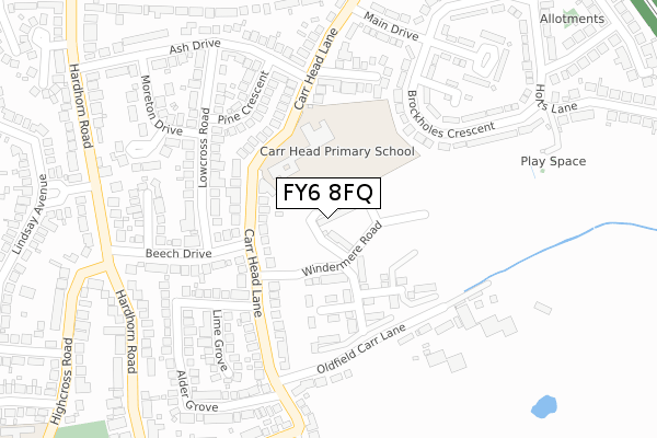
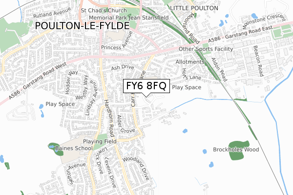
FY6 8FQ is located in the Hardhorn with High Cross electoral ward, within the local authority district of Wyre and the English Parliamentary constituency of Wyre and Preston North. The Sub Integrated Care Board (ICB) Location is NHS Lancashire and South Cumbria ICB - 02M and the police force is Lancashire. This postcode has been in use since September 2017.


GetTheData
Source: OS Open Zoomstack (Ordnance Survey)
Licence: Open Government Licence (requires attribution)
Attribution: Contains OS data © Crown copyright and database right 2024
Source: Open Postcode Geo
Licence: Open Government Licence (requires attribution)
Attribution: Contains OS data © Crown copyright and database right 2024; Contains Royal Mail data © Royal Mail copyright and database right 2024; Source: Office for National Statistics licensed under the Open Government Licence v.3.0
| Easting | 335205 |
| Northing | 438702 |
| Latitude | 53.840521 |
| Longitude | -2.986192 |
GetTheData
Source: Open Postcode Geo
Licence: Open Government Licence
| Country | England |
| Postcode District | FY6 |
| ➜ FY6 open data dashboard ➜ See where FY6 is on a map ➜ Where is Poulton-le-Fylde? | |
GetTheData
Source: Land Registry Price Paid Data
Licence: Open Government Licence
| Ward | Hardhorn With High Cross |
| Constituency | Wyre And Preston North |
GetTheData
Source: ONS Postcode Database
Licence: Open Government Licence
| January 2024 | Public order | On or near Hodgson Place | 403m |
| September 2022 | Anti-social behaviour | On or near Maple Drive | 215m |
| June 2022 | Vehicle crime | On or near Pine Crescent | 217m |
| ➜ Get more crime data in our Crime section | |||
GetTheData
Source: data.police.uk
Licence: Open Government Licence
| Beech Drive (Hardhorn Road) | Hardhorn | 342m |
| Brockholes Crescent | Poulton-le-fylde | 343m |
| Beech Drive (Hardhorn Road) | Hardhorn | 355m |
| Holts Lane Estate (Garstang Road East) | Poulton-le-fylde | 360m |
| High Cross Road (Highcross Road) | High Cross | 417m |
| Poulton-le-Fylde Station | 0.9km |
| Layton (Lancs) Station | 2.9km |
| Blackpool North Station | 4.6km |
GetTheData
Source: NaPTAN
Licence: Open Government Licence
| Percentage of properties with Next Generation Access | 100.0% |
| Percentage of properties with Superfast Broadband | 100.0% |
| Percentage of properties with Ultrafast Broadband | 100.0% |
| Percentage of properties with Full Fibre Broadband | 100.0% |
Superfast Broadband is between 30Mbps and 300Mbps
Ultrafast Broadband is > 300Mbps
| Percentage of properties unable to receive 2Mbps | 0.0% |
| Percentage of properties unable to receive 5Mbps | 0.0% |
| Percentage of properties unable to receive 10Mbps | 0.0% |
| Percentage of properties unable to receive 30Mbps | 0.0% |
GetTheData
Source: Ofcom
Licence: Ofcom Terms of Use (requires attribution)
GetTheData
Source: ONS Postcode Database
Licence: Open Government Licence


➜ Get more ratings from the Food Standards Agency
GetTheData
Source: Food Standards Agency
Licence: FSA terms & conditions
| Last Collection | |||
|---|---|---|---|
| Location | Mon-Fri | Sat | Distance |
| 1 Carr Head Lane, Poulton | 16:00 | 12:45 | 317m |
| Lowcross | 17:30 | 12:45 | 320m |
| Lower Green | 17:00 | 11:45 | 488m |
GetTheData
Source: Dracos
Licence: Creative Commons Attribution-ShareAlike
| Facility | Distance |
|---|---|
| Carr Head Primary School Carr Head Lane, Poulton-le-fylde Grass Pitches | 124m |
| Poulton-le-fylde St Chads C Of E Primary School Hardhorn Road, Poulton-le-fylde Grass Pitches | 588m |
| Gymetc. (Poulton Le Fylde) Premier Way, Poulton Industrial Estate, Poulton-le-fylde Swimming Pool, Health and Fitness Gym, Studio | 640m |
GetTheData
Source: Active Places
Licence: Open Government Licence
| School | Phase of Education | Distance |
|---|---|---|
| Poulton-le-Fylde Carr Head Primary School Carr Head Lane, Poulton-le-Fylde, FY6 8JB | Primary | 124m |
| Poulton-le-Fylde St Chad's CofE Primary School Hardhorn Road, Poulton-le-Fylde, FY6 7SR | Primary | 588m |
| Baines School Highcross Road, Poulton-le-Fylde, FY6 8BE | Secondary | 697m |
GetTheData
Source: Edubase
Licence: Open Government Licence
The below table lists the International Territorial Level (ITL) codes (formerly Nomenclature of Territorial Units for Statistics (NUTS) codes) and Local Administrative Units (LAU) codes for FY6 8FQ:
| ITL 1 Code | Name |
|---|---|
| TLD | North West (England) |
| ITL 2 Code | Name |
| TLD4 | Lancashire |
| ITL 3 Code | Name |
| TLD44 | Lancaster and Wyre |
| LAU 1 Code | Name |
| E07000128 | Wyre |
GetTheData
Source: ONS Postcode Directory
Licence: Open Government Licence
The below table lists the Census Output Area (OA), Lower Layer Super Output Area (LSOA), and Middle Layer Super Output Area (MSOA) for FY6 8FQ:
| Code | Name | |
|---|---|---|
| OA | E00129743 | |
| LSOA | E01025566 | Wyre 014A |
| MSOA | E02005332 | Wyre 014 |
GetTheData
Source: ONS Postcode Directory
Licence: Open Government Licence
| FY6 8JB | Carr Head Lane | 111m |
| FY6 8EG | Carr Head Lane | 162m |
| FY6 8HX | Brockholes Crescent | 186m |
| FY6 8EA | Low Cross Road | 204m |
| FY6 8JD | Poplar Avenue | 206m |
| FY6 8EQ | Maple Drive | 215m |
| FY6 8EF | Beech Drive | 220m |
| FY6 8EB | Pine Crescent | 227m |
| FY6 8EN | Oldfield Carr Lane | 228m |
| FY6 8EL | Lime Grove | 245m |
GetTheData
Source: Open Postcode Geo; Land Registry Price Paid Data
Licence: Open Government Licence