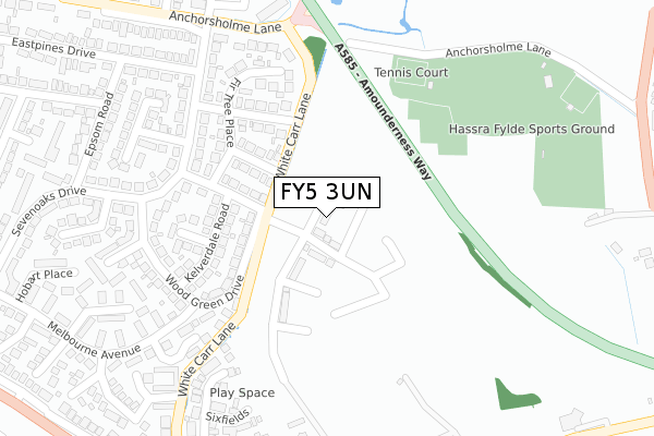
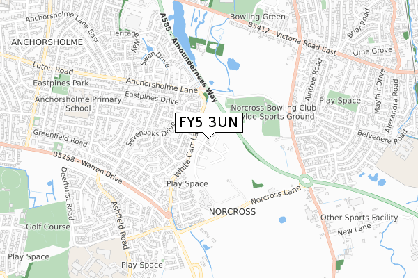
FY5 3UN is located in the Victoria & Norcross electoral ward, within the local authority district of Wyre and the English Parliamentary constituency of Blackpool North and Cleveleys. The Sub Integrated Care Board (ICB) Location is NHS Lancashire and South Cumbria ICB - 02M and the police force is Lancashire. This postcode has been in use since January 2020.


GetTheData
Source: OS Open Zoomstack (Ordnance Survey)
Licence: Open Government Licence (requires attribution)
Attribution: Contains OS data © Crown copyright and database right 2024
Source: Open Postcode Geo
Licence: Open Government Licence (requires attribution)
Attribution: Contains OS data © Crown copyright and database right 2024; Contains Royal Mail data © Royal Mail copyright and database right 2024; Source: Office for National Statistics licensed under the Open Government Licence v.3.0
| Easting | 333120 |
| Northing | 441629 |
| Latitude | 53.866559 |
| Longitude | -3.018511 |
GetTheData
Source: Open Postcode Geo
Licence: Open Government Licence
| Country | England |
| Postcode District | FY5 |
| ➜ FY5 open data dashboard ➜ See where FY5 is on a map ➜ Where is Blackpool? | |
GetTheData
Source: Land Registry Price Paid Data
Licence: Open Government Licence
| Ward | Victoria & Norcross |
| Constituency | Blackpool North And Cleveleys |
GetTheData
Source: ONS Postcode Database
Licence: Open Government Licence
1, WHITE HILL COURT, THORNTON-CLEVELEYS, FY5 3UN 2020 28 FEB £204,995 |
GetTheData
Source: HM Land Registry Price Paid Data
Licence: Contains HM Land Registry data © Crown copyright and database right 2024. This data is licensed under the Open Government Licence v3.0.
| June 2022 | Criminal damage and arson | On or near Wood Green Drive | 143m |
| June 2022 | Anti-social behaviour | On or near Melbourne Avenue | 251m |
| June 2022 | Criminal damage and arson | On or near Oldbury Place | 292m |
| ➜ Get more crime data in our Crime section | |||
GetTheData
Source: data.police.uk
Licence: Open Government Licence
| Grassington Place (Sevenoaks Drive) | Anchorsholme | 249m |
| Grassington Place (Sevenoaks Drive) | Anchorsholme | 263m |
| Lockhurst Avenue (Wood Green Drive) | Anchorsholme | 272m |
| Lockhurst Avenue (Wood Green Drive) | Anchorsholme | 278m |
| The Spinney (Melbourne Avenue) | Anchorsholme | 333m |
| Cleveleys (Blackpool Tramway) (York Avenue) | Cleveleys | 1,863m |
| Poulton-le-Fylde Station | 2.7km |
| Layton (Lancs) Station | 3.6km |
| Blackpool North Station | 5.4km |
GetTheData
Source: NaPTAN
Licence: Open Government Licence
GetTheData
Source: ONS Postcode Database
Licence: Open Government Licence


➜ Get more ratings from the Food Standards Agency
GetTheData
Source: Food Standards Agency
Licence: FSA terms & conditions
| Last Collection | |||
|---|---|---|---|
| Location | Mon-Fri | Sat | Distance |
| Beechwood Drive | 16:00 | 12:00 | 577m |
| Eastpines Post Office | 18:00 | 11:30 | 773m |
| 131 Kincraig Place | 17:15 | 13:15 | 1,006m |
GetTheData
Source: Dracos
Licence: Creative Commons Attribution-ShareAlike
| Facility | Distance |
|---|---|
| Hassra Sports Ground Anchorsholme Lane, Thornton, Thornton Cleveleys Grass Pitches, Artificial Grass Pitch, Sports Hall, Outdoor Tennis Courts | 261m |
| Ici (Closed) Victoria Road East, Thornton-cleveleys Grass Pitches | 678m |
| King George Playing Field (Thorton) Victoria Road East, Thornton Cleveleys Grass Pitches | 840m |
GetTheData
Source: Active Places
Licence: Open Government Licence
| School | Phase of Education | Distance |
|---|---|---|
| Anchorsholme Primary Academy Eastpines Drive, Thornton-Cleveleys, FY5 3RX | Primary | 782m |
| Blackpool and the Fylde College Ashfield Road, Bispham, Blackpool, FY2 0HB | 16 plus | 947m |
| Kincraig Primary School Kincraig Road, Bispham, Blackpool, FY2 0HN | Primary | 1.1km |
GetTheData
Source: Edubase
Licence: Open Government Licence
The below table lists the International Territorial Level (ITL) codes (formerly Nomenclature of Territorial Units for Statistics (NUTS) codes) and Local Administrative Units (LAU) codes for FY5 3UN:
| ITL 1 Code | Name |
|---|---|
| TLD | North West (England) |
| ITL 2 Code | Name |
| TLD4 | Lancashire |
| ITL 3 Code | Name |
| TLD44 | Lancaster and Wyre |
| LAU 1 Code | Name |
| E07000128 | Wyre |
GetTheData
Source: ONS Postcode Directory
Licence: Open Government Licence
The below table lists the Census Output Area (OA), Lower Layer Super Output Area (LSOA), and Middle Layer Super Output Area (MSOA) for FY5 3UN:
| Code | Name | |
|---|---|---|
| OA | E00129939 | |
| LSOA | E01025602 | Wyre 010D |
| MSOA | E02005328 | Wyre 010 |
GetTheData
Source: ONS Postcode Directory
Licence: Open Government Licence
| FY5 3DU | Green Oak Place | 135m |
| FY5 3DW | Bovington Avenue | 148m |
| FY5 3DL | Kelverdale Road | 171m |
| FY5 3DT | Grassington Place | 195m |
| FY5 3DP | Fir Tree Place | 224m |
| FY5 3BZ | Sevenoaks Drive | 226m |
| FY5 3DN | Quarry Bank | 237m |
| FY5 3DH | Wood Green Drive | 249m |
| FY5 3BU | Sevenoaks Drive | 256m |
| FY5 3BB | The Spinney | 262m |
GetTheData
Source: Open Postcode Geo; Land Registry Price Paid Data
Licence: Open Government Licence