FY4 5GW maps, stats, and open data
FY4 5GW is located in the Stanley electoral ward, within the unitary authority of Blackpool and the English Parliamentary constituency of Blackpool South. The Sub Integrated Care Board (ICB) Location is NHS Lancashire and South Cumbria ICB - 00R and the police force is Lancashire. This postcode has been in use since February 2018.
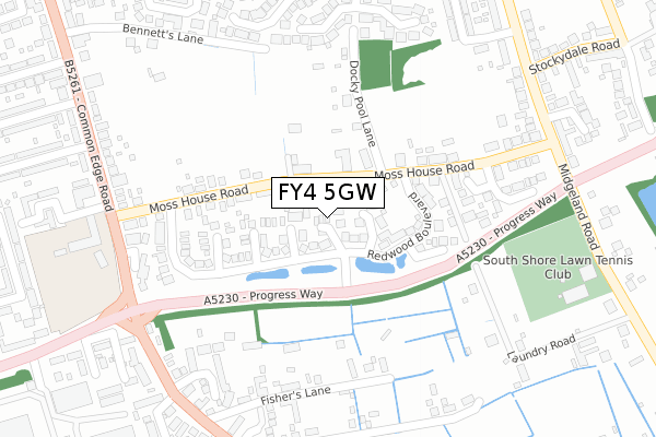
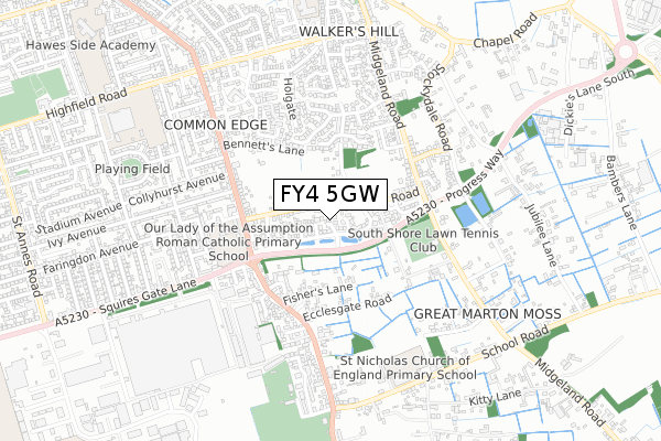
FY4 5GW maps


Licence: Open Government Licence (requires attribution)
Attribution: Contains OS data © Crown copyright and database right 2025
Source: Open Postcode Geo
Licence: Open Government Licence (requires attribution)
Attribution: Contains OS data © Crown copyright and database right 2025; Contains Royal Mail data © Royal Mail copyright and database right 2025; Source: Office for National Statistics licensed under the Open Government Licence v.3.0
FY4 5GW geodata
| Easting | 333051 |
| Northing | 432472 |
| Latitude | 53.784261 |
| Longitude | -3.017566 |
Where is FY4 5GW?
| Country | England |
| Postcode District | FY4 |
Politics
| Ward | Stanley |
|---|---|
| Constituency | Blackpool South |
House Prices
Sales of detached houses in FY4 5GW
2021 24 MAR £215,000 |
5, HOLLYTREE AVENUE, BLACKPOOL, FY4 5GW 2018 14 DEC £189,995 |
2018 10 DEC £189,995 |
1, HOLLYTREE AVENUE, BLACKPOOL, FY4 5GW 2018 21 SEP £189,995 |
Licence: Contains HM Land Registry data © Crown copyright and database right 2025. This data is licensed under the Open Government Licence v3.0.
Transport
Nearest bus stops to FY4 5GW
| Squires Gate Lane (Common Edge Road) | Highfield | 328m |
| Squires Gate Lane (Common Edge Road) | Highfield | 331m |
| Our Lady Church (Common Edge Road) | Highfield | 349m |
| Moss House Road (Midgeland Road) | Marton Moss | 355m |
| Fishers Lane (Common Edge Road) | Boundary | 368m |
Nearest railway stations to FY4 5GW
| Squires Gate Station | 2.3km |
| Blackpool Pleasure Beach Station | 2.4km |
| Blackpool South Station | 2.6km |
Broadband
Broadband access in FY4 5GW (2020 data)
| Percentage of properties with Next Generation Access | 100.0% |
| Percentage of properties with Superfast Broadband | 100.0% |
| Percentage of properties with Ultrafast Broadband | 100.0% |
| Percentage of properties with Full Fibre Broadband | 0.0% |
Superfast Broadband is between 30Mbps and 300Mbps
Ultrafast Broadband is > 300Mbps
Broadband speed in FY4 5GW (2019 data)
Download
| Median download speed | 100.0Mbps |
| Average download speed | 135.3Mbps |
| Maximum download speed | 350.00Mbps |
Upload
| Median upload speed | 1.2Mbps |
| Average upload speed | 1.2Mbps |
| Maximum upload speed | 1.64Mbps |
Broadband limitations in FY4 5GW (2020 data)
| Percentage of properties unable to receive 2Mbps | 0.0% |
| Percentage of properties unable to receive 5Mbps | 0.0% |
| Percentage of properties unable to receive 10Mbps | 0.0% |
| Percentage of properties unable to receive 30Mbps | 0.0% |
Deprivation
52.9% of English postcodes are less deprived than FY4 5GW:Food Standards Agency
Three nearest food hygiene ratings to FY4 5GW (metres)


➜ Get more ratings from the Food Standards Agency
Nearest post box to FY4 5GW
| Last Collection | |||
|---|---|---|---|
| Location | Mon-Fri | Sat | Distance |
| Willow Bank Avenue | 16:00 | 12:15 | 387m |
| Brookfield Avenue | 16:00 | 12:30 | 452m |
| Avondale Crescent | 17:00 | 12:30 | 701m |
FY4 5GW ITL and FY4 5GW LAU
The below table lists the International Territorial Level (ITL) codes (formerly Nomenclature of Territorial Units for Statistics (NUTS) codes) and Local Administrative Units (LAU) codes for FY4 5GW:
| ITL 1 Code | Name |
|---|---|
| TLD | North West (England) |
| ITL 2 Code | Name |
| TLD4 | Lancashire |
| ITL 3 Code | Name |
| TLD42 | Blackpool |
| LAU 1 Code | Name |
| E06000009 | Blackpool |
FY4 5GW census areas
The below table lists the Census Output Area (OA), Lower Layer Super Output Area (LSOA), and Middle Layer Super Output Area (MSOA) for FY4 5GW:
| Code | Name | |
|---|---|---|
| OA | E00064205 | |
| LSOA | E01012730 | Blackpool 018C |
| MSOA | E02002650 | Blackpool 018 |
Nearest postcodes to FY4 5GW
| FY4 5JE | Moss House Road | 46m |
| FY4 5JF | Moss House Road | 81m |
| FY4 5NB | Preston New Road | 112m |
| FY4 5JG | Docky Pool Lane | 187m |
| FY4 5DN | Fishers Lane | 259m |
| FY4 5FG | Sovereign Gate | 288m |
| FY4 5NL | Kildonan Avenue | 304m |
| FY4 5NA | Belverdale Gardens | 315m |
| FY4 5DG | Common Edge Road | 318m |
| FY4 5DW | Ecclesgate Road | 322m |