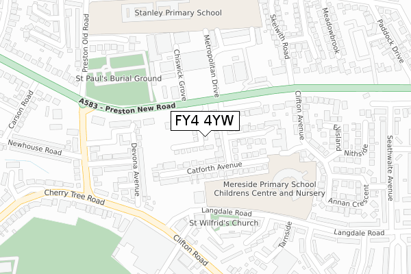
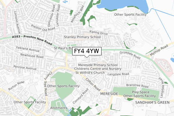
FY4 4YW is located in the Clifton electoral ward, within the unitary authority of Blackpool and the English Parliamentary constituency of Blackpool South. The Sub Integrated Care Board (ICB) Location is NHS Lancashire and South Cumbria ICB - 00R and the police force is Lancashire. This postcode has been in use since March 2019.


GetTheData
Source: OS Open Zoomstack (Ordnance Survey)
Licence: Open Government Licence (requires attribution)
Attribution: Contains OS data © Crown copyright and database right 2024
Source: Open Postcode Geo
Licence: Open Government Licence (requires attribution)
Attribution: Contains OS data © Crown copyright and database right 2024; Contains Royal Mail data © Royal Mail copyright and database right 2024; Source: Office for National Statistics licensed under the Open Government Licence v.3.0
| Easting | 333738 |
| Northing | 434394 |
| Latitude | 53.801621 |
| Longitude | -3.007554 |
GetTheData
Source: Open Postcode Geo
Licence: Open Government Licence
| Country | England |
| Postcode District | FY4 |
| ➜ FY4 open data dashboard ➜ See where FY4 is on a map ➜ Where is Blackpool? | |
GetTheData
Source: Land Registry Price Paid Data
Licence: Open Government Licence
| Ward | Clifton |
| Constituency | Blackpool South |
GetTheData
Source: ONS Postcode Database
Licence: Open Government Licence
2, MELROSE GARDENS, BLACKPOOL, FY4 4YW 2023 13 FEB £235,000 |
36, MELROSE GARDENS, BLACKPOOL, FY4 4YW 2022 28 JAN £195,000 |
55, MELROSE GARDENS, BLACKPOOL, FY4 4YW 2021 29 OCT £180,000 |
49, MELROSE GARDENS, BLACKPOOL, FY4 4YW 2021 24 SEP £255,000 |
47, MELROSE GARDENS, BLACKPOOL, FY4 4YW 2021 28 JUL £195,000 |
22, MELROSE GARDENS, BLACKPOOL, FY4 4YW 2021 28 MAY £233,000 |
19, MELROSE GARDENS, BLACKPOOL, FY4 4YW 2020 21 FEB £200,000 |
17, MELROSE GARDENS, BLACKPOOL, FY4 4YW 2019 20 DEC £200,000 |
10, MELROSE GARDENS, BLACKPOOL, FY4 4YW 2019 11 OCT £199,000 |
GetTheData
Source: HM Land Registry Price Paid Data
Licence: Contains HM Land Registry data © Crown copyright and database right 2024. This data is licensed under the Open Government Licence v3.0.
| October 2023 | Criminal damage and arson | On or near Cherry Tree Road North | 242m |
| October 2023 | Violence and sexual offences | On or near Clifton Avenue | 330m |
| May 2023 | Public order | On or near Cherry Tree Road North | 242m |
| ➜ Get more crime data in our Crime section | |||
GetTheData
Source: data.police.uk
Licence: Open Government Licence
| Clifton Road (Langdale Road) | Mereside | 182m |
| Langdale Road (Clifton Road) | Mereside | 209m |
| Preston Old Road (Preston New Road) | Marton | 215m |
| Langdale Road (Clifton Road) | Mereside | 216m |
| Metropolitan Business Pk (Preston New Road) | Little Marton | 224m |
| Blackpool South Station | 2.7km |
| Blackpool Pleasure Beach Station | 3.4km |
| Blackpool North Station | 3.6km |
GetTheData
Source: NaPTAN
Licence: Open Government Licence
| Percentage of properties with Next Generation Access | 100.0% |
| Percentage of properties with Superfast Broadband | 100.0% |
| Percentage of properties with Ultrafast Broadband | 44.4% |
| Percentage of properties with Full Fibre Broadband | 44.4% |
Superfast Broadband is between 30Mbps and 300Mbps
Ultrafast Broadband is > 300Mbps
| Percentage of properties unable to receive 2Mbps | 0.0% |
| Percentage of properties unable to receive 5Mbps | 0.0% |
| Percentage of properties unable to receive 10Mbps | 0.0% |
| Percentage of properties unable to receive 30Mbps | 0.0% |
GetTheData
Source: Ofcom
Licence: Ofcom Terms of Use (requires attribution)
GetTheData
Source: ONS Postcode Database
Licence: Open Government Licence


➜ Get more ratings from the Food Standards Agency
GetTheData
Source: Food Standards Agency
Licence: FSA terms & conditions
| Last Collection | |||
|---|---|---|---|
| Location | Mon-Fri | Sat | Distance |
| 7 Cherry Tree Road North | 17:00 | 12:15 | 236m |
| Clifton Avenue | 17:00 | 12:30 | 322m |
| 8 Skelwith Road | 17:00 | 11:00 | 330m |
GetTheData
Source: Dracos
Licence: Creative Commons Attribution-ShareAlike
| Facility | Distance |
|---|---|
| Stanley Primary School Wordsworth Avenue, Blackpool Grass Pitches | 330m |
| Universe Gym (Closed) Binwell Road, Blackpool Health and Fitness Gym, Studio | 417m |
| St Georges Swimming Pool (Closed) Cherry Tree Road, Blackpool Swimming Pool | 637m |
GetTheData
Source: Active Places
Licence: Open Government Licence
| School | Phase of Education | Distance |
|---|---|---|
| Mereside Primary Academy Langdale Road, Blackpool, FY4 4RR | Primary | 282m |
| Stanley Primary School Wordsworth Avenue, Blackpool, FY3 9UT | Primary | 330m |
| Lotus School Langdale Road, Blackpool, FY4 4RR | Not applicable | 429m |
GetTheData
Source: Edubase
Licence: Open Government Licence
The below table lists the International Territorial Level (ITL) codes (formerly Nomenclature of Territorial Units for Statistics (NUTS) codes) and Local Administrative Units (LAU) codes for FY4 4YW:
| ITL 1 Code | Name |
|---|---|
| TLD | North West (England) |
| ITL 2 Code | Name |
| TLD4 | Lancashire |
| ITL 3 Code | Name |
| TLD42 | Blackpool |
| LAU 1 Code | Name |
| E06000009 | Blackpool |
GetTheData
Source: ONS Postcode Directory
Licence: Open Government Licence
The below table lists the Census Output Area (OA), Lower Layer Super Output Area (LSOA), and Middle Layer Super Output Area (MSOA) for FY4 4YW:
| Code | Name | |
|---|---|---|
| OA | E00063956 | |
| LSOA | E01012689 | Blackpool 014D |
| MSOA | E02002646 | Blackpool 014 |
GetTheData
Source: ONS Postcode Directory
Licence: Open Government Licence
| FY4 4SD | Ribchester Avenue | 87m |
| FY4 4SF | Catforth Avenue | 99m |
| FY4 4NU | Devona Avenue | 118m |
| FY4 4NA | Cherry Tree Road | 158m |
| FY4 4SE | Ribby Place | 173m |
| FY4 4NT | Kumara Crescent | 177m |
| FY4 4PU | Clifton Road | 189m |
| FY4 4RE | Preston New Road | 192m |
| FY4 4NX | Radworth Crescent | 197m |
| FY4 4NY | Cherry Tree Road North | 220m |
GetTheData
Source: Open Postcode Geo; Land Registry Price Paid Data
Licence: Open Government Licence