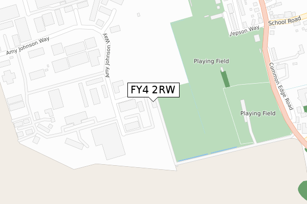
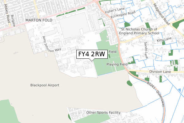
FY4 2RW is located in the Stanley electoral ward, within the unitary authority of Blackpool and the English Parliamentary constituency of Blackpool South. The Sub Integrated Care Board (ICB) Location is NHS Lancashire and South Cumbria ICB - 00R and the police force is Lancashire. This postcode has been in use since May 2018.


GetTheData
Source: OS Open Zoomstack (Ordnance Survey)
Licence: Open Government Licence (requires attribution)
Attribution: Contains OS data © Crown copyright and database right 2024
Source: Open Postcode Geo
Licence: Open Government Licence (requires attribution)
Attribution: Contains OS data © Crown copyright and database right 2024; Contains Royal Mail data © Royal Mail copyright and database right 2024; Source: Office for National Statistics licensed under the Open Government Licence v.3.0
| Easting | 332694 |
| Northing | 431499 |
| Latitude | 53.775471 |
| Longitude | -3.022771 |
GetTheData
Source: Open Postcode Geo
Licence: Open Government Licence
| Country | England |
| Postcode District | FY4 |
| ➜ FY4 open data dashboard ➜ See where FY4 is on a map ➜ Where is Blackpool? | |
GetTheData
Source: Land Registry Price Paid Data
Licence: Open Government Licence
| Ward | Stanley |
| Constituency | Blackpool South |
GetTheData
Source: ONS Postcode Database
Licence: Open Government Licence
| June 2022 | Public order | On or near Sports/Recreation Area | 250m |
| June 2022 | Anti-social behaviour | On or near Sports/Recreation Area | 250m |
| June 2022 | Vehicle crime | On or near Calder Court | 372m |
| ➜ Get more crime data in our Crime section | |||
GetTheData
Source: data.police.uk
Licence: Open Government Licence
| Borough Boundary | Boundary | 409m |
| Borough Boundary (Common Edge Road) | Boundary | 412m |
| The Shovels (Common Edge Road) | Boundary | 536m |
| The Shovels (Common Edge Road) | Boundary | 558m |
| St Nicholas' Church (Common Edge Road) | Boundary | 668m |
| Squires Gate Station | 1.8km |
| Blackpool Pleasure Beach Station | 2.5km |
| St Annes-on-the-Sea Station | 2.5km |
GetTheData
Source: NaPTAN
Licence: Open Government Licence
GetTheData
Source: ONS Postcode Database
Licence: Open Government Licence


➜ Get more ratings from the Food Standards Agency
GetTheData
Source: Food Standards Agency
Licence: FSA terms & conditions
| Last Collection | |||
|---|---|---|---|
| Location | Mon-Fri | Sat | Distance |
| Amy Johnson Way | 18:15 | 682m | |
| Amy Johnson Way | 17:30 | 12:00 | 683m |
| The Hamlet | 17:00 | 12:00 | 758m |
GetTheData
Source: Dracos
Licence: Creative Commons Attribution-ShareAlike
| Facility | Distance |
|---|---|
| Collins Park Common Edge Road, Blackpool Grass Pitches | 311m |
| South Shore Cricket Club Common Edge Road, Blackpool Health and Fitness Gym, Grass Pitches, Squash Courts | 388m |
| Common Edge Common Edge Road, Blackpool Grass Pitches, Artificial Grass Pitch | 398m |
GetTheData
Source: Active Places
Licence: Open Government Licence
| School | Phase of Education | Distance |
|---|---|---|
| Blackpool St Nicholas CofE Primary School School Road, Marton Moss, Blackpool, FY4 5DS | Primary | 708m |
| Our Lady of the Assumption Catholic Primary School Common Edge Road, Blackpool, FY4 5DF | Primary | 943m |
| Highfield Leadership Academy Highfield Road, Blackpool, FY4 3JZ | Secondary | 1.4km |
GetTheData
Source: Edubase
Licence: Open Government Licence
The below table lists the International Territorial Level (ITL) codes (formerly Nomenclature of Territorial Units for Statistics (NUTS) codes) and Local Administrative Units (LAU) codes for FY4 2RW:
| ITL 1 Code | Name |
|---|---|
| TLD | North West (England) |
| ITL 2 Code | Name |
| TLD4 | Lancashire |
| ITL 3 Code | Name |
| TLD42 | Blackpool |
| LAU 1 Code | Name |
| E06000009 | Blackpool |
GetTheData
Source: ONS Postcode Directory
Licence: Open Government Licence
The below table lists the Census Output Area (OA), Lower Layer Super Output Area (LSOA), and Middle Layer Super Output Area (MSOA) for FY4 2RW:
| Code | Name | |
|---|---|---|
| OA | E00064206 | |
| LSOA | E01012731 | Blackpool 018D |
| MSOA | E02002650 | Blackpool 018 |
GetTheData
Source: ONS Postcode Directory
Licence: Open Government Licence
| FY4 2RJ | Shorebury Point | 292m |
| FY4 2RG | Amy Johnson Way | 320m |
| FY4 3RS | Blackpool Business Park | 335m |
| FY4 5FH | Jepson Way | 347m |
| FY4 5DY | Common Edge Road | 432m |
| FY4 5FD | Oakwood Close | 452m |
| FY4 5FJ | Marton Fold | 505m |
| FY4 5DJ | Common Edge Road | 510m |
| FY4 5DT | Primrose Terrace | 536m |
| FY4 5FP | Bramley Close | 581m |
GetTheData
Source: Open Postcode Geo; Land Registry Price Paid Data
Licence: Open Government Licence