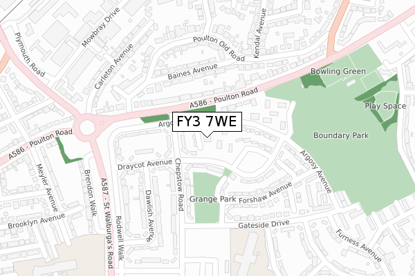
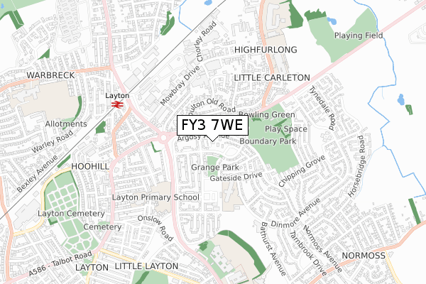
FY3 7WE is located in the Park electoral ward, within the unitary authority of Blackpool and the English Parliamentary constituency of Blackpool North and Cleveleys. The Sub Integrated Care Board (ICB) Location is NHS Lancashire and South Cumbria ICB - 00R and the police force is Lancashire. This postcode has been in use since November 2019.


GetTheData
Source: OS Open Zoomstack (Ordnance Survey)
Licence: Open Government Licence (requires attribution)
Attribution: Contains OS data © Crown copyright and database right 2024
Source: Open Postcode Geo
Licence: Open Government Licence (requires attribution)
Attribution: Contains OS data © Crown copyright and database right 2024; Contains Royal Mail data © Royal Mail copyright and database right 2024; Source: Office for National Statistics licensed under the Open Government Licence v.3.0
| Easting | 332863 |
| Northing | 437928 |
| Latitude | 53.833267 |
| Longitude | -3.021609 |
GetTheData
Source: Open Postcode Geo
Licence: Open Government Licence
| Country | England |
| Postcode District | FY3 |
| ➜ FY3 open data dashboard ➜ See where FY3 is on a map ➜ Where is Blackpool? | |
GetTheData
Source: Land Registry Price Paid Data
Licence: Open Government Licence
| Ward | Park |
| Constituency | Blackpool North And Cleveleys |
GetTheData
Source: ONS Postcode Database
Licence: Open Government Licence
| November 2023 | Anti-social behaviour | On or near Carleton Avenue | 289m |
| October 2023 | Anti-social behaviour | On or near Carleton Avenue | 289m |
| October 2023 | Violence and sexual offences | On or near Carleton Avenue | 289m |
| ➜ Get more crime data in our Crime section | |||
GetTheData
Source: data.police.uk
Licence: Open Government Licence
| Argosy Avenue (Chepstow Road) | Boundary Park | 75m |
| Argosy Avenue (Chepstow Road) | Wades Farm | 88m |
| Wades Farm (Poulton Road) | Wades Farm | 119m |
| Wades Farm (Poulton Road) | Wades Farm | 129m |
| Gateside Drive (Chepstow Road) | Grange Park | 172m |
| Layton (Lancs) Station | 0.6km |
| Blackpool North Station | 2.2km |
| Poulton-le-Fylde Station | 2.6km |
GetTheData
Source: NaPTAN
Licence: Open Government Licence
GetTheData
Source: ONS Postcode Database
Licence: Open Government Licence


➜ Get more ratings from the Food Standards Agency
GetTheData
Source: Food Standards Agency
Licence: FSA terms & conditions
| Last Collection | |||
|---|---|---|---|
| Location | Mon-Fri | Sat | Distance |
| 46 Draycot Avenue | 17:00 | 12:15 | 153m |
| Poulton Road | 17:15 | 12:15 | 209m |
| Grange Park Post Office | 17:30 | 11:30 | 319m |
GetTheData
Source: Dracos
Licence: Creative Commons Attribution-ShareAlike
| Facility | Distance |
|---|---|
| Boundary Primary School Dinmore Avenue, Blackpool Sports Hall, Artificial Grass Pitch | 313m |
| Boundary Park (Blackpool) Garstang Road West, Blackpool Grass Pitches | 435m |
| Blackpool Sixth Form College Blackpool Old Road, Blackpool Health and Fitness Gym, Sports Hall, Studio, Grass Pitches | 621m |
GetTheData
Source: Active Places
Licence: Open Government Licence
| School | Phase of Education | Distance |
|---|---|---|
| Lancashire Alternative Provision 30 Mowbray Drive, Blackpool, FY3 7UN | Not applicable | 407m |
| Boundary Primary School Dinmore Avenue, Blackpool, FY3 7RW | Primary | 496m |
| Layton Primary School Meyler Avenue, Layton, Blackpool, FY3 7DX | Primary | 502m |
GetTheData
Source: Edubase
Licence: Open Government Licence
The below table lists the International Territorial Level (ITL) codes (formerly Nomenclature of Territorial Units for Statistics (NUTS) codes) and Local Administrative Units (LAU) codes for FY3 7WE:
| ITL 1 Code | Name |
|---|---|
| TLD | North West (England) |
| ITL 2 Code | Name |
| TLD4 | Lancashire |
| ITL 3 Code | Name |
| TLD42 | Blackpool |
| LAU 1 Code | Name |
| E06000009 | Blackpool |
GetTheData
Source: ONS Postcode Directory
Licence: Open Government Licence
The below table lists the Census Output Area (OA), Lower Layer Super Output Area (LSOA), and Middle Layer Super Output Area (MSOA) for FY3 7WE:
| Code | Name | |
|---|---|---|
| OA | E00064155 | |
| LSOA | E01012724 | Blackpool 007D |
| MSOA | E02002639 | Blackpool 007 |
GetTheData
Source: ONS Postcode Directory
Licence: Open Government Licence
| FY3 7NN | Argosy Avenue | 68m |
| FY3 7NW | Chepstow Road | 97m |
| FY3 7NP | Draycot Avenue | 108m |
| FY3 7JL | Poulton Road | 108m |
| FY3 7JJ | Poulton Road | 120m |
| FY3 7LA | Baines Avenue | 153m |
| FY3 7NL | Argosy Avenue | 154m |
| FY3 7NR | Draycot Avenue | 161m |
| FY3 7PW | Forshaw Avenue | 178m |
| FY3 7PJ | Chepstow Road | 184m |
GetTheData
Source: Open Postcode Geo; Land Registry Price Paid Data
Licence: Open Government Licence