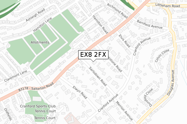
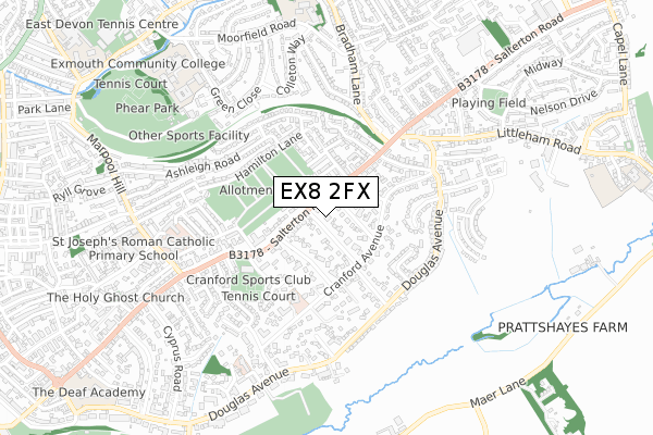
EX8 2FX is located in the Exmouth Littleham electoral ward, within the local authority district of East Devon and the English Parliamentary constituency of East Devon. The Sub Integrated Care Board (ICB) Location is NHS Devon ICB - 15N and the police force is Devon & Cornwall. This postcode has been in use since February 2019.


GetTheData
Source: OS Open Zoomstack (Ordnance Survey)
Licence: Open Government Licence (requires attribution)
Attribution: Contains OS data © Crown copyright and database right 2024
Source: Open Postcode Geo
Licence: Open Government Licence (requires attribution)
Attribution: Contains OS data © Crown copyright and database right 2024; Contains Royal Mail data © Royal Mail copyright and database right 2024; Source: Office for National Statistics licensed under the Open Government Licence v.3.0
| Easting | 301532 |
| Northing | 81143 |
| Latitude | 50.621639 |
| Longitude | -3.393356 |
GetTheData
Source: Open Postcode Geo
Licence: Open Government Licence
| Country | England |
| Postcode District | EX8 |
| ➜ EX8 open data dashboard ➜ See where EX8 is on a map ➜ Where is Exmouth? | |
GetTheData
Source: Land Registry Price Paid Data
Licence: Open Government Licence
| Ward | Exmouth Littleham |
| Constituency | East Devon |
GetTheData
Source: ONS Postcode Database
Licence: Open Government Licence
| June 2022 | Anti-social behaviour | On or near Stevenstone Road | 100m |
| June 2022 | Other theft | On or near Petrol Station | 218m |
| June 2022 | Violence and sexual offences | On or near Chichester Close | 439m |
| ➜ Get more crime data in our Crime section | |||
GetTheData
Source: data.police.uk
Licence: Open Government Licence
| Stevenstone Road (Salterton Road) | Withycombe Raleigh | 75m |
| Hamilton Road (Salterton Road) | Withycombe Raleigh | 149m |
| Elwyn Road (Salterton Road) | Withycombe Raleigh | 199m |
| Elwyn Road (Salterton Road) | Withycombe Raleigh | 205m |
| Stevenstone Road (Cranford Avenue) | Withycombe Raleigh | 207m |
| Exmouth Station | 1.5km |
| Starcross Station | 3.9km |
| Lympstone Village Station | 4km |
GetTheData
Source: NaPTAN
Licence: Open Government Licence
GetTheData
Source: ONS Postcode Database
Licence: Open Government Licence


➜ Get more ratings from the Food Standards Agency
GetTheData
Source: Food Standards Agency
Licence: FSA terms & conditions
| Last Collection | |||
|---|---|---|---|
| Location | Mon-Fri | Sat | Distance |
| Cranford Avenue | 18:15 | 12:45 | 222m |
| Elwyn Road | 17:45 | 12:15 | 268m |
| Littleham Cross Post Office | 18:15 | 12:30 | 471m |
GetTheData
Source: Dracos
Licence: Creative Commons Attribution-ShareAlike
| Facility | Distance |
|---|---|
| Cranford Sports Club Salterton Road, Exmouth Health and Fitness Gym, Swimming Pool, Sports Hall, Studio, Outdoor Tennis Courts | 365m |
| Phear Park Withycombe Road, Withycombe Road, Exmouth Outdoor Tennis Courts | 817m |
| Rolle College Playing Field (Closed) Douglas Avenue, Exmouth Grass Pitches | 826m |
GetTheData
Source: Active Places
Licence: Open Government Licence
| School | Phase of Education | Distance |
|---|---|---|
| St Joseph's Catholic Primary School, Exmouth Regents Gate, Exmouth, EX8 1TA | Primary | 769m |
| Marpool Primary School Moorfield Road, Exmouth, EX8 3QW | Primary | 787m |
| Withycombe Raleigh Church of England Primary School Withycombe Village Road, Exmouth, EX8 3BA | Primary | 1km |
GetTheData
Source: Edubase
Licence: Open Government Licence
The below table lists the International Territorial Level (ITL) codes (formerly Nomenclature of Territorial Units for Statistics (NUTS) codes) and Local Administrative Units (LAU) codes for EX8 2FX:
| ITL 1 Code | Name |
|---|---|
| TLK | South West (England) |
| ITL 2 Code | Name |
| TLK4 | Devon |
| ITL 3 Code | Name |
| TLK43 | Devon CC |
| LAU 1 Code | Name |
| E07000040 | East Devon |
GetTheData
Source: ONS Postcode Directory
Licence: Open Government Licence
The below table lists the Census Output Area (OA), Lower Layer Super Output Area (LSOA), and Middle Layer Super Output Area (MSOA) for EX8 2FX:
| Code | Name | |
|---|---|---|
| OA | E00100799 | |
| LSOA | E01019915 | East Devon 020D |
| MSOA | E02004148 | East Devon 020 |
GetTheData
Source: ONS Postcode Directory
Licence: Open Government Licence
| EX8 2EP | Stevenstone Road | 55m |
| EX8 2HY | Sarlsdown Road | 88m |
| EX8 2EW | Salterton Road | 113m |
| EX8 2EN | Salterton Road | 137m |
| EX8 2ES | Walnut Grove | 149m |
| EX8 2PZ | Cranford Avenue | 162m |
| EX8 2LS | Emmasfield | 169m |
| EX8 2LD | Hamilton Road | 176m |
| EX8 2EL | Elwyn Road | 203m |
| EX8 2LT | Hamilton Road | 215m |
GetTheData
Source: Open Postcode Geo; Land Registry Price Paid Data
Licence: Open Government Licence