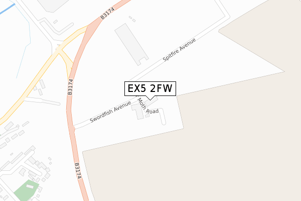
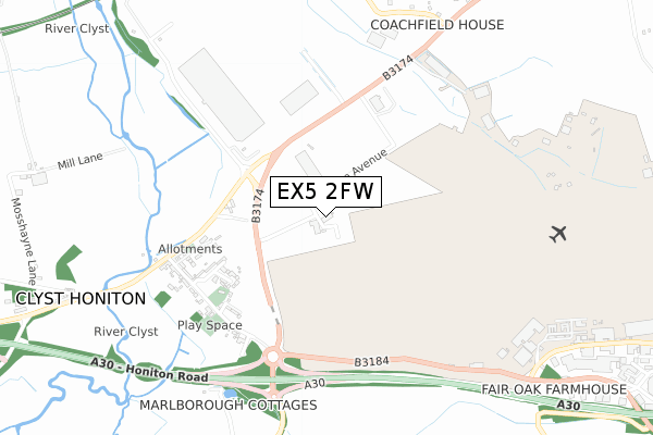
EX5 2FW is located in the Broadclyst electoral ward, within the local authority district of East Devon and the English Parliamentary constituency of East Devon. The Sub Integrated Care Board (ICB) Location is NHS Devon ICB - 15N and the police force is Devon & Cornwall. This postcode has been in use since January 2018.


GetTheData
Source: OS Open Zoomstack (Ordnance Survey)
Licence: Open Government Licence (requires attribution)
Attribution: Contains OS data © Crown copyright and database right 2024
Source: Open Postcode Geo
Licence: Open Government Licence (requires attribution)
Attribution: Contains OS data © Crown copyright and database right 2024; Contains Royal Mail data © Royal Mail copyright and database right 2024; Source: Office for National Statistics licensed under the Open Government Licence v.3.0
| Easting | 299342 |
| Northing | 93809 |
| Latitude | 50.735133 |
| Longitude | -3.427756 |
GetTheData
Source: Open Postcode Geo
Licence: Open Government Licence
| Country | England |
| Postcode District | EX5 |
| ➜ EX5 open data dashboard ➜ See where EX5 is on a map | |
GetTheData
Source: Land Registry Price Paid Data
Licence: Open Government Licence
| Ward | Broadclyst |
| Constituency | East Devon |
GetTheData
Source: ONS Postcode Database
Licence: Open Government Licence
| June 2022 | Drugs | On or near Sports/Recreation Area | 142m |
| April 2022 | Vehicle crime | On or near Sports/Recreation Area | 142m |
| April 2022 | Other theft | On or near Sports/Recreation Area | 142m |
| ➜ Get more crime data in our Crime section | |||
GetTheData
Source: data.police.uk
Licence: Open Government Licence
| Exeter Skypark (B3174) | Clyst Honiton | 458m |
| Exeter Skypark (B3174) | Clyst Honiton | 468m |
| Duke Of York (Honiton Road) | Clyst Honiton | 579m |
| Exeter Inn (Honiton Road) | Clyst Honiton | 652m |
| Exeter International Airport | Clyst Honiton | 914m |
| Cranbrook Station | 1.7km |
| Pinhoe Station | 2.9km |
| Digby & Sowton Station | 4km |
GetTheData
Source: NaPTAN
Licence: Open Government Licence
GetTheData
Source: ONS Postcode Database
Licence: Open Government Licence


➜ Get more ratings from the Food Standards Agency
GetTheData
Source: Food Standards Agency
Licence: FSA terms & conditions
| Last Collection | |||
|---|---|---|---|
| Location | Mon-Fri | Sat | Distance |
| Stonefield | 16:10 | 09:00 | 1,429m |
| Sowton | 16:15 | 08:30 | 2,052m |
| Langaton Lane | 18:15 | 13:00 | 2,593m |
GetTheData
Source: Dracos
Licence: Creative Commons Attribution-ShareAlike
| Facility | Distance |
|---|---|
| Waterslade Park (Closed) Waterslade Lane, Clyst Honiton, Exeter Grass Pitches | 145m |
| St Martin's C Of E Primary School (Cranbrook) Younghayes Road, Cranbrook, Exeter Grass Pitches | 1.7km |
| Younghayes Centre Younghayes Road, Cranbrook, Exeter Sports Hall | 1.7km |
GetTheData
Source: Active Places
Licence: Open Government Licence
| School | Phase of Education | Distance |
|---|---|---|
| St Martin's CofE Primary & Nursery School Younghayes Road, Cranbrook, Exeter, EX5 7DT | Primary | 1.7km |
| Clyst Vale Community College Station Road, Broadclyst, Exeter, EX5 3AJ | Secondary | 2.7km |
| Rockbeare Church of England Primary School and Pre-School Rockbeare, Exeter, EX5 2EQ | Primary | 2.8km |
GetTheData
Source: Edubase
Licence: Open Government Licence
The below table lists the International Territorial Level (ITL) codes (formerly Nomenclature of Territorial Units for Statistics (NUTS) codes) and Local Administrative Units (LAU) codes for EX5 2FW:
| ITL 1 Code | Name |
|---|---|
| TLK | South West (England) |
| ITL 2 Code | Name |
| TLK4 | Devon |
| ITL 3 Code | Name |
| TLK43 | Devon CC |
| LAU 1 Code | Name |
| E07000040 | East Devon |
GetTheData
Source: ONS Postcode Directory
Licence: Open Government Licence
The below table lists the Census Output Area (OA), Lower Layer Super Output Area (LSOA), and Middle Layer Super Output Area (MSOA) for EX5 2FW:
| Code | Name | |
|---|---|---|
| OA | E00100670 | |
| LSOA | E01019893 | East Devon 006C |
| MSOA | E02004134 | East Devon 006 |
GetTheData
Source: ONS Postcode Directory
Licence: Open Government Licence
| EX5 2ND | St Michaels Close | 422m |
| EX5 2NB | St Michaels Hill | 481m |
| EX5 2NQ | Ship Lane | 517m |
| EX5 2LX | 566m | |
| EX5 2NH | York Terrace | 574m |
| EX5 2LZ | 574m | |
| EX5 2NE | 580m | |
| EX5 2NF | 593m | |
| EX5 2NG | 612m | |
| EX5 2NJ | 649m |
GetTheData
Source: Open Postcode Geo; Land Registry Price Paid Data
Licence: Open Government Licence