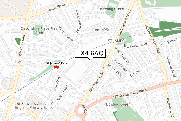
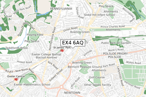
EX4 6AQ is located in the Duryard and St James electoral ward, within the local authority district of Exeter and the English Parliamentary constituency of Exeter. The Sub Integrated Care Board (ICB) Location is NHS Devon ICB - 15N and the police force is Devon & Cornwall. This postcode has been in use since September 2019.


GetTheData
Source: OS Open Zoomstack (Ordnance Survey)
Licence: Open Government Licence (requires attribution)
Attribution: Contains OS data © Crown copyright and database right 2024
Source: Open Postcode Geo
Licence: Open Government Licence (requires attribution)
Attribution: Contains OS data © Crown copyright and database right 2024; Contains Royal Mail data © Royal Mail copyright and database right 2024; Source: Office for National Statistics licensed under the Open Government Licence v.3.0
| Easting | 292839 |
| Northing | 93520 |
| Latitude | 50.731370 |
| Longitude | -3.519791 |
GetTheData
Source: Open Postcode Geo
Licence: Open Government Licence
| Country | England |
| Postcode District | EX4 |
| ➜ EX4 open data dashboard ➜ See where EX4 is on a map ➜ Where is Exeter? | |
GetTheData
Source: Land Registry Price Paid Data
Licence: Open Government Licence
| Ward | Duryard And St James |
| Constituency | Exeter |
GetTheData
Source: ONS Postcode Database
Licence: Open Government Licence
| October 2022 | Other theft | On or near South View Terrace | 109m |
| October 2022 | Violence and sexual offences | On or near South View Terrace | 109m |
| September 2022 | Violence and sexual offences | On or near South View Terrace | 109m |
| ➜ Get more crime data in our Crime section | |||
GetTheData
Source: data.police.uk
Licence: Open Government Licence
| Albion Place (Old Tiverton Road) | St James | 86m |
| Iddesleigh Road (Old Tiverton Road) | St James | 127m |
| St James Road (Old Tiverton Road) | Exeter City Centre | 227m |
| Sorry Head (Blackboy Road) | Exeter City Centre | 230m |
| St James Road (Old Tiverton Road) | Exeter City Centre | 233m |
| St James Park (Devon) Station | 0.2km |
| Exeter Central Station | 1.1km |
| Polsloe Bridge Station | 1.3km |
GetTheData
Source: NaPTAN
Licence: Open Government Licence
| Percentage of properties with Next Generation Access | 100.0% |
| Percentage of properties with Superfast Broadband | 100.0% |
| Percentage of properties with Ultrafast Broadband | 100.0% |
| Percentage of properties with Full Fibre Broadband | 100.0% |
Superfast Broadband is between 30Mbps and 300Mbps
Ultrafast Broadband is > 300Mbps
| Percentage of properties unable to receive 2Mbps | 0.0% |
| Percentage of properties unable to receive 5Mbps | 0.0% |
| Percentage of properties unable to receive 10Mbps | 0.0% |
| Percentage of properties unable to receive 30Mbps | 0.0% |
GetTheData
Source: Ofcom
Licence: Ofcom Terms of Use (requires attribution)
GetTheData
Source: ONS Postcode Database
Licence: Open Government Licence


➜ Get more ratings from the Food Standards Agency
GetTheData
Source: Food Standards Agency
Licence: FSA terms & conditions
| Last Collection | |||
|---|---|---|---|
| Location | Mon-Fri | Sat | Distance |
| Old Tiverton Road | 18:30 | 12:30 | 93m |
| Victoria Road | 18:30 | 12:30 | 168m |
| Sidwell Street | 18:30 | 12:30 | 252m |
GetTheData
Source: Dracos
Licence: Creative Commons Attribution-ShareAlike
| Facility | Distance |
|---|---|
| Exeter City Fc (St James Park) Stadium Way, Exeter Grass Pitches | 157m |
| Exonia Indoor And Outdoor Bowls Club Union Road, Exeter Indoor Bowls | 316m |
| Body 2000 Gym (Closed) Verney Street, Exeter Health and Fitness Gym | 414m |
GetTheData
Source: Active Places
Licence: Open Government Licence
| School | Phase of Education | Distance |
|---|---|---|
| St Sidwell's Church of England Primary School & Nursery York Road, St Sidwell's Ce Primary School and Nursery, Exeter, EX4 6PG | Primary | 412m |
| Newtown Primary School Clifton Road, Exeter, EX1 2BP | Primary | 639m |
| Stoke Hill Infant and Nursery School Stoke Hill, Exeter, EX4 7DB | Primary | 701m |
GetTheData
Source: Edubase
Licence: Open Government Licence
The below table lists the International Territorial Level (ITL) codes (formerly Nomenclature of Territorial Units for Statistics (NUTS) codes) and Local Administrative Units (LAU) codes for EX4 6AQ:
| ITL 1 Code | Name |
|---|---|
| TLK | South West (England) |
| ITL 2 Code | Name |
| TLK4 | Devon |
| ITL 3 Code | Name |
| TLK43 | Devon CC |
| LAU 1 Code | Name |
| E07000041 | Exeter |
GetTheData
Source: ONS Postcode Directory
Licence: Open Government Licence
The below table lists the Census Output Area (OA), Lower Layer Super Output Area (LSOA), and Middle Layer Super Output Area (MSOA) for EX4 6AQ:
| Code | Name | |
|---|---|---|
| OA | E00101340 | |
| LSOA | E01020020 | Exeter 004C |
| MSOA | E02004152 | Exeter 004 |
GetTheData
Source: ONS Postcode Directory
Licence: Open Government Licence
| EX4 6LG | Old Tiverton Road | 60m |
| EX4 6LQ | Old Tiverton Road | 99m |
| EX4 6JF | South View Terrace | 118m |
| EX4 6LJ | Old Tiverton Road | 121m |
| EX4 6JG | Victoria Street | 123m |
| EX4 6JE | Rosewood Terrace | 134m |
| EX4 6LE | Toronto Road | 145m |
| EX4 6JH | Culverland Road | 146m |
| EX4 6LF | Toronto Road | 152m |
| EX4 6QA | Well Street | 153m |
GetTheData
Source: Open Postcode Geo; Land Registry Price Paid Data
Licence: Open Government Licence