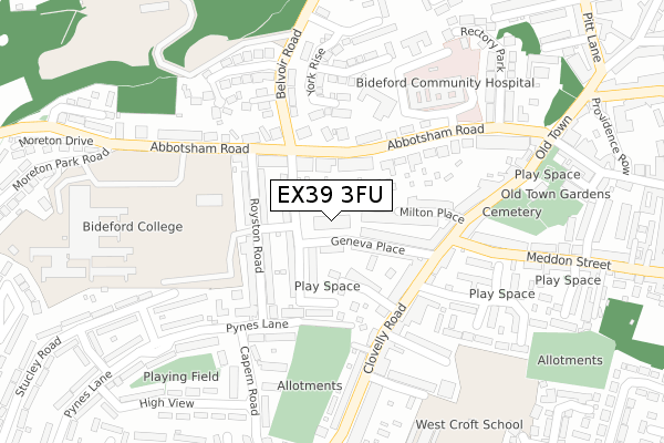
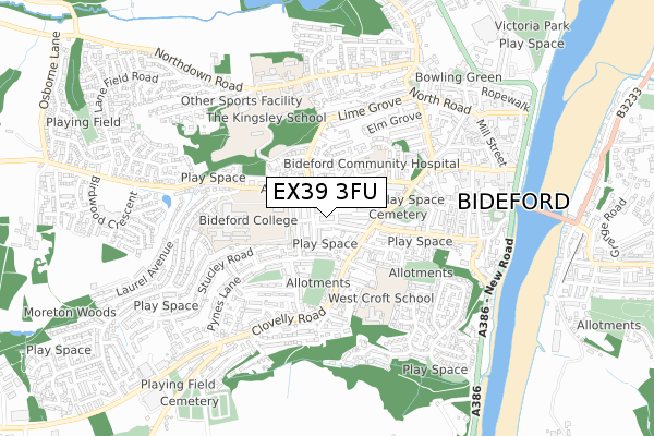
EX39 3FU is located in the Bideford West electoral ward, within the local authority district of Torridge and the English Parliamentary constituency of Torridge and West Devon. The Sub Integrated Care Board (ICB) Location is NHS Devon ICB - 15N and the police force is Devon & Cornwall. This postcode has been in use since February 2018.


GetTheData
Source: OS Open Zoomstack (Ordnance Survey)
Licence: Open Government Licence (requires attribution)
Attribution: Contains OS data © Crown copyright and database right 2024
Source: Open Postcode Geo
Licence: Open Government Licence (requires attribution)
Attribution: Contains OS data © Crown copyright and database right 2024; Contains Royal Mail data © Royal Mail copyright and database right 2024; Source: Office for National Statistics licensed under the Open Government Licence v.3.0
| Easting | 244731 |
| Northing | 126407 |
| Latitude | 51.016017 |
| Longitude | -4.214979 |
GetTheData
Source: Open Postcode Geo
Licence: Open Government Licence
| Country | England |
| Postcode District | EX39 |
| ➜ EX39 open data dashboard ➜ See where EX39 is on a map ➜ Where is Bideford? | |
GetTheData
Source: Land Registry Price Paid Data
Licence: Open Government Licence
| Ward | Bideford West |
| Constituency | Torridge And West Devon |
GetTheData
Source: ONS Postcode Database
Licence: Open Government Licence
| October 2022 | Violence and sexual offences | On or near Montague Place | 124m |
| October 2022 | Burglary | On or near Higher Gunstone | 479m |
| September 2022 | Violence and sexual offences | On or near Lime Grove | 452m |
| ➜ Get more crime data in our Crime section | |||
GetTheData
Source: data.police.uk
Licence: Open Government Licence
| Clovelly Road | Bideford | 154m |
| Clovelly Road | Bideford | 161m |
| Marland Terrace (Clovelly Road) | Bideford | 218m |
| First In Last Out (Clovelly Road) | Bideford | 226m |
| Hospital (Abbotsham Road) | Bideford | 261m |
GetTheData
Source: NaPTAN
Licence: Open Government Licence
➜ Broadband speed and availability dashboard for EX39 3FU
| Percentage of properties with Next Generation Access | 100.0% |
| Percentage of properties with Superfast Broadband | 100.0% |
| Percentage of properties with Ultrafast Broadband | 0.0% |
| Percentage of properties with Full Fibre Broadband | 0.0% |
Superfast Broadband is between 30Mbps and 300Mbps
Ultrafast Broadband is > 300Mbps
| Median download speed | 45.2Mbps |
| Average download speed | 42.5Mbps |
| Maximum download speed | 54.83Mbps |
| Median upload speed | 10.0Mbps |
| Average upload speed | 11.1Mbps |
| Maximum upload speed | 18.82Mbps |
| Percentage of properties unable to receive 2Mbps | 0.0% |
| Percentage of properties unable to receive 5Mbps | 0.0% |
| Percentage of properties unable to receive 10Mbps | 0.0% |
| Percentage of properties unable to receive 30Mbps | 0.0% |
➜ Broadband speed and availability dashboard for EX39 3FU
GetTheData
Source: Ofcom
Licence: Ofcom Terms of Use (requires attribution)
GetTheData
Source: ONS Postcode Database
Licence: Open Government Licence


➜ Get more ratings from the Food Standards Agency
GetTheData
Source: Food Standards Agency
Licence: FSA terms & conditions
| Last Collection | |||
|---|---|---|---|
| Location | Mon-Fri | Sat | Distance |
| Hunestone Street | 17:45 | 12:00 | 351m |
| Market Place | 18:15 | 12:30 | 559m |
| Bideford Delivery Office | 18:30 | 13:00 | 883m |
GetTheData
Source: Dracos
Licence: Creative Commons Attribution-ShareAlike
| Facility | Distance |
|---|---|
| Bideford College (Closed) Abbotsham Road, Bideford Sports Hall | 202m |
| Kingsley School (Belvoir Road Site) (Closed) Belvoir Road, Bideford Sports Hall | 263m |
| Bideford College Abbotsham Road, Bideford Health and Fitness Gym, Artificial Grass Pitch, Sports Hall, Studio, Outdoor Tennis Courts, Grass Pitches | 375m |
GetTheData
Source: Active Places
Licence: Open Government Licence
| School | Phase of Education | Distance |
|---|---|---|
| Bideford College Abbotsham Road, Bideford, EX39 3AR | Secondary | 353m |
| West Croft School Coronation Road, Bideford, EX39 3DE | Primary | 418m |
| Kingsley School Northdown Road, Bideford, EX39 3LY | Not applicable | 584m |
GetTheData
Source: Edubase
Licence: Open Government Licence
The below table lists the International Territorial Level (ITL) codes (formerly Nomenclature of Territorial Units for Statistics (NUTS) codes) and Local Administrative Units (LAU) codes for EX39 3FU:
| ITL 1 Code | Name |
|---|---|
| TLK | South West (England) |
| ITL 2 Code | Name |
| TLK4 | Devon |
| ITL 3 Code | Name |
| TLK43 | Devon CC |
| LAU 1 Code | Name |
| E07000046 | Torridge |
GetTheData
Source: ONS Postcode Directory
Licence: Open Government Licence
The below table lists the Census Output Area (OA), Lower Layer Super Output Area (LSOA), and Middle Layer Super Output Area (MSOA) for EX39 3FU:
| Code | Name | |
|---|---|---|
| OA | E00102745 | |
| LSOA | E01020284 | Torridge 004E |
| MSOA | E02004223 | Torridge 004 |
GetTheData
Source: ONS Postcode Directory
Licence: Open Government Licence
| EX39 3AL | Ashley Terrace | 68m |
| EX39 3BW | Lansdowne Terrace | 74m |
| EX39 3BQ | Metherell Road | 78m |
| EX39 3BS | Geneva Place | 92m |
| EX39 3AQ | Abbotsham Road | 97m |
| EX39 3BX | Montague Place | 106m |
| EX39 3AW | Royston Road | 123m |
| EX39 3AH | Abbotsham Road | 131m |
| EX39 3AN | Royston Road | 134m |
| EX39 3BN | Milton Place | 147m |
GetTheData
Source: Open Postcode Geo; Land Registry Price Paid Data
Licence: Open Government Licence